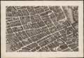
Category:Sheet 10 of the Turgot map of Paris
Jump to navigation
Jump to search

Media in category "Sheet 10 of the Turgot map of Paris"
The following 9 files are in this category, out of 9 total.
-
 Fac similé d'une partie du plan de Turgot, quartier du Laune - BnF.jpg 12,000 × 7,896; 20.3 MB
-
 Sheet 10. Paris. Plan de Turgot - David Rumsey.jpg 12,374 × 8,171; 36.1 MB
-
 Turgot map of Paris, sheet 10 - Norman B. Leventhal Map Center.tif 10,208 × 7,088; 207.04 MB
-
 Turgot map of Paris, sheet 10 - Norman B. Leventhal Map Center.jpg 8,950 × 5,710; 40.9 MB
-
 Turgot map of Paris (1739) - Sheet 10 - Bibliothèque nationale de France.jpg 10,206 × 6,840; 19.16 MB
-
 Turgot map of Paris - Sheet 10 - Bibliothèque nationale de France.jpg 9,169 × 6,338; 13.2 MB
-
 Turgot map of Paris - Sheet 10 - David Rumsey.jpg 21,000 × 14,000; 207 MB
-
 Turgot map of Paris - Sheet 10 - UWM Libraries.jpg 6,336 × 4,314; 6.02 MB
-
 Turgot map Paris KU 10.jpg 4,800 × 2,900; 4.24 MB


_-_Sheet_10_-_Biblioth%C3%A8que_nationale_de_France.jpg)


Categories:
- Sheets of the Turgot map of Paris
- Old maps of Île de la Cité
- Pont Notre-Dame 1500-1786
- Historical images of Hôtel de Ville de Paris
- Remote views of Hôtel de Ville de Paris
- Historical images of Place de l'Hôtel-de-Ville - Esplanade de la Libération
- Exterior of Église Saint-Gervais-Saint-Protais
- Historical images of Église Saint-Gervais-Saint-Protais
- Historical images of Église Saint-Nicolas-des-Champs
- Historical images of the Hôtel de Soubise
- Historical images of Pont au Change
- Hôtel Salé
- Église Saint-Merri
- Église Saint-Jacques-de-la-Boucherie (Paris)
- Cimetière des Innocents
- Historical images of Église Saint-Leu-Saint-Gilles (Paris)
- Chapelle Saint-Éloi (Paris)
- Churches on Turgot map of Paris
- Old maps of Les Halles, Paris
- Grenier à sel de Paris