
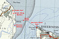
Category:Sheerness
town on the Isle of Sheppey in Kent, England  | |||||
| Upload media | |||||
| Spoken text audio | |||||
|---|---|---|---|---|---|
| Instance of | |||||
| Location | Swale, Kent, South East England, England | ||||
| Population |
| ||||
 | |||||
Subcategories
This category has the following 13 subcategories, out of 13 total.
A
B
G
- Garrison Point (9 F)
H
P
S
- Sheerness Clock Tower (17 F)
- Sheerness Steel Works (3 F)
- Sheerness War Memorial (7 F)
T
Media in category "Sheerness"
The following 200 files are in this category, out of 521 total.
(previous page) (next page)-
 "Sea Sheppey 2005", Blue Town - geograph.org.uk - 5570969.jpg 480 × 640; 131 KB
-
 'Our fathers have told us' , HMS 'Actaeon', 1918 RMG PU6219.jpg 1,032 × 1,280; 1.18 MB
-
 'Trafalgar' 120 Guns RMG PU7885.jpg 1,280 × 836; 1.45 MB
-
 'Trafalgar' 120 Guns RMG PU7887.jpg 1,280 × 823; 1.22 MB
-
-

-

-
 A ship from the Suadiaz Group moored at Garrison Point - geograph.org.uk - 5293877.jpg 6,000 × 2,072; 3.65 MB
-
 A249 Brielle Way - geograph.org.uk - 5775777.jpg 640 × 428; 90 KB
-
 A249 Brielle Way - geograph.org.uk - 5775795.jpg 640 × 428; 93 KB
-
 A249 Brielle Way - geograph.org.uk - 5776388.jpg 640 × 428; 93 KB
-
 Access ramp to Beach Street, Sheerness - geograph.org.uk - 6295132.jpg 1,024 × 768; 151 KB
-
 Acorn Street, Sheerness - geograph.org.uk - 4410423.jpg 2,272 × 1,704; 721 KB
-

-
 Admiralty Chart No 3683 Approaches to Sheerness, Published 1908, New Edition 1921.jpg 16,271 × 10,880; 52.27 MB
-
 Admiralty Chart No 3683 Sheerness and Approaches, Published 1930.jpg 18,777 × 11,312; 69.59 MB
-
 "Agia Methodia" - Sheerness, 1995.jpeg 1,758 × 1,172; 487 KB
-
 Alexandra Road, Sheerness - geograph.org.uk - 3603490.jpg 3,488 × 2,616; 2.14 MB
-
 Alexandra Road, Sheerness - geograph.org.uk - 4410949.jpg 2,272 × 1,704; 760 KB
-
 Alma Road, Sheerness - geograph.org.uk - 3603498.jpg 3,488 × 2,616; 2.18 MB
-
 Almond Tree Close, Sheerness - geograph.org.uk - 3719301.jpg 3,488 × 2,616; 2.16 MB
-
 Amusement arcade, Sheerness - geograph.org.uk - 6295100.jpg 1,024 × 768; 140 KB
-
 Anchor in High Street, Blue Town - geograph.org.uk - 5570629.jpg 640 × 459; 116 KB
-
 Anchor monument, High Street, Blue Town - geograph.org.uk - 4409796.jpg 2,272 × 1,704; 890 KB
-
 Anchor monument, High Street, Blue Town - geograph.org.uk - 4409803.jpg 2,272 × 1,704; 1.18 MB
-
 Apartment block, 13, Railway Road - geograph.org.uk - 6007867.jpg 2,448 × 3,264; 1.81 MB
-
 Appledore Avenue, Sheerness - geograph.org.uk - 3728747.jpg 3,456 × 2,484; 1.95 MB
-
 B ^ A Whelan, Chapel Street - geograph.org.uk - 4197841.jpg 1,142 × 856; 198 KB
-
 B ^ A Whelan, Chapel Street - geograph.org.uk - 4197851.jpg 1,142 × 856; 191 KB
-

-
 Barton's point Canal - geograph.org.uk - 1019326.jpg 640 × 481; 54 KB
-
 Barton's Point Coastal Park - geograph.org.uk - 653157.jpg 640 × 480; 95 KB
-
 Barton's point Coastal Park - geograph.org.uk - 65809.jpg 480 × 640; 78 KB
-

-

-

-
 Beach and Sheerness Docks - geograph.org.uk - 634400.jpg 640 × 480; 67 KB
-
 Beach at Sheerness - geograph.org.uk - 834377.jpg 640 × 480; 82 KB
-
 Beach beside Sheerness Esplanade - geograph.org.uk - 2996691.jpg 4,288 × 3,216; 7.11 MB
-
 Beach fishing, Sheerness - geograph.org.uk - 3851609.jpg 640 × 480; 197 KB
-
 Beach near Barton's Point - geograph.org.uk - 5272168.jpg 3,689 × 2,767; 1.98 MB
-
 Beach Street, Sheerness - geograph.org.uk - 1805911.jpg 3,488 × 2,616; 2.12 MB
-
 Beach Street, Sheerness - geograph.org.uk - 3603418.jpg 3,488 × 2,616; 2.1 MB
-
 Beach Street, Sheerness - geograph.org.uk - 4413615.jpg 2,272 × 1,704; 727 KB
-
 Beach Street, Sheerness - geograph.org.uk - 6295094.jpg 1,024 × 768; 133 KB
-
 Beach Terrace, Sheerness - geograph.org.uk - 4413639.jpg 2,272 × 1,704; 836 KB
-
 Beckley Road, Sheerness - geograph.org.uk - 4411037.jpg 2,272 × 1,704; 572 KB
-
 Benchmark on Holy Trinity Church - geograph.org.uk - 2025828.jpg 1,024 × 768; 261 KB
-
 Benchmark on RC Church - geograph.org.uk - 2026493.jpg 768 × 1,024; 198 KB
-
 Benchmark on ^46 High Street - geograph.org.uk - 2025805.jpg 768 × 1,024; 326 KB
-
 Beowulf mural, Sheerness - geograph.org.uk - 5302784.jpg 5,184 × 3,456; 5.91 MB
-
 Berridge Road, Sheerness - geograph.org.uk - 4410456.jpg 2,272 × 1,704; 740 KB
-
 Blue Town heritage centre - geograph.org.uk - 5302692.jpg 5,202 × 3,465; 3.69 MB
-
 Blue Town sign and guide - geograph.org.uk - 4409792.jpg 2,272 × 1,704; 1.24 MB
-
 Boating lake near Barton's Point - geograph.org.uk - 3603487.jpg 3,488 × 2,616; 2.15 MB
-
 Boundary Earth bank - geograph.org.uk - 1019322.jpg 640 × 481; 94 KB
-
 Bredhurst Close, Sheerness - geograph.org.uk - 3728749.jpg 3,488 × 2,616; 2.21 MB
-
 Bridge over Brielle Way - geograph.org.uk - 6007344.jpg 3,264 × 2,448; 3.28 MB
-
 Brielle Way (A249) - geograph.org.uk - 3172978.jpg 913 × 684; 147 KB
-
 Brielle Way (A249) - geograph.org.uk - 3172994.jpg 893 × 646; 136 KB
-
 Brielle Way, near Sheerness - geograph.org.uk - 3719339.jpg 3,488 × 2,616; 2.2 MB
-
 Brielle Way, Sheerness - geograph.org.uk - 3719379.jpg 640 × 480; 48 KB
-
 Brielle Way, Sheerness - geograph.org.uk - 5302615.jpg 5,184 × 3,456; 5.11 MB
-
 Brielle Way. Disused rail track to the Sheerness Docks - geograph.org.uk - 5302666.jpg 5,184 × 3,456; 6.84 MB
-
 Broad Street, Sheerness - geograph.org.uk - 3728732.jpg 3,488 × 2,616; 2.15 MB
-
 Broad Street, Sheerness - geograph.org.uk - 4413582.jpg 2,272 × 1,704; 702 KB
-
 Broadway, Sheerness - geograph.org.uk - 4409919.jpg 2,272 × 1,704; 796 KB
-
 Broadway, Sheerness - geograph.org.uk - 4411062.jpg 2,272 × 1,704; 721 KB
-
 Broadway, Sheerness - geograph.org.uk - 6295089.jpg 1,024 × 768; 173 KB
-
 Bulk carrier 'Vela' at Sheerness - geograph.org.uk - 6859352.jpg 1,024 × 684; 233 KB
-
 HMS Bulwark explodes.jpg 800 × 606; 69 KB
-
 Buoy no. 11, Medway Approach Channel - geograph.org.uk - 4696250.jpg 640 × 480; 83 KB
-
 Cafe at Sheerness seafront - geograph.org.uk - 1727451.jpg 3,348 × 2,511; 2.38 MB
-
 Car Park off Marine Parade, Sheerness - geograph.org.uk - 834369.jpg 640 × 480; 61 KB
-
 Cavour Road, Sheerness - geograph.org.uk - 4411087.jpg 2,272 × 1,704; 777 KB
-
 Cecil Avenue, Sheerness - geograph.org.uk - 3728745.jpg 3,488 × 2,616; 2.11 MB
-
 Centre Bastion, Sheerness - geograph.org.uk - 1805757.jpg 3,488 × 2,616; 2.12 MB
-
 Centre Bastion, Sheerness - geograph.org.uk - 1805760.jpg 3,488 × 2,616; 2.19 MB
-
 Centre bastion. Sheerness Docks - geograph.org.uk - 5302768.jpg 5,202 × 3,465; 2 MB
-
 Changing pilots, PS 'Waverley' - geograph.org.uk - 6858784.jpg 1,024 × 768; 260 KB
-
 Chapel Street, Blue Town - geograph.org.uk - 4409809.jpg 2,272 × 1,704; 720 KB
-
 Chapel Street, Blue Town, Sheerness - geograph.org.uk - 1727349.jpg 3,488 × 2,616; 2.17 MB
-
 Charles Street, Blue Town - geograph.org.uk - 4409800.jpg 2,272 × 1,704; 648 KB
-
 Charles Street, Blue Town - geograph.org.uk - 4409845.jpg 2,272 × 1,704; 757 KB
-
 Cherry Tree Close, Sheerness - geograph.org.uk - 3719294.jpg 3,488 × 2,616; 2.19 MB
-
 Clarence Row, Sheerness - geograph.org.uk - 4413608.jpg 2,272 × 1,704; 785 KB
-
 Clock Tower, Broadway, Sheerness, Isle of Sheppey - geograph.org.uk - 6798430.jpg 3,456 × 5,184; 5.61 MB
-
 Clock Tower, Sheerness - geograph.org.uk - 5779251.jpg 1,024 × 768; 304 KB
-
 Coast between Sheerness and Minster - geograph.org.uk - 3851574.jpg 640 × 480; 213 KB
-
 Coast Path, Sheerness - geograph.org.uk - 835567.jpg 640 × 480; 50 KB
-
 Coastal Path, Sheerness - geograph.org.uk - 6270999.jpg 3,264 × 2,448; 2.8 MB
-
 Coats Avenue, Sheerness - geograph.org.uk - 3719308.jpg 3,488 × 2,616; 1.86 MB
-
 Corner Shop, Sheerness-on-Sea - geograph.org.uk - 7370553.jpg 1,024 × 683; 228 KB
-
 Coronation Road, Sheerness - geograph.org.uk - 4410419.jpg 2,272 × 1,704; 731 KB
-
 Crane on jetty, Sheerness - geograph.org.uk - 4702864.jpg 640 × 480; 61 KB
-
 Criterion Passage, Blue Town - geograph.org.uk - 5670640.jpg 3,024 × 4,032; 3.39 MB
-
 Cromwell Road, West Minster - geograph.org.uk - 3719330.jpg 3,488 × 2,616; 2.16 MB
-
 Cromwell Road, West Minster - geograph.org.uk - 3728757.jpg 3,488 × 2,616; 2.15 MB
-
 Cromwell Road, West Minster - geograph.org.uk - 3728759.jpg 3,488 × 2,616; 2.19 MB
-
 Cromwell Road, West Minster - geograph.org.uk - 3728761.jpg 3,488 × 2,616; 2.16 MB
-
 Cut Bench Mark by a path near Broadway - geograph.org.uk - 7370575.jpg 1,024 × 683; 308 KB
-
 Delamark Road, Sheerness - geograph.org.uk - 3603502.jpg 3,488 × 2,616; 2.25 MB
-
 Derelict building - geograph.org.uk - 5172846.jpg 3,264 × 2,448; 2.41 MB
-
 Detling Close, Sheerness - geograph.org.uk - 3728751.jpg 3,488 × 2,616; 2.17 MB
-
 Development site, Brielle Way - geograph.org.uk - 5172756.jpg 3,264 × 2,448; 2.1 MB
-

-
 Disused railway line crossing Brielle Way (A249) - geograph.org.uk - 3171512.jpg 1,142 × 856; 186 KB
-
 Disused railway line from Sheerness Docks - geograph.org.uk - 3172885.jpg 1,104 × 793; 154 KB
-
 Disused railway line to Sheerness Docks - geograph.org.uk - 3172908.jpg 878 × 639; 158 KB
-
 Disused railway tracks on Thamesteel site - geograph.org.uk - 3172943.jpg 1,098 × 799; 144 KB
-

-
 Disused railway, Sheerness - geograph.org.uk - 5777080.jpg 640 × 480; 153 KB
-
 Edenbridge Drive, Sheerness - geograph.org.uk - 3719281.jpg 3,488 × 2,616; 1.78 MB
-
 Edenbridge Drive, Sheerness - geograph.org.uk - 3728755.jpg 3,488 × 2,616; 2.37 MB
-

-
 End of the line, Sheerness Docks - geograph.org.uk - 5302670.jpg 5,202 × 3,465; 4.54 MB
-
 Entrance to River Medway, Sheerness - geograph.org.uk - 4190677.jpg 3,072 × 876; 230 KB
-
 Entrance to Stonnes Fishing Lakes - geograph.org.uk - 3719172.jpg 3,488 × 2,616; 1.78 MB
-
 Entrance, CYC Coastal Club - geograph.org.uk - 3853328.jpg 640 × 480; 123 KB
-
 Esplanade on Sea Wall - geograph.org.uk - 1278932.jpg 640 × 480; 68 KB
-
 Esplanade Ramp, Cheyney Rock - geograph.org.uk - 2996748.jpg 4,288 × 3,216; 5.66 MB
-
 Esplanade ^ Cycle Path Near Sheerness - geograph.org.uk - 2056497.jpg 1,496 × 1,122; 418 KB
-
 Estuary Road, Sheerness - geograph.org.uk - 3728744.jpg 3,488 × 2,616; 2.48 MB
-
 Festival Field Gate - geograph.org.uk - 1019316.jpg 481 × 640; 112 KB
-
 Fishing pier, Sheerness - geograph.org.uk - 2996688.jpg 4,288 × 3,216; 5.74 MB
-
 Fleet Avenue, Sheerness - geograph.org.uk - 3728743.jpg 3,488 × 2,616; 2.13 MB
-
 Fonblanque Road, Sheerness - geograph.org.uk - 3603436.jpg 3,488 × 2,616; 2.14 MB
-
 Fonblanque Road, Sheerness - geograph.org.uk - 4410452.jpg 2,272 × 1,704; 712 KB
-

-
 Footbridge over the Railway, West Minster - geograph.org.uk - 3719326.jpg 3,488 × 2,616; 1.79 MB
-
 Footpath towards Sheerness Dockyard - geograph.org.uk - 4409787.jpg 2,272 × 1,704; 1.11 MB
-

-
 Former Sheerness Waterworks - geograph.org.uk - 4411083.jpg 2,272 × 1,704; 670 KB
-
 Former Thamesteel site, Brielle Way - geograph.org.uk - 5171795.jpg 3,264 × 2,448; 2.2 MB
-
 Former Thamesteel Site, Brielle Way - geograph.org.uk - 5171814.jpg 3,264 × 2,448; 2 MB
-
 Former Thamesteel Site, Brielle Way - geograph.org.uk - 5171820.jpg 3,264 × 2,448; 2.03 MB
-
 Former Thamesteel Site, Brielle Way - geograph.org.uk - 5576325.jpg 3,264 × 2,448; 2.23 MB
-
 Former Thamesteel Site, Brielle Way - geograph.org.uk - 5576334.jpg 3,264 × 2,448; 2.06 MB
-
 Former Thamesteel Site, Brielle Way - geograph.org.uk - 5576349.jpg 3,264 × 2,448; 2.32 MB
-
 Former toll house, Sheerness Pier - geograph.org.uk - 5778272.jpg 1,024 × 768; 224 KB
-
 Former trackbed of Sheppey Light Railway - geograph.org.uk - 3061366.jpg 685 × 513; 102 KB
-
 Former Victory Inn, 13, Railway Road - geograph.org.uk - 5578277.jpg 2,201 × 3,256; 1.71 MB
-

-
 Former water tower, Trinity Road - geograph.org.uk - 5172819.jpg 3,264 × 2,448; 2.64 MB
-
 Former water tower, Trinity Road - geograph.org.uk - 5172823.jpg 3,264 × 2,448; 1.98 MB
-
 Former Woolworths, Sheerness - geograph.org.uk - 1564775.jpg 640 × 480; 83 KB
-
 Fort, Garrison Point, Sheerness - geograph.org.uk - 4696964.jpg 640 × 480; 67 KB
-
 Fridel Meyer (15a).JPG 2,780 × 2,892; 657 KB
-
 Fridel Meyer (16a).JPG 2,568 × 2,668; 784 KB
-
 Fridel Meyer (17).JPG 3,360 × 2,996; 4.43 MB
-
 Fridel Meyer (17a).jpg 1,160 × 1,240; 641 KB
-
 Galway Road, Sheerness - geograph.org.uk - 4410422.jpg 2,272 × 1,704; 679 KB
-

-
 Garrison Point Fort - geograph.org.uk - 4190269.jpg 640 × 409; 47 KB
-
 Garrison Point Fort, Sheerness - geograph.org.uk - 4205487.jpg 1,024 × 808; 106 KB
-
 Garrison Point from the air - geograph.org.uk - 4668660.jpg 640 × 584; 102 KB
-
 Garrison Point, Sheerness, Kent - geograph.org.uk - 4194701.jpg 1,238 × 825; 603 KB
-
 Garrison Point, Sheerness, Kent - geograph.org.uk - 4194702.jpg 1,238 × 825; 549 KB
-
 Garrison Point, Sheerness, Kent - geograph.org.uk - 4194704.jpg 1,238 × 825; 601 KB
-
 Grain-Garrison Point forts OS 7th Series map.jpg 685 × 458; 157 KB
-
 Grain4964.JPG 2,048 × 1,536; 808 KB
-
 Grain4965.JPG 2,048 × 1,536; 793 KB
-
 Grain4976.JPG 2,000 × 1,472; 730 KB
-
 Grain5008.JPG 2,048 × 1,536; 771 KB
-
 Grain5009.JPG 2,048 × 1,536; 792 KB
-
 Granville Road, Sheerness - geograph.org.uk - 4410413.jpg 2,272 × 1,704; 774 KB
-
 Granville Road, Sheerness - geograph.org.uk - 4413575.jpg 2,272 × 1,704; 707 KB
-
 Groynes on Sheerness Beach - geograph.org.uk - 1278929.jpg 640 × 480; 105 KB
-
 Groynes on Sheerness Beach - geograph.org.uk - 7370595.jpg 1,024 × 683; 142 KB
-
 Gun emplacement, Sheerness - geograph.org.uk - 5779141.jpg 1,024 × 683; 281 KB
-
 Halfway Road, near Sheerness - geograph.org.uk - 3719174.jpg 3,488 × 2,616; 2.15 MB
-
 Hartlip Close, Sheerness - geograph.org.uk - 3728752.jpg 3,488 × 2,616; 2.2 MB
-
 Hawthorn Avenue, Sheerness - geograph.org.uk - 3719291.jpg 3,488 × 2,616; 2.2 MB
-
 Heights of Alma, Sheerness - geograph.org.uk - 4410950.jpg 1,704 × 2,272; 737 KB
-
 High Street mosaic - geograph.org.uk - 5302752.jpg 5,202 × 3,465; 5.64 MB
-
 High Street, Blue Town - geograph.org.uk - 3169815.jpg 913 × 541; 135 KB
-
 High Street, Blue Town - geograph.org.uk - 4409797.jpg 2,272 × 1,704; 694 KB
-
 High Street, Blue Town - geograph.org.uk - 4409802.jpg 2,272 × 1,704; 738 KB
-
 High Street, Blue Town - geograph.org.uk - 4409812.jpg 2,272 × 1,704; 724 KB
-
 High Street, Blue Town - geograph.org.uk - 5302740.jpg 2,562 × 4,644; 1.89 MB
-
 High Street, Blue Town - geograph.org.uk - 5670633.jpg 4,032 × 3,024; 2.9 MB
-
 High Street, Blue Town, Sheerness - geograph.org.uk - 5777576.jpg 640 × 480; 113 KB
-
 High Street, Sheerness - geograph.org.uk - 3603415.jpg 3,488 × 2,616; 2.2 MB
-
 High Street, Sheerness - geograph.org.uk - 3719219.jpg 3,488 × 2,616; 2.14 MB
-
 High Street, Sheerness - geograph.org.uk - 4409920.jpg 2,272 × 1,704; 688 KB
-
 High Street, Sheerness - geograph.org.uk - 4413658.jpg 2,272 × 1,704; 727 KB
-
 HMS 'Clyde' Arriving at Sheerness After the 'Nore' Mutiny, 30 May 1797 RMG BHC0497.tiff 7,200 × 4,765; 98.16 MB
-
 HMS Forte Figurehead, Sheerness - geograph.org.uk - 4410979.jpg 2,272 × 1,704; 1.17 MB
-

-
 Hope Street, Sheerness - geograph.org.uk - 4409912.jpg 2,272 × 1,704; 778 KB
-
 Houses in Trinity Road Sheerness - geograph.org.uk - 1285618.jpg 640 × 480; 106 KB
-
 Hulks, probably at Sheerness, 1838 RMG PU9410.jpg 1,280 × 905; 1.23 MB
-
 Industrial demolition at Sheerness - geograph.org.uk - 5302665.jpg 5,202 × 3,465; 3.43 MB
-
 Installation of a bridge, Brielle Way - geograph.org.uk - 5576300.jpg 3,264 × 2,448; 3.64 MB
-
 Invicta Road, Sheerness - geograph.org.uk - 3603445.jpg 3,488 × 2,616; 2.14 MB
-
 Invicta Road, Sheerness - geograph.org.uk - 4410428.jpg 2,272 × 1,704; 749 KB
-
 Invicta Road, Sheerness - geograph.org.uk - 4410948.jpg 2,272 × 1,704; 719 KB
-
 Isle of Sheerness Sailing Club, Sheerness - geograph.org.uk - 2996756.jpg 4,288 × 3,216; 4.51 MB
-
 Isle of Sheppey Academy (West), Sheerness - geograph.org.uk - 2996728.jpg 4,288 × 3,216; 4.37 MB
-
 Isle of Sheppey, Kent - geograph.org.uk - 4195132.jpg 1,238 × 929; 859 KB


_Sheerness_Dockyard_from_stern_port_of_the_%27Trafalgar%27,_25_January_1851;_(Verso)_%27Monarch%27_at_Sheerness_from_the_%27Trafalgar%27_29_January_1851_RMG_PZ0855-001.jpg)


_-_geograph.org.uk_-_3172978.jpg)
_-_geograph.org.uk_-_3172994.jpg)


_-_geograph.org.uk_-_3171512.jpg)


.JPG)
.JPG)
.JPG)
.jpg)


_(Recto)_Sheerness_Dockyard_from_stern_port_of_the_%27Trafalgar%27,_25_January_1851_RMG_PZ0855-001_(cropped).jpg)


,_Sheerness_-_geograph.org.uk_-_2996728.jpg)
