Category:Shavington cum Gresty
Jump to navigation
Jump to search
English: Shavington cum Gresty is a civil parish in the unitary authority of Cheshire East and the ceremonial county of Cheshire, England. It lies to the south of Crewe. It includes the large village of Shavington (at ), which lies 2½ miles south of Crewe, as well as the smaller settlements of Dodds Bank, Park Estate, Puseydale, Sugar Loaf and part of Goodall's Corner. Nearby villages include Basford, Hough, Willaston, Wistaston and Wybunbury. The total population of the civil parish is a little under 5000.
civil parish in Cheshire East, UK  | |||||
| Upload media | |||||
| Instance of | |||||
|---|---|---|---|---|---|
| Location | Cheshire East, Cheshire, North West England, England | ||||
| Population |
| ||||
 | |||||
Media in category "Shavington cum Gresty"
The following 74 files are in this category, out of 74 total.
-
 179 of 'The History of Shavington, in the County of Salop' (11210110045).jpg 3,680 × 2,668; 1.09 MB
-
 A500 passes under Crewe Road - geograph.org.uk - 3172123.jpg 640 × 480; 48 KB
-
 A500 passes under Rope Lane - geograph.org.uk - 3172122.jpg 640 × 481; 50 KB
-
 Access Bridge over the A500 - geograph.org.uk - 3868899.jpg 4,520 × 2,191; 4.13 MB
-
 B5071 at the southern edge of Crewe - geograph.org.uk - 5954589.jpg 1,024 × 737; 184 KB
-
 B5071 bridge over A500 - geograph.org.uk - 2669743.jpg 800 × 600; 365 KB
-
 Bargain Booze, Shavington - geograph.org.uk - 2248552.jpg 1,024 × 672; 701 KB
-
 Barn at Rope Farm - geograph.org.uk - 2130652.jpg 1,866 × 1,392; 447 KB
-
 Barns at Rope Farm - geograph.org.uk - 2248587.jpg 1,024 × 768; 807 KB
-
 Basford West spine road - geograph.org.uk - 4414399.jpg 4,176 × 2,784; 4.42 MB
-
 Basford West spine road - geograph.org.uk - 4414404.jpg 4,176 × 2,784; 4.96 MB
-
 Bella Terrace, Shavington - geograph.org.uk - 2248579.jpg 640 × 480; 136 KB
-
 Betley Street, Crewe - geograph.org.uk - 388488.jpg 640 × 480; 100 KB
-
 Blakelow House Farm - geograph.org.uk - 5194195.jpg 640 × 404; 38 KB
-
 Brighton Terrace, Nantwich Road, Crewe - geograph.org.uk - 389811.jpg 640 × 548; 216 KB
-

-
 Bus-stop, Shavington centre - geograph.org.uk - 4981880.jpg 1,504 × 935; 223 KB
-
 Cheshire Cheese, Shavington.jpg 1,200 × 746; 831 KB
-
 Commemorative planting - geograph.org.uk - 2248574.jpg 1,024 × 768; 1.15 MB
-

-
 Crewe Road (B5071), Shavington - geograph.org.uk - 5194221.jpg 640 × 480; 58 KB
-
 Crewe Road (B5071), Shavington - geograph.org.uk - 5194246.jpg 640 × 480; 96 KB
-
 Crewe Road - geograph.org.uk - 2248611.jpg 640 × 480; 93 KB
-
 Crewe Road bridge over A500 - geograph.org.uk - 6088122.jpg 1,600 × 1,142; 857 KB
-
 Crewe Yard behind Gresty Road - geograph.org.uk - 2562572.jpg 640 × 480; 111 KB
-

-

-
 End of cycle route, Gresty Road, Crewe - geograph.org.uk - 5954201.jpg 933 × 1,024; 218 KB
-
 Farm bridge over A500 near Rope Hall - geograph.org.uk - 2669764.jpg 800 × 465; 271 KB
-
 Farm on a snowy night - geograph.org.uk - 1768307.jpg 3,872 × 2,592; 5.61 MB
-
 Farmland soon to be a building site - geograph.org.uk - 4553222.jpg 1,200 × 851; 199 KB
-
 Former chapel in Main Street - geograph.org.uk - 2248562.jpg 640 × 480; 92 KB
-
 Grazing, Blakelow - geograph.org.uk - 5194198.jpg 640 × 480; 62 KB
-
 Gresty Brook, Crewe - geograph.org.uk - 5954207.jpg 1,024 × 768; 373 KB
-

-
 Junction of Crewe Road and Gresty Lane, Gresty - geograph.org.uk - 4981837.jpg 1,024 × 768; 149 KB
-
 Main Road, Shavington - geograph.org.uk - 2248564.jpg 1,024 × 714; 689 KB
-
 Main Road, Shavington - geograph.org.uk - 5194207.jpg 640 × 480; 49 KB
-
 Memorial tree, Shavington - geograph.org.uk - 2248550.jpg 768 × 1,024; 339 KB
-
 New build houses on Jack Mills Way - geograph.org.uk - 5194253.jpg 640 × 480; 80 KB
-

-
 New roundabout, B5071 - geograph.org.uk - 5047494.jpg 640 × 322; 100 KB
-
 Newcastle Road, Blakelow - geograph.org.uk - 5194200.jpg 640 × 480; 66 KB
-
 Newcastle Road, Shavington - geograph.org.uk - 4357648.jpg 800 × 600; 392 KB
-
 Path junction beyond the southern edge of Crewe - geograph.org.uk - 5954210.jpg 1,024 × 765; 155 KB
-
 Path to Park Estate - geograph.org.uk - 2248607.jpg 1,024 × 768; 928 KB
-
 Pond and landscaping - geograph.org.uk - 5194260.jpg 480 × 640; 80 KB
-
 Pond and landscaping - geograph.org.uk - 5194275.jpg 640 × 480; 84 KB
-

-
 Refurbished retail unit to let - geograph.org.uk - 2248604.jpg 640 × 461; 115 KB
-

-
 Rope Lane, Shavington - geograph.org.uk - 5194214.jpg 640 × 480; 87 KB
-
 Roundabout on the A500 at Shavington - geograph.org.uk - 3868895.jpg 4,289 × 2,371; 4.09 MB
-
 Shavington Co-op - geograph.org.uk - 2248555.jpg 640 × 473; 87 KB
-
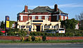 Shavington cum Gresty - Cheshire Cheese, Gresty.jpg 640 × 375; 149 KB
-
 Shavington cum Gresty Village Hall - geograph.org.uk - 2248522.jpg 640 × 460; 76 KB
-
 Shavington cum Gresty Village Hall - geograph.org.uk - 5194218.jpg 640 × 480; 83 KB
-
 Shavington farmland.jpg 1,200 × 807; 430 KB
-
 Shavington Post Office - geograph.org.uk - 2248558.jpg 820 × 1,024; 262 KB
-
 Shavington Youth Centre - geograph.org.uk - 2248538.jpg 1,024 × 768; 1.29 MB
-

-

-
 St John's Methodist Church - geograph.org.uk - 2248535.jpg 1,024 × 768; 761 KB
-
 St Mark's Church, Shavington - geograph.org.uk - 5194216.jpg 640 × 480; 84 KB
-
 Stile on footpath - geograph.org.uk - 416090.jpg 640 × 480; 126 KB
-
 Technical Institute - geograph.org.uk - 386689.jpg 640 × 480; 100 KB
-
 The A500, Shavington - geograph.org.uk - 118835.jpg 640 × 480; 82 KB
-
 The Cheshire Cheese pub, Gresty - geograph.org.uk - 4981838.jpg 1,024 × 768; 176 KB
-
 The Cheshire Cheese, Shavington - geograph.org.uk - 2248621.jpg 1,024 × 768; 687 KB
-

-
 The Vine public house, Shavington - geograph.org.uk - 5194210.jpg 640 × 480; 59 KB
-
 Vine Tree Villas, Nantwich Road, Crewe - geograph.org.uk - 389821.jpg 640 × 410; 149 KB
-
 Welcome to Crewe - Home of Mornflake Oat Cereals - geograph.org.uk - 5954172.jpg 1,024 × 751; 216 KB
-
 Gresty Brook - geograph.org.uk - 389827.jpg 452 × 640; 186 KB
.jpg)


,_Shavington_-_geograph.org.uk_-_5194249.jpg)
,_Shavington_-_geograph.org.uk_-_5194221.jpg)
,_Shavington_-_geograph.org.uk_-_5194246.jpg)


,_Shavington_-_geograph.org.uk_-_5194222.jpg)


_-_geograph.org.uk_-_381620.jpg)