Category:Sharrington
Jump to navigation
Jump to search
English: Sharrington is a village within the civil parish of Brinton in the English county of Norfolk.. The village is laid out on the southern edge of the A148, 3.5 miles west of Holt. The village is 10 miles east north east of the town of Fakenham, 13.4 miles west south west of Cromer and 124 miles north north east of London. The nearest railway station is at Sheringham for the Bittern Line which runs between Sheringham, Cromer and Norwich. The nearest airport is Norwich International Airport.
village in United Kingdom  | |||||
| Upload media | |||||
| Instance of |
| ||||
|---|---|---|---|---|---|
| Location | Brinton, North Norfolk, Norfolk, East of England, England | ||||
 | |||||
Subcategories
This category has the following 4 subcategories, out of 4 total.
Media in category "Sharrington"
The following 50 files are in this category, out of 50 total.
-

-
 A148 near Sharrington - geograph.org.uk - 3835053.jpg 640 × 430; 90 KB
-
 A148 near Sharrington - geograph.org.uk - 4644154.jpg 640 × 480; 338 KB
-
 Black Sheep - geograph.org.uk - 121405.jpg 480 × 640; 111 KB
-
 Heading northeast towards Brinton - geograph.org.uk - 550778.jpg 640 × 480; 64 KB
-
 Junction of A148 with B1156.jpg 640 × 480; 55 KB
-

-

-
 Junction with road to Saxlingham - geograph.org.uk - 529818.jpg 640 × 480; 53 KB
-
 New Road, Sharrington - geograph.org.uk - 529807.jpg 640 × 480; 99 KB
-
 North towards Holt Road (A148) - geograph.org.uk - 547796.jpg 480 × 640; 88 KB
-
 Remains of an ancient cross - geograph.org.uk - 3014683.jpg 640 × 480; 112 KB
-
 Sharrington Community Bus - geograph.org.uk - 121408.jpg 640 × 430; 109 KB
-
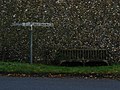
 Sharrington village sign (detail) - geograph.org.uk - 4581337.jpg 640 × 480; 195 KB
-
 Sharrington village sign - geograph.org.uk - 4581332.jpg 640 × 480; 217 KB
-
 The old preaching cross at Sharrington - geograph.org.uk - 5616263.jpg 2,592 × 3,456; 3.06 MB
-
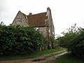
 The Old Rectory, Sharrington - geograph.org.uk - 529792.jpg 640 × 480; 73 KB
-
 The Street, Sharrington - geograph.org.uk - 529800.jpg 640 × 480; 65 KB
-

-

-
 Village Hall, Sharrington - geograph.org.uk - 529804.jpg 640 × 480; 59 KB
-
 Village Sign, Sharrington - geograph.org.uk - 529771.jpg 480 × 640; 122 KB
-
 A farm track leading west - geograph.org.uk - 550472.jpg 640 × 480; 65 KB
-
 A field of yellow flowers - geograph.org.uk - 550682.jpg 640 × 480; 103 KB
-

-
 Approaching Bale from the north - geograph.org.uk - 529925.jpg 480 × 640; 57 KB
-
 B1156 to Langham - geograph.org.uk - 529815.jpg 640 × 480; 67 KB
-
 Bales of Hay - geograph.org.uk - 313025.jpg 640 × 480; 133 KB
-

-
 Clipstreet Farm - geograph.org.uk - 529907.jpg 640 × 480; 55 KB
-
 Common Lane - geograph.org.uk - 529895.jpg 480 × 640; 49 KB
-
 Cottages on Sharrington Road - geograph.org.uk - 550526.jpg 640 × 480; 71 KB
-
 East on Sharrington Road - geograph.org.uk - 550535.jpg 480 × 640; 60 KB
-
 Entrance to Bale Hall - geograph.org.uk - 529919.jpg 480 × 640; 91 KB
-

-

-
 Harvested field near Green Farm - geograph.org.uk - 529813.jpg 640 × 480; 52 KB
-
 House amidst stubble - geograph.org.uk - 529837.jpg 640 × 480; 66 KB
-
 Junction of Upper Hall Road with A148 - geograph.org.uk - 529808.jpg 640 × 480; 56 KB
-
 Lane near Kettlestone - geograph.org.uk - 313021.jpg 640 × 480; 114 KB
-
 Looking south on Clipstreet Lane - geograph.org.uk - 550602.jpg 640 × 480; 91 KB
-
 North past Clipstreet Farm - geograph.org.uk - 550600.jpg 480 × 640; 73 KB
-
 Part Of Little Snoring Airfield - geograph.org.uk - 299400.jpg 640 × 480; 63 KB
-
 Ploughed field and hedgerows - geograph.org.uk - 550615.jpg 636 × 412; 71 KB
-
 Smoker's Hole - geograph.org.uk - 529842.jpg 640 × 480; 117 KB
-
 The Quiet Life - geograph.org.uk - 86578.jpg 640 × 480; 125 KB
-
 Track into harvested field - geograph.org.uk - 550699.jpg 640 × 480; 70 KB
-
 Track leading east - geograph.org.uk - 550479.jpg 640 × 480; 53 KB
-
 Track leading east to Brinton - geograph.org.uk - 550651.jpg 480 × 640; 76 KB
-
 Water Lane - geograph.org.uk - 46011.jpg 640 × 480; 98 KB


_-_geograph.org.uk_-_547796.jpg)


_-_geograph.org.uk_-_4581337.jpg)


