Category:Shardlow
Jump to navigation
Jump to search
village in Derbyshire, United Kingdom  | |||||
| Upload media | |||||
| Instance of | |||||
|---|---|---|---|---|---|
| Location | Shardlow and Great Wilne, South Derbyshire, Derbyshire, East Midlands, England | ||||
 | |||||
Subcategories
This category has the following 13 subcategories, out of 13 total.
C
- The Clock Warehouse, Shardlow (17 F)
D
- Derwent Mouth Lock (21 F)
H
- Hanson Log Boat (7 F)
J
L
- Long Horse Bridge (11 F)
M
- Malt Shovel, Shardlow (7 F)
N
- The Navigation Inn, Shardlow (6 F)
- New Inn, Shardlow (11 F)
S
- Shardlow Gas Pipe Bridge (5 F)
- Shardlow Hall (6 F)
- Shardlow Marina (5 F)
T
Media in category "Shardlow"
The following 65 files are in this category, out of 65 total.
-
 2 and 4 Canal Bank, Shardlow.jpg 1,280 × 960; 258 KB
-
 4 Aston Lane, Shardlow.jpg 1,280 × 960; 379 KB
-
 44A and 46 The Wharf, Shardlow.jpg 1,050 × 1,280; 417 KB
-
 47 The Wharf, Shardlow.jpg 1,013 × 1,280; 449 KB
-
 5 and 7 Canal Bank, Shardlow.jpg 1,280 × 933; 237 KB
-
 7 The Wharf, Shardlow.jpg 1,280 × 960; 314 KB
-
 83 London Road, Shardlow.jpg 1,280 × 960; 357 KB
-
 9-17 The Wharf, Shardlow.jpg 1,280 × 960; 430 KB
-
 A50 looking East - geograph.org.uk - 5288.jpg 640 × 407; 48 KB
-
 A50- A6 Junction - geograph.org.uk - 9643.jpg 640 × 396; 136 KB
-
 An abandoned boat at Shardlow - geograph.org.uk - 584479.jpg 482 × 640; 129 KB
-
 Barn West of 83 London Road, Shardlow.jpg 1,280 × 960; 411 KB
-
 Broken Weir - geograph.org.uk - 1183458.jpg 427 × 640; 194 KB
-
 Broken Weir - geograph.org.uk - 1183517.jpg 427 × 640; 186 KB
-
 Broughton House, Shardlow.jpg 1,280 × 920; 266 KB
-
 Cowlushaw close, Shardlow.jpg 3,264 × 2,448; 2.68 MB
-
 Dead and Surviving Ivy - geograph.org.uk - 874143.jpg 640 × 427; 335 KB
-
 Derwent Footbridge - geograph.org.uk - 932350.jpg 640 × 427; 275 KB
-
 Dog and Duck Shardlow Russ.JPG 3,672 × 2,036; 1.53 MB
-
 Fields near Shardlow - geograph.org.uk - 11947.jpg 640 × 434; 129 KB
-
 Former gravel pits south of Shardlow - geograph.org.uk - 655300.jpg 640 × 419; 85 KB
-
 Garden wall and gate - Shardlow - geograph.org.uk - 584543.jpg 640 × 490; 122 KB
-
 Gravel Pit, Aston Upon Trent - geograph.org.uk - 5289.jpg 640 × 258; 26 KB
-
 Holden House, Shardlow.jpg 1,280 × 967; 278 KB
-
 Ivy House, Shardlow.jpg 1,280 × 822; 521 KB
-
 Marina east of Shardlow, Derbyshire - geograph.org.uk - 1618556.jpg 640 × 459; 112 KB
-
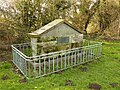
 Milepost, Shardlow.jpg 868 × 1,500; 182 KB
-
 No. 1 Store, Shardlow.jpg 1,280 × 910; 305 KB
-
 No. 2 Store, Shardlow.jpg 1,280 × 896; 248 KB
-
 No. 3 Mill, Shardlow.jpg 1,280 × 848; 304 KB
-
 Old Barn Shardlow.JPG 3,872 × 2,592; 2.05 MB
-
 Path at Shardlow - geograph.org.uk - 1158337.jpg 640 × 480; 169 KB
-
 Private Fishing Sign - geograph.org.uk - 932354.jpg 640 × 429; 164 KB
-
 River Trent at Shardlow - geograph.org.uk - 7480.jpg 640 × 362; 93 KB
-
 Riverside Plants and Reflected Clouds - geograph.org.uk - 932367.jpg 427 × 640; 225 KB
-

-
 Shardlow Field and trees - geograph.org.uk - 1158328.jpg 640 × 480; 176 KB
-
 Shardlow house on London Road - geograph.org.uk - 1158319.jpg 640 × 480; 205 KB
-
 Shardlow house on London Road - geograph.org.uk - 1159818.jpg 480 × 640; 65 KB
-
 Shardlow House.jpg 1,280 × 1,280; 393 KB
-
 Shardlow Manor.jpg 1,280 × 782; 274 KB
-
 Shardlow metalwork.jpg 2,592 × 1,952; 864 KB
-
 Shardlow Post Office & Store - geograph.org.uk - 3172193.jpg 1,024 × 768; 166 KB
-
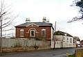
 Shardlow Primary School - geograph.org.uk - 5299.jpg 640 × 328; 50 KB
-
 Shardlow Primary School - geograph.org.uk - 898071.jpg 640 × 427; 185 KB
-
 Shardlow School.jpg 1,280 × 855; 261 KB
-
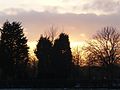
 Shardlow sunset - geograph.org.uk - 1158308.jpg 640 × 480; 169 KB
-
 Shardlow sunset by the Church - geograph.org.uk - 1158288.jpg 640 × 480; 170 KB
-
 ShardlowHeritage22.JPG 1,377 × 862; 763 KB
-
 ShardlowWareh.JPG 1,177 × 759; 768 KB
-
 Snaking Footpath - geograph.org.uk - 932426.jpg 640 × 427; 264 KB
-
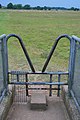 Stile on a Footbridge - geograph.org.uk - 873993.jpg 427 × 640; 267 KB
-
 The Dog & Duck in Shardlow - geograph.org.uk - 4625479.jpg 800 × 586; 109 KB
-
 The Dog and Duck, Shardlow.jpg 1,280 × 904; 244 KB
-
 The Dower House, Shardlow.jpg 1,280 × 960; 363 KB
-
 The Firs, Shardlow.jpg 1,280 × 960; 552 KB
-
 The Grove Hospital, Shardlow - geograph.org.uk - 5284.jpg 640 × 385; 60 KB
-
 The Lady in Grey, Shardlow.jpg 1,280 × 880; 318 KB
-
 The Old Salt Warehouse - Shardlow - geograph.org.uk - 551503.jpg 482 × 640; 80 KB
-
 The River Derwent, not far to go now - geograph.org.uk - 873989.jpg 640 × 427; 183 KB
-
 Toll Sign, Shardlow.jpg 1,280 × 960; 719 KB
-
 Tollcharges.jpg 640 × 480; 231 KB
-
 Trent Corn Mill No. 1, Shardlow.jpg 1,280 × 935; 267 KB
-
 Gas Pumping Station - geograph.org.uk - 6398.jpg 640 × 480; 191 KB
-


