Category:Shamley Green
Jump to navigation
Jump to search
English: Shamley Green is a small village in the county of Surrey, England. Neighbouring villages include Wonersh, Chilworth, Farncombe and Bramley. Nearby railway stations include Chilworth railway station (2.3 miles) and Farncombe railway station (3.8 miles).
Svenska: Shamley Green är en liten by i Surrey i England. Byn har 1.500 invånare, och nästa större ort är Guildford.
village in Surrey, England, UK  | |||||
| Upload media | |||||
| Instance of | |||||
|---|---|---|---|---|---|
| Location | Wonersh, Waverley, Surrey, South East England, England | ||||
 | |||||
Subcategories
This category has the following 3 subcategories, out of 3 total.
Media in category "Shamley Green"
The following 43 files are in this category, out of 43 total.
-
 Attractive house at Shamley Green - geograph.org.uk - 1536780.jpg 640 × 360; 63 KB
-
 Bridleway By Woodhill Lane - geograph.org.uk - 1388559.jpg 640 × 480; 120 KB
-
 Church Hill - geograph.org.uk - 1096715.jpg 640 × 480; 162 KB
-
 Cows on Lordshill Common - geograph.org.uk - 182188.jpg 640 × 426; 131 KB
-
 Deer on Reelhall Hill - geograph.org.uk - 1386949.jpg 640 × 490; 56 KB
-
 Dodman's Cottage - geograph.org.uk - 164332.jpg 640 × 480; 143 KB
-
 Downs Link by Rooks Hill Farm - geograph.org.uk - 1096620.jpg 640 × 480; 147 KB
-
 Downs Link Footbridge - geograph.org.uk - 928419.jpg 640 × 480; 107 KB
-
 Downs Link Junction - geograph.org.uk - 928414.jpg 640 × 480; 146 KB
-

-
 Fields north of Northcote Lane - geograph.org.uk - 164334.jpg 640 × 480; 103 KB
-

-
 Former Congregational Chapel, Cranleigh Road, Shamley Green (May 2014) (1).JPG 1,800 × 1,600; 637 KB
-
 Former Congregational Chapel, Cranleigh Road, Shamley Green (May 2014) (2).JPG 2,600 × 2,400; 1.18 MB
-
 Green Lane - geograph.org.uk - 164338.jpg 640 × 480; 172 KB
-
 House at Shamley Green - geograph.org.uk - 1536793.jpg 640 × 360; 80 KB
-
 Houses on Hullbrook Lane, Shamley Green - geograph.org.uk - 4851187.jpg 2,048 × 1,536; 1.52 MB
-
 Hullbrook House - geograph.org.uk - 1095917.jpg 640 × 480; 107 KB
-
 Hullhatch House and pond - geograph.org.uk - 681446.jpg 640 × 480; 106 KB
-
-
-
 Plonk's Hill - geograph.org.uk - 1096704.jpg 640 × 480; 111 KB
-
 Pond by Woodhill Manor - geograph.org.uk - 1388523.jpg 640 × 480; 110 KB
-
 Pond on Madgehole Lane - geograph.org.uk - 1388265.jpg 640 × 480; 143 KB
-
 Pond on Woodhill Lane - geograph.org.uk - 1388514.jpg 640 × 480; 121 KB
-
 Reel Hall Farm Road End - geograph.org.uk - 1388537.jpg 640 × 480; 135 KB
-
 Sandhurst Copse - geograph.org.uk - 1386962.jpg 480 × 640; 153 KB
-
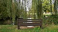 Seat by duck pond at Shamley Green - geograph.org.uk - 1536789.jpg 640 × 360; 95 KB
-
 Shamley Green - geograph.org.uk - 1386937.jpg 640 × 480; 117 KB
-
 Shamley Green - geograph.org.uk - 2035.jpg 640 × 480; 38 KB
-
 Shamley Green Duck Pond - geograph.org.uk - 1096739.jpg 640 × 480; 154 KB
-
 Shamley Green Pond - geograph.org.uk - 1094225.jpg 640 × 480; 117 KB
-
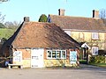
 Shamley Green Stores - geograph.org.uk - 1388578.jpg 480 × 640; 91 KB
-
 Shamley Green, Fanesbridge on the Downs Link path looking north.jpg 3,500 × 2,625; 3.33 MB
-
 Shamley Green, Hazel Wood bridge on the Downs Link path.jpg 3,500 × 2,625; 4.69 MB
-
 Signs of the Times, Shamley Green. - geograph.org.uk - 136100.jpg 640 × 397; 107 KB
-
 The Cook Shop, Shamley Green - geograph.org.uk - 1095853.jpg 640 × 480; 93 KB
-

-
 The green at Shamley Green - geograph.org.uk - 1536747.jpg 640 × 360; 56 KB
-
 The Green, Shamley Green - geograph.org.uk - 1095882.jpg 640 × 480; 118 KB
-
 Tree by the green at Shamley Green - geograph.org.uk - 1536786.jpg 360 × 640; 63 KB
-
 Wealden Landscape near Shamley Green - geograph.org.uk - 1096602.jpg 640 × 480; 87 KB
-
 Westland Farm - geograph.org.uk - 1095902.jpg 640 × 480; 92 KB


_(1).JPG)
_(2).JPG)


_with_drive_to_Hullbrook_Court_(centre_right)_-_geograph.org.uk_-_182582.jpg)
_with_Stroud_Lane_-_geograph.org.uk_-_164327.jpg)


