Category:Shalford, Essex
Jump to navigation
Jump to search
English: Shalford is a village and civil parish in Essex, England. The village is about four miles north from Braintree on the B1057. The parish includes the hamlets of Church End, Jasper's Green, and Shalford Green.

village and civil parish in Essex, England, UK  | |||||
| Upload media | |||||
| Instance of | |||||
|---|---|---|---|---|---|
| Location | Braintree, Essex, East of England, England | ||||
| Population |
| ||||
 | |||||
Subcategories
This category has the following 5 subcategories, out of 5 total.
A
- St Andrew's Church, Shalford (19 F)
C
- Church End, Braintree (1 F)
G
- The George, Shalford (2 F)
J
- Jasper's Green (1 F)
S
- Sheering Hall, Braintree (1 F)
Media in category "Shalford, Essex"
The following 56 files are in this category, out of 56 total.
-
 A house known as Ringers - geograph.org.uk - 401181.jpg 640 × 480; 87 KB
-
 A way into Jasper's Green - geograph.org.uk - 3376637.jpg 640 × 480; 149 KB
-
 Blackbird Foraging.jpg 2,736 × 3,648; 2.18 MB
-
 Bridleway near Hunts Farm, Shalford - geograph.org.uk - 3536616.jpg 3,648 × 2,736; 3.74 MB
-
 Bridleway to Shalford - geograph.org.uk - 3536678.jpg 3,648 × 2,736; 4.02 MB
-
 Bridleway to Shalford - geograph.org.uk - 3536683.jpg 3,648 × 2,736; 4.33 MB
-
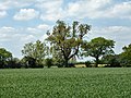
 Countryside at Shalford, Essex - geograph.org.uk - 152481.jpg 640 × 480; 92 KB
-
 Cut Hedge Cottage - geograph.org.uk - 3244358.jpg 640 × 428; 151 KB
-
 Entering Church End, Shalford - geograph.org.uk - 3376575.jpg 640 × 480; 146 KB
-
 Entering Jasper's Green - geograph.org.uk - 3376620.jpg 640 × 480; 130 KB
-
 Entrance to field on Kynaston Road - geograph.org.uk - 3498540.jpg 2,048 × 1,536; 1.5 MB
-
 Eversons Farm, Shalford - geograph.org.uk - 6560888.jpg 1,600 × 1,045; 409 KB
-
 Field entrance off Water Lane - geograph.org.uk - 5297662.jpg 640 × 480; 204 KB
-
 Field south of Hulls Lane - geograph.org.uk - 3376510.jpg 640 × 480; 98 KB
-
 Fishing Lake and Church, Shalford - geograph.org.uk - 2600668.jpg 1,865 × 1,395; 534 KB
-
 Flowering Dog Rose in hedgerow along bridleway, Shalford - geograph.org.uk - 3536735.jpg 3,648 × 2,736; 3.1 MB
-
 Footpath and church at Shalford - geograph.org.uk - 2600652.jpg 2,048 × 1,536; 754 KB
-
 Footpath from Shalford towards Shalford Green - geograph.org.uk - 6308500.jpg 1,024 × 685; 351 KB
-
 Garretts Lane, Shalford - geograph.org.uk - 3376597.jpg 640 × 480; 141 KB
-
 Hedgerow trees - geograph.org.uk - 3480132.jpg 640 × 480; 133 KB
-
 Hubbard's Farm - geograph.org.uk - 5297578.jpg 640 × 480; 127 KB
-
 Hunt's Farm, Shalford - geograph.org.uk - 6561008.jpg 1,600 × 1,067; 577 KB
-
 Junction of two lanes in Shalford Green - geograph.org.uk - 3497507.jpg 2,048 × 1,536; 1.52 MB
-

-
 Mowing the grass, Shalford - geograph.org.uk - 3521400.jpg 4,320 × 3,240; 3.46 MB
-
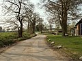
 Parkend Lane - geograph.org.uk - 5297583.jpg 640 × 480; 163 KB
-
 Parkend Lane - geograph.org.uk - 5297630.jpg 640 × 480; 220 KB
-
 Parkend Lane - geograph.org.uk - 5297632.jpg 640 × 480; 240 KB
-
 Parkend Lane - geograph.org.uk - 5297654.jpg 640 × 480; 121 KB
-
 Parkend Lane - geograph.org.uk - 5297659.jpg 640 × 480; 215 KB
-
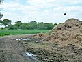 Parkend Lane curving round manure heap - geograph.org.uk - 5297648.jpg 640 × 480; 140 KB
-
 Pod's Brook, Littles Lane, Shalford Green, Essex - geograph.org.uk - 6167370.jpg 3,264 × 2,448; 2 MB
-
 Redfants Manor, Shalford - geograph.org.uk - 6560885.jpg 640 × 390; 118 KB
-
 Riding on Water Hall Lane, Shalford - geograph.org.uk - 3513618.jpg 3,648 × 2,736; 4.09 MB
-
 Ringers, Bardfield Road, Shalford - geograph.org.uk - 6560880.jpg 1,600 × 1,191; 786 KB
-
 Road from Shalford to Waltham Cross - geograph.org.uk - 3536691.jpg 3,648 × 2,736; 2.89 MB
-
 Rough pastureland near Redfants Manor Farm, Shalford - geograph.org.uk - 6560897.jpg 1,600 × 1,067; 563 KB
-
 Shalford church - geograph.org.uk - 6308444.jpg 1,024 × 685; 431 KB
-
 Shalford Park woodland - geograph.org.uk - 3244311.jpg 640 × 428; 191 KB
-
 Shalford Primary School - geograph.org.uk - 3521390.jpg 4,320 × 3,240; 2.95 MB
-
 Shalford village sign - geograph.org.uk - 5892555.jpg 3,240 × 4,320; 6.13 MB
-
 The Street, Shalford, Essex - geograph.org.uk - 6533886.jpg 4,608 × 3,072; 5.36 MB
-
 Track to Lone's Hole, Shalford - geograph.org.uk - 3513617.jpg 3,648 × 2,736; 5.43 MB
-
 Tree at head of shallow valley - geograph.org.uk - 3376521.jpg 640 × 480; 112 KB
-

-
 Valley of River Pant near Shalford - geograph.org.uk - 6560902.jpg 640 × 383; 57 KB
-
 Village hall, Shalford - geograph.org.uk - 3521397.jpg 4,320 × 3,240; 2.9 MB
-
 Water Lane - geograph.org.uk - 3480139.jpg 640 × 480; 162 KB
-
 Water Lane - geograph.org.uk - 3482588.jpg 640 × 480; 169 KB
-
 Water tanks, Shalford Hall Farm - geograph.org.uk - 6308434.jpg 1,024 × 685; 251 KB
-
 Wheat field near Sheering Hall - geograph.org.uk - 5297707.jpg 640 × 480; 125 KB
-
 Approach to Hunt's Farm - geograph.org.uk - 401189.jpg 640 × 480; 111 KB
-
 Barn and lych gate - geograph.org.uk - 405684.jpg 640 × 428; 400 KB
-
 Cottage on Water Lane - geograph.org.uk - 405119.jpg 640 × 469; 442 KB
-
 Hubbard's Farm, Shalford, Essex - geograph.org.uk - 152470.jpg 640 × 480; 64 KB
-
 Stream at edge of Shalford Park - geograph.org.uk - 405032.jpg 640 × 428; 425 KB


