Category:ShakeMaps of earthquakes in Pakistan
Jump to navigation
Jump to search
Media in category "ShakeMaps of earthquakes in Pakistan"
The following 11 files are in this category, out of 11 total.
-
2001 Gujarat earthquake intensity.jpg 787 × 982; 362 KB
-
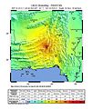
2005 Kashmir earthquake shakemap.jpg 787 × 990; 453 KB
-
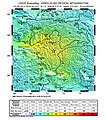
2008 Quetta Pakistan earthquake.jpg 612 × 719; 132 KB
-
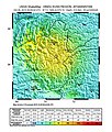
2011 Pakistan earthquake.jpg 612 × 717; 122 KB
-
2013 iran pakistan earthquake.jpg 612 × 718; 124 KB
-
2013 Pakistan earthquake ShakeMap.jpg 612 × 718; 115 KB
-
2019 Kashmir Earthquake - ShakeMap.jpg 808 × 997; 314 KB
-
M7.7 - 66km NNE of Awaran, Pakistan.jpg 612 × 718; 116 KB
-
Shakemap us10003re5 highres.jpg 2,550 × 2,871; 5.55 MB
-
Shakemap us10003re5.jpg 612 × 718; 159 KB
-
USGS Shakemap - 2005 Kashmir earthquake.jpg 612 × 718; 124 KB


