Category:ShakeMaps of earthquakes in Mexico
Jump to navigation
Jump to search
Countries of North America: Canada · Costa Rica · El Salvador · Guatemala · Haiti · Honduras · Mexico · Nicaragua · Panama · United States of America‡
‡: partly located in North America
‡: partly located in North America
Media in category "ShakeMaps of earthquakes in Mexico"
The following 43 files are in this category, out of 43 total.
-
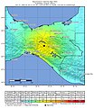
1985 Mexico Earthquake 19850919 1317 UTC loc.jpg 612 × 721; 156 KB
-
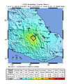
1985 Mexico Earthquake 21091985 0137 UTC loc.jpg 612 × 720; 171 KB
-
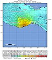
1995 Chiapas Earthquake.jpg 863 × 995; 328 KB
-
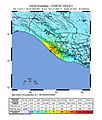
1995 USGS Colima.jpg 787 × 975; 268 KB
-
1999 Puebla M7 Intensity.jpg 612 × 722; 199 KB
-
2014 Guerrero Earthquake ShakeMap.jpg 612 × 717; 108 KB
-
2017 Intensity of the earthquake in Mexico (Chiapas).jpg 612 × 723; 110 KB
-
2018 Oaxaca earthquake shake map.jpg 612 × 718; 103 KB
-
2019-02-01 Frontera Hidalgo, Mexico M6.5 earthquake shakemap (USGS).jpg 879 × 1,072; 307 KB
-
2019-02-01 Puerto Madero, Mexico M6.6 earthquake shakemap (USGS).jpg 612 × 718; 106 KB
-
2019-11-20 Puerto Madero, Mexico M6.3 earthquake shakemap (USGS).jpg 812 × 1,024; 167 KB
-
2020-05-22 San Jose del Cabo, Mexico M6.1 earthquake shakemap (USGS).jpg 835 × 998; 153 KB
-
2021-09-08 Acapulco, Mexico M7 earthquake shakemap (USGS).jpg 787 × 996; 310 KB
-
2021-12-22 La Cruz de Loreto, Mexico M6 earthquake shakemap (USGS).jpg 790 × 998; 158 KB
-
2021-12-23 La Cruz de Loreto, Mexico M6 earthquake shakemap (USGS).jpg 787 × 995; 161 KB
-
2022-09-19 Aquila, Mexico M7.6 earthquake shakemap (USGS).jpg 788 × 1,000; 142 KB
-
2022-09-22 Aguililla, Mexico M6.8 earthquake shakemap (USGS).jpg 811 × 999; 137 KB
-
April 2010 Baja California aftershock intensity USGS.jpg 863 × 1,077; 559 KB
-
April 2010 Baja California earthquake intensity USGS.jpg 612 × 718; 123 KB
-
1995 Chiapas earthquake USGS shakemap.jpg 612 × 717; 119 KB
-
Colima 1995 10 09 USGS loc.jpg 612 × 723; 156 KB
-
Earthquake 5 km ENE of Raboso, Mexico, 2017.jpg 612 × 718; 117 KB
-
2011 Guerrero earthquake USGS shakemap.jpg 541 × 662; 174 KB
-
Intensidad del terremoto en Chiapas, México, 2017.png 648 × 874; 437 KB
-
Intensity (1).jpg 612 × 718; 95 KB
-
Intensity chiapas 2014.jpg 612 × 717; 97 KB
-
M 7.7 - Oaxaca, Mexico (1978).jpg 787 × 984; 270 KB
-
Mapa del temblor.jpg 612 × 717; 117 KB
-
Michoacan Earthquake 2012.jpg 612 × 718; 103 KB
-
Intensity Oaxaca 2012.jpg 612 × 720; 118 KB
-
ShakeMap 7.5 Colima, Mexico.jpg 612 × 717; 102 KB
-
ShakeMap 7.6 Michoacan, Mexico.jpg 2,466 × 3,116; 788 KB
-
Shakemap USGS 7.5 Ch.jpg 833 × 1,078; 324 KB
-
Sismo Guerrero-Oaxaca abril 2012.jpg 612 × 717; 101 KB
-
USGS Guerrero shakemap.png 524 × 537; 456 KB
-
USGS Shakemap - 1979 Imperial Valley earthquake.jpg 612 × 722; 185 KB
-
USGS Shakemap 2011 Guerrero Mexico Earthquake.jpg 612 × 717; 126 KB


