Category:Shaft southwest of Hoeve Zonneberg (Sint Pietersberg)
Jump to navigation
Jump to search
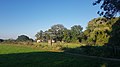
English: This shaft was used as the chimney of the underground bakery, part of the evacuation plan in World War II.
| Object location | | View all coordinates using: OpenStreetMap |
|---|
Media in category "Shaft southwest of Hoeve Zonneberg (Sint Pietersberg)"
The following 14 files are in this category, out of 14 total.
-
 20130504 Maastricht Sint-Pietersberg 14 Ventilation shaft for the caves underneath.JPG 2,448 × 3,264; 1.98 MB
-
 Maastricht-Hoeve Zonneberg (27).jpg 4,032 × 2,268; 2.64 MB
-
 Maastricht-Hoeve Zonneberg (28).jpg 4,032 × 2,268; 2.14 MB
-
 Maastricht-Hoeve Zonneberg (29).jpg 4,032 × 2,268; 3.78 MB
-
 Maastricht-schacht ten zuidwesten Hoeve Zonneberg (1).jpg 4,032 × 2,268; 4.97 MB
-
 Maastricht-schacht ten zuidwesten Hoeve Zonneberg (10).jpg 4,032 × 2,268; 1.78 MB
-
 Maastricht-schacht ten zuidwesten Hoeve Zonneberg (2).jpg 4,032 × 2,268; 4.17 MB
-
 Maastricht-schacht ten zuidwesten Hoeve Zonneberg (3).jpg 4,032 × 2,268; 2.51 MB
-
 Maastricht-schacht ten zuidwesten Hoeve Zonneberg (4).jpg 4,032 × 2,268; 3.47 MB
-
 Maastricht-schacht ten zuidwesten Hoeve Zonneberg (5).jpg 4,032 × 2,268; 3.01 MB
-
 Maastricht-schacht ten zuidwesten Hoeve Zonneberg (6).jpg 4,032 × 2,268; 3.73 MB
-
 Maastricht-schacht ten zuidwesten Hoeve Zonneberg (7).jpg 4,032 × 2,268; 2.25 MB
-
 Maastricht-schacht ten zuidwesten Hoeve Zonneberg (8).jpg 4,032 × 2,268; 2.57 MB
-
 Maastricht-schacht ten zuidwesten Hoeve Zonneberg (9).jpg 4,032 × 2,268; 2.58 MB

.jpg)
.jpg)
.jpg)
.jpg)
.jpg)
.jpg)
.jpg)
.jpg)
.jpg)
.jpg)
.jpg)
.jpg)
.jpg)