Category:Shadoxhurst
Jump to navigation
Jump to search
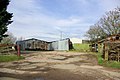
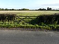
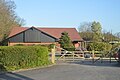
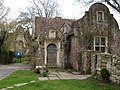
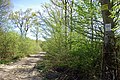
English: Shadoxhurst is civil parish and a village on the Kent Weald, near Ashford in Kent, England located between the North Downs and Romney Marsh in wooded countryside and farmland. The parish covers approximately , with the Whitewater Dyke (a tributary of the River Stour) rising in the area.
village and civil parish in Kent, United Kingdom  | |||||
| Upload media | |||||
| Instance of | |||||
|---|---|---|---|---|---|
| Location | Ashford, Kent, South East England, England | ||||
| Area |
| ||||
| Said to be the same as | Shadoxhurst (Wikimedia duplicated page, civil parish) | ||||
 | |||||
Subcategories
This category has the following 2 subcategories, out of 2 total.
O
- Oasts in Shadoxhurst (2 F)
Media in category "Shadoxhurst"
The following 108 files are in this category, out of 108 total.
-
 Access road to Moat Farm - geograph.org.uk - 1726436.jpg 2,592 × 1,944; 1.03 MB
-
 Bend in Hamstreet Road - geograph.org.uk - 3248142.jpg 2,256 × 1,496; 914 KB
-
 Bend on Ashford Road - geograph.org.uk - 1559875.jpg 640 × 427; 97 KB
-
 Berberis Place from a footpath - geograph.org.uk - 6126598.jpg 3,264 × 2,448; 3.77 MB
-
 Berberis Place from a footpath - geograph.org.uk - 6126604.jpg 2,989 × 2,448; 1.72 MB
-
 Berberis Place, Woodchurch Road - geograph.org.uk - 6126583.jpg 3,264 × 2,448; 2.16 MB
-
 Blind Grooms Farmhouse - geograph.org.uk - 1726475.jpg 1,024 × 768; 109 KB
-
 Building site, Woodchurch Road - geograph.org.uk - 5486007.jpg 3,264 × 2,448; 3.58 MB
-
 Building site, Woodchurch Road - geograph.org.uk - 5802200.jpg 3,264 × 2,448; 3.87 MB
-
 Building site, Woodchurch Road - geograph.org.uk - 5804570.jpg 3,264 × 2,448; 3.76 MB
-
 Building site, Woodchurch Road - geograph.org.uk - 5804614.jpg 3,264 × 2,448; 3.84 MB
-
 Byway in Great Turrels Wood - geograph.org.uk - 2068282.jpg 3,072 × 2,304; 3.25 MB
-
 Byway off Hornash Lane - geograph.org.uk - 1559873.jpg 640 × 480; 140 KB
-
 Byway to Bromley Green - geograph.org.uk - 1726439.jpg 2,592 × 1,944; 1.91 MB
-
 Byway to Great Turrels Wood - geograph.org.uk - 2068281.jpg 3,072 × 2,304; 3.57 MB
-
 Chequers Green, Woodchurch Road - geograph.org.uk - 6125459.jpg 3,264 × 2,448; 2.05 MB
-
 Church Lane - geograph.org.uk - 1559871.jpg 640 × 480; 140 KB
-
 Church Lane heading towards Shadoxhurst - geograph.org.uk - 1726442.jpg 2,592 × 1,944; 1.53 MB
-
 Communications Antenna - geograph.org.uk - 3248136.jpg 2,256 × 1,496; 904 KB
-
 Corner Stone, Woodchurch Road - geograph.org.uk - 5804635.jpg 3,264 × 2,448; 3.77 MB
-
 Corrugated Iron Sheds - geograph.org.uk - 339800.jpg 640 × 428; 104 KB
-
 Crossroads at Bromley Green - geograph.org.uk - 3248123.jpg 2,256 × 1,496; 909 KB
-
 Development of Shadoxhurst Garage site, Woodchurch Road - geograph.org.uk - 4607836.jpg 3,264 × 2,448; 3.84 MB
-
 Disused Greenhouses, Bromley Green - geograph.org.uk - 339840.jpg 640 × 417; 77 KB
-
 Duck Lane - geograph.org.uk - 4341566.jpg 640 × 480; 121 KB
-
 Entrance into a building site, Woodchurch Road - geograph.org.uk - 5960183.jpg 3,264 × 2,448; 1.95 MB
-
 Entrance to building site, Woodchurch Road - geograph.org.uk - 5804653.jpg 3,264 × 2,448; 3.61 MB
-
 Entrance to building site, Woodchurch Road - geograph.org.uk - 5960193.jpg 3,264 × 2,448; 3.8 MB
-
 Entrance to Shadoxhurst - geograph.org.uk - 4156390.jpg 640 × 480; 62 KB
-
 Farmland, Bethersden Road - geograph.org.uk - 5546210.jpg 3,264 × 2,448; 4.01 MB
-
 Farmland, Bethersden Road - geograph.org.uk - 5546222.jpg 3,264 × 2,448; 3.77 MB
-
 Farmland, Criol Lane - geograph.org.uk - 5603707.jpg 3,264 × 2,448; 2.61 MB
-
 Farmland, Criol Lane - geograph.org.uk - 5604475.jpg 3,264 × 2,448; 2.24 MB
-
 Farmland, Criol Lane - geograph.org.uk - 5604483.jpg 3,264 × 2,448; 2.57 MB
-
 Farmland, Criol Lane - geograph.org.uk - 5604498.jpg 3,264 × 2,448; 2.43 MB
-
 Farmland, Criol Lane - geograph.org.uk - 5604503.jpg 3,264 × 2,448; 2.37 MB
-
 Farmland, Criol Lane - geograph.org.uk - 5605558.jpg 3,264 × 2,448; 2.4 MB
-
 Farmland, Criol Lane - geograph.org.uk - 5605563.jpg 3,264 × 2,448; 2.51 MB
-
 Farmland, Criol Lane - geograph.org.uk - 5605571.jpg 3,264 × 2,448; 2.58 MB
-
 Field off Hornash Lane - geograph.org.uk - 3248129.jpg 2,256 × 1,496; 2.25 MB
-
 Fields off Bethersden Road - geograph.org.uk - 3248322.jpg 2,256 × 1,496; 931 KB
-
 Fields off Bethersden Road - geograph.org.uk - 3248329.jpg 2,256 × 1,496; 910 KB
-
 Footbridge and stile near Shadoxhurst - geograph.org.uk - 1726451.jpg 2,592 × 1,944; 1.98 MB
-
 Footpath in Bambridge Wood (2) - geograph.org.uk - 2068303.jpg 3,072 × 2,304; 2.86 MB
-
 Footpath in Bambridge Wood - geograph.org.uk - 2068300.jpg 2,304 × 3,072; 2.68 MB
-
 Footpath junction on byway in Great Turrels Wood - geograph.org.uk - 2068291.jpg 3,072 × 2,304; 3.1 MB
-
 Former Shadoxhurst Garage - geograph.org.uk - 2181231.jpg 640 × 244; 41 KB
-
 Former Shadoxhurst Garage, Woodchurch Road - geograph.org.uk - 3874980.jpg 3,264 × 2,448; 4 MB
-
 Forty Acre Wood - geograph.org.uk - 5509134.jpg 640 × 330; 30 KB
-
 Green Farm - geograph.org.uk - 396865.jpg 640 × 480; 223 KB
-
 Hornash House - geograph.org.uk - 1726464.jpg 2,592 × 1,944; 1.63 MB
-
 Hornash Lane - geograph.org.uk - 3248130.jpg 2,256 × 1,496; 918 KB
-
 Houses under construction - geograph.org.uk - 5960171.jpg 3,239 × 2,448; 2.37 MB
-
 Houses under construction - geograph.org.uk - 5960177.jpg 3,264 × 2,448; 2.19 MB
-
 Houses under construction, Woodchurch Road - geograph.org.uk - 5960210.jpg 3,264 × 2,448; 3.78 MB
-
 Jehovah's Witnesses Kingdow Hall - geograph.org.uk - 2042592.jpg 3,072 × 2,304; 1.91 MB
-
 Jenkey Farm - geograph.org.uk - 3121964.jpg 2,256 × 1,496; 758 KB
-

-
 Junction on Tally Ho Road - geograph.org.uk - 1726477.jpg 2,592 × 1,944; 792 KB
-
 Land behind the King’s Head, Woodchurch Road - geograph.org.uk - 5546171.jpg 3,264 × 2,448; 3.96 MB
-
 Land behind the King’s Head, Woodchurch Road - geograph.org.uk - 5546181.jpg 3,264 × 2,448; 2.99 MB
-
 Lead downpipe on the School house - geograph.org.uk - 396826.jpg 480 × 640; 282 KB
-
 Looking north-northwest along Church Lane - geograph.org.uk - 4617792.jpg 3,264 × 2,448; 2.53 MB
-
 Manor Farm, Bromley Green - geograph.org.uk - 2068324.jpg 3,072 × 2,304; 1.97 MB
-
 Monkey Puzzle Tree, Bethersden Road, Shadoxhurst - geograph.org.uk - 3772490.jpg 2,035 × 3,072; 3.79 MB
-
 Nairne Close, Shadoxhurst - geograph.org.uk - 1209018.jpg 640 × 480; 63 KB
-
 Nickley Wood Road - geograph.org.uk - 3121970.jpg 2,256 × 1,496; 919 KB
-
 Oak Fields, Woodchurch Road - geograph.org.uk - 5087373.jpg 3,264 × 2,448; 1.99 MB
-
 Oak View - geograph.org.uk - 5087382.jpg 3,264 × 2,448; 1.74 MB
-
 On Hamstreet Rd - geograph.org.uk - 5509132.jpg 640 × 426; 73 KB
-
 Orlestone Forest Northern Boundary - geograph.org.uk - 339858.jpg 640 × 428; 145 KB
-
 Park Farm House, Shadoxhurst - geograph.org.uk - 3248309.jpg 2,256 × 1,496; 901 KB
-
 Quince Cottage, Shadoxhurst - geograph.org.uk - 339872.jpg 640 × 428; 80 KB
-
 Road junction on Hornash Lane - geograph.org.uk - 1726460.jpg 2,592 × 1,944; 860 KB
-
 Rosemary Cottage - geograph.org.uk - 1726445.jpg 2,592 × 1,944; 1,013 KB
-
 Shadoxhurst Millennium Sign - geograph.org.uk - 4156397.jpg 640 × 480; 133 KB
-
 Shadoxhurst Village Hall - geograph.org.uk - 1726454.jpg 2,592 × 1,944; 904 KB
-
 Shadoxhurst Village Sign - geograph.org.uk - 2068335.jpg 2,304 × 3,072; 2.26 MB
-
 Sheenam, Woodchurch Road - geograph.org.uk - 5804721.jpg 3,264 × 2,448; 2.36 MB
-
 Sheep Mostly Lying Down - geograph.org.uk - 339889.jpg 640 × 428; 81 KB
-
 Stile and footbridge near Jenkey Farm - geograph.org.uk - 1726431.jpg 2,592 × 1,944; 1.8 MB
-
 Stile near Longrope Farm - geograph.org.uk - 1726423.jpg 2,592 × 1,944; 1.45 MB
-
 Tally Ho Road - geograph.org.uk - 5805826.jpg 3,264 × 2,448; 2.14 MB
-

-
 The School house - geograph.org.uk - 396806.jpg 640 × 480; 319 KB
-
 Track into Great Turtle Wood - geograph.org.uk - 2068293.jpg 2,304 × 3,072; 3.04 MB
-
 Traffic control, Woodchurch Road - geograph.org.uk - 5804688.jpg 3,264 × 2,448; 3.9 MB
-
 View from Tally Ho Road - geograph.org.uk - 5805820.jpg 3,264 × 2,448; 3.88 MB
-
 Village pump and bench - geograph.org.uk - 395655.jpg 480 × 640; 264 KB
-
 Walkers in Field - geograph.org.uk - 4341569.jpg 640 × 480; 77 KB
-
 Woodchurch Road, Shadoxhurst - geograph.org.uk - 3248314.jpg 2,256 × 1,496; 908 KB
-
 Woodgate house - geograph.org.uk - 396858.jpg 640 × 480; 371 KB
-
 Woodland Track near Bambridge Wood - geograph.org.uk - 2068297.jpg 3,072 × 2,304; 1.9 MB
-
 Wymondham, Woodchurch Road - geograph.org.uk - 4884290.jpg 3,264 × 2,448; 2.28 MB
-
 Beacon House and Small Profits - geograph.org.uk - 340213.jpg 640 × 428; 117 KB
-
 Byway through the woods - geograph.org.uk - 408817.jpg 640 × 428; 475 KB
-
 Byway towards Kingsland's Wood - geograph.org.uk - 408793.jpg 640 × 423; 382 KB
-
 Coldblow near Beaconhill Nurseries - geograph.org.uk - 340205.jpg 640 × 428; 81 KB
-
 Fly-tipping by Chart Road - geograph.org.uk - 339795.jpg 640 × 428; 93 KB
-
 Handcock's Farm - geograph.org.uk - 339898.jpg 640 × 428; 111 KB
-
 Hornash Lane, Shadoxhurst - geograph.org.uk - 339816.jpg 640 × 428; 100 KB
-
 Jenkey Farm - geograph.org.uk - 339865.jpg 640 × 428; 103 KB
-
 Junction on Shadoxhurst Road - geograph.org.uk - 339902.jpg 640 × 428; 78 KB
-
 Manufacturer's name and date on pump - geograph.org.uk - 395659.jpg 480 × 640; 337 KB
-
 Mayshaves House - geograph.org.uk - 339906.jpg 640 × 428; 159 KB
-
 Nichols House - geograph.org.uk - 396841.jpg 640 × 480; 260 KB
-
 Pond in a Field - geograph.org.uk - 339893.jpg 640 × 428; 80 KB
-
 Road Junction, Shadoxhurst - geograph.org.uk - 339881.jpg 640 × 428; 85 KB


_-_geograph.org.uk_-_2068303.jpg)


