Category:Sgùrr Bàn
Jump to navigation
Jump to search
989m high mountain in Highland, Scotland, UK  | |||||
| Upload media | |||||
| Instance of | |||||
|---|---|---|---|---|---|
| Location | Highland, Scottish Highlands, Scotland | ||||
| Topographic prominence |
| ||||
| Elevation above sea level |
| ||||
 | |||||
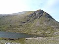
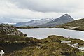
Sgùrr Bàn is a mountain in the northwest Highlands of Scotland. It is located 11 km to the north of the village of Kinlochewe. It is 989 m high, and listed as a Munro and a Marilyn.
Media in category "Sgùrr Bàn"
The following 21 files are in this category, out of 21 total.
-
 Boulderfield on Sgurr Ban - geograph.org.uk - 1256911.jpg 640 × 480; 73 KB
-
 Boulderfield on Sgurr Ban - geograph.org.uk - 1257488.jpg 640 × 480; 78 KB
-

-
 Hags with a view. - geograph.org.uk - 1275700.jpg 640 × 480; 63 KB
-
 Loch a' Bhrisidh - geograph.org.uk - 353470.jpg 640 × 480; 97 KB
-
 Mullach Coire Mhic Fhearchair - geograph.org.uk - 1285868.jpg 640 × 320; 53 KB
-
 Mullach Coire Mhic Fhearchair ^ Sgurr Ban - geograph.org.uk - 3361285.jpg 5,184 × 3,456; 6.92 MB
-

-
 Summit cairn on Sgurr Ban - geograph.org.uk - 1256876.jpg 640 × 440; 61 KB
-
 The slabs of Sgurr Ban - geograph.org.uk - 1890677.jpg 640 × 480; 74 KB
-

-

-

-
 View northeast from Beinn Tarsuinn - geograph.org.uk - 1008038.jpg 800 × 600; 232 KB
-
 Loch a' Bhrisidh - geograph.org.uk - 466316.jpg 640 × 496; 185 KB
-
 Loch an Nid - geograph.org.uk - 466266.jpg 640 × 480; 178 KB
-
 Lochan na Brathan - geograph.org.uk - 698296.jpg 1,000 × 668; 245 KB
-
 Sgurr Ban - geograph.org.uk - 466325.jpg 640 × 454; 131 KB
-
 Sgurr Ban - Summit - geograph.org.uk - 466329.jpg 640 × 457; 182 KB
-
 SSW Corrie, Creag Rainich - geograph.org.uk - 166888.jpg 640 × 480; 204 KB
-


