Category:Serrat Voltor
Jump to navigation
Jump to search
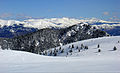
2,281 meter mountain that is located between the municipalities of Fígols, Saldes and Vallcebre _-_panoramio.jpg) El Serrat Voltor des de la Creu de Ferro | |||||
| Upload media | |||||
| Instance of | |||||
|---|---|---|---|---|---|
| Part of | |||||
| Made from material | |||||
| Located in protected area | |||||
| Location | |||||
| Mountain range | |||||
| Topographic prominence |
| ||||
| Topographic isolation |
| ||||
| Elevation above sea level |
| ||||
| Parent peak |
| ||||
 | |||||
Media in category "Serrat Voltor"
The following 3 files are in this category, out of 3 total.
-
 Serrat Voltor 2282m.JPG 2,592 × 1,567; 4.64 MB
-
 Serrat Voltor des de la Creu de Ferro (desembre 2010) - panoramio.jpg 2,048 × 1,536; 1.15 MB
-
 Serrat Voltor P1220405.jpg 2,145 × 1,319; 611 KB

