Category:September 2008 in County Antrim
Jump to navigation
Jump to search
English: Images taken in County Antrim, Northern Ireland in this month of 2008 (not the date of the upload).
| Jan | Feb | Mar | Apr | May | Jun | Jul | Aug | Sep | Oct | Nov | Dec | ||
| ← | 127 | 62 | 31 | 62 | 48 | 137 | 38 | 15 | 42 | 11 | 8 | 12 | → |
|---|
Media in category "September 2008 in County Antrim"
The following 42 files are in this category, out of 42 total.
-
 "Two Houses", Glenarm - geograph.org.uk - 954756.jpg 640 × 479; 56 KB
-
 'Junction One' shopping centre - geograph.org.uk - 975279.jpg 640 × 480; 223 KB
-
 Antrim Arms Cottages, Glenarm - geograph.org.uk - 954776.jpg 640 × 479; 51 KB
-
 Autumn leaves, Tardree forest - geograph.org.uk - 982456.jpg 544 × 349; 93 KB
-
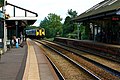 Belfast train approaching Carrickfergus Station - panoramio.jpg 2,816 × 1,880; 2.62 MB
-
 Calocera viscosa, Tardree forest (9) - geograph.org.uk - 982405.jpg 612 × 459; 147 KB
-
 Carnlough Internment Bonfire.jpg 500 × 376; 24 KB
-
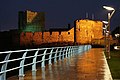
 Carrickfergus at twilight (1) - geograph.org.uk - 968541.jpg 640 × 421; 71 KB
-
 Carrickfergus at twilight (2) - geograph.org.uk - 968605.jpg 640 × 390; 25 KB
-
 Carrickfergus at twilight (4) - geograph.org.uk - 968668.jpg 640 × 426; 67 KB
-
 Carrickfergus Railway Station - panoramio - Pastor Sam (1).jpg 2,816 × 1,880; 3.08 MB
-
 Carrickfergus Railway Station - panoramio - Pastor Sam.jpg 2,816 × 1,880; 2.48 MB
-
 Castle Street, Clenarm - geograph.org.uk - 954755.jpg 640 × 479; 62 KB
-
 Conifers, Tardree forest - geograph.org.uk - 982439.jpg 640 × 417; 94 KB
-
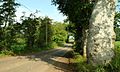
 Farm track near Antrim - geograph.org.uk - 982210.jpg 640 × 386; 105 KB
-
 Forest and road near Broughshane - geograph.org.uk - 961716.jpg 640 × 368; 77 KB
-
 Forest Gates, Glenarm - geograph.org.uk - 954740.jpg 640 × 479; 86 KB
-
 Fungus, Glenarm forest - geograph.org.uk - 946397.jpg 640 × 441; 74 KB
-
 Fungus, Tardree forest (6) - geograph.org.uk - 982282.jpg 640 × 429; 89 KB
-
 Fungus, Tardree forest (7) - geograph.org.uk - 982343.jpg 613 × 380; 104 KB
-
 Fungus, Tardree forest (8) - geograph.org.uk - 982371.jpg 571 × 397; 112 KB
-
 Glenarm and District Bird Club - geograph.org.uk - 953833.jpg 640 × 479; 57 KB
-
 Glenarm Gospel Hall - geograph.org.uk - 954724.jpg 640 × 479; 53 KB
-
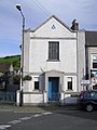 Glenarm Masonic Hall - geograph.org.uk - 953846.jpg 479 × 640; 80 KB
-
 Glenarm Post Office - geograph.org.uk - 954725.jpg 640 × 479; 62 KB
-
 Glenarm RC Church - geograph.org.uk - 953826.jpg 640 × 479; 55 KB
-
 Hill country near Broughshane (2) - geograph.org.uk - 961663.jpg 640 × 411; 72 KB
-
 Hill country near Broughshane - geograph.org.uk - 961592.jpg 640 × 391; 62 KB
-
 House with a yellow door, Glenarm - geograph.org.uk - 954731.jpg 640 × 479; 42 KB
-
 Margaret's B and B, Glenarm - geograph.org.uk - 954747.jpg 640 × 479; 65 KB
-
 Old cottage near Broughshane - geograph.org.uk - 961686.jpg 640 × 413; 85 KB
-
 Plaque, Castle Street, Glenarm - geograph.org.uk - 954760.jpg 640 × 479; 64 KB
-
 Red berries, Tardree forest - geograph.org.uk - 982625.jpg 640 × 401; 85 KB
-

-

-
 The Ballynoe Road near Antrim - geograph.org.uk - 982712.jpg 640 × 410; 99 KB
-
 The Barbican, Glenarm - geograph.org.uk - 954775.jpg 640 × 479; 45 KB
-
 The Connor Road near Tardree - geograph.org.uk - 982245.jpg 640 × 402; 99 KB
-
 The old school house, Glenarm - geograph.org.uk - 954761.jpg 640 × 479; 69 KB
-
 The Rathbeg Road near Antrim - geograph.org.uk - 982174.jpg 640 × 385; 98 KB
-
 Tobervine Street, Glenarm - geograph.org.uk - 954730.jpg 640 × 479; 56 KB
-
 Wolfenden's Bridge, Lambeg - geograph.org.uk - 960627.jpg 626 × 405; 97 KB


_-_geograph.org.uk_-_982405.jpg)

_-_geograph.org.uk_-_968541.jpg)
_-_geograph.org.uk_-_968605.jpg)
_-_geograph.org.uk_-_968668.jpg)
.jpg)


_-_geograph.org.uk_-_982282.jpg)
_-_geograph.org.uk_-_982343.jpg)
_-_geograph.org.uk_-_982371.jpg)


_-_geograph.org.uk_-_961663.jpg)


