Category:September 2005 Ireland photographs
Jump to navigation
Jump to search
Countries of Europe: Albania · Austria · Belarus · Belgium · Bulgaria · Croatia · Cyprus‡ · Czech Republic · Denmark · Estonia · Finland · France‡ · Georgia‡ · Germany · Greece · Hungary · Republic of Ireland · Italy · Kazakhstan‡ · Latvia · Lithuania · Luxembourg · Malta · Montenegro · Netherlands‡ · Norway · Poland · Portugal‡ · Romania · Russia‡ · Serbia · Slovakia · Slovenia · Spain‡ · Sweden · Switzerland · Turkey‡ · Ukraine · United Kingdom · Vatican City
Specific status: Gibraltar · Isle of Man
‡: partly located in Europe
Specific status: Gibraltar · Isle of Man
‡: partly located in Europe
English: Images taken in Ireland during this month of 2005 (not the date of the upload). With CatScan, this allows one to browse any Ireland-related category by year or month. Images should be placed directly in this category, not in subcategories. Note: Images from 2005 should be also added into the appropriate province, territory or city category of Category:2005 photographs of Ireland.
| Jan | Feb | Mar | Apr | May | Jun | Jul | Aug | Sep | Oct | Nov | Dec | ||
| ← | 0 | 1 | 0 | 0 | 150 | 0 | 2 | 0 | 200 | 0 | 0 | 0 | → |
|---|
Media in category "September 2005 Ireland photographs"
The following 200 files are in this category, out of 200 total.
-
 JamesJoyceStatue.JPG 1,712 × 2,288; 877 KB
-
 OConnell Bridge Dublin.jpg 2,288 × 1,287; 557 KB
-
 Jester's Chair - Dermot Morgan - geograph.org.uk - 312454.jpg 480 × 640; 160 KB
-
 Oscar Wilde, The fuller picture... - geograph.org.uk - 312448.jpg 480 × 640; 115 KB
-
 Aclare.jpeg 400 × 300; 21 KB
-

-
 Ardara - Charlie's West End Cafe - geograph.org.uk - 1351971.jpg 640 × 427; 66 KB
-

-
 Ardara - Interior of Nancy's Pub - geograph.org.uk - 1351963.jpg 640 × 427; 98 KB
-
 Ardara - West End Bar - geograph.org.uk - 1352724.jpg 640 × 427; 72 KB
-
 Assarnacally Waterfall - geograph.org.uk - 1157284.jpg 426 × 640; 331 KB
-
 AutographTreeCoolePark.jpg 1,580 × 3,711; 2.84 MB
-
 BaltimoreBeacon.jpg 2,032 × 1,524; 509 KB
-
 Belcruit - St Mary's Catholic Church - geograph.org.uk - 1170126.jpg 640 × 426; 197 KB
-
 Belcruit - St Mary's Catholic Church - geograph.org.uk - 1170137.jpg 640 × 426; 205 KB
-
 Belcruit - St Mary's Catholic Church - geograph.org.uk - 1170143.jpg 640 × 426; 224 KB
-
 Belcruit - St Mary's Catholic Church - geograph.org.uk - 1170145.jpg 640 × 480; 194 KB
-
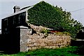
 Brinlack - 4-room thatched-roof cottage - geograph.org.uk - 1180419.jpg 640 × 426; 213 KB
-

-
 Brinlack - Derelict building - geograph.org.uk - 1181383.jpg 639 × 426; 305 KB
-
 Brinlack - Derelict cottage - geograph.org.uk - 1181473.jpg 639 × 426; 297 KB
-
 Brinlack - Derelict cottage - geograph.org.uk - 1181478.jpg 639 × 426; 278 KB
-

-

-

-

-

-

-
 Brinlack - Hillside with stone walls - geograph.org.uk - 1180356.jpg 640 × 426; 282 KB
-

-

-

-
 Brinlack - Houses near Bloody Foreland - geograph.org.uk - 1180529.jpg 639 × 426; 234 KB
-
 Brinlack - Stone wall - geograph.org.uk - 1181431.jpg 640 × 426; 324 KB
-
 Brinlack - Stone walls - geograph.org.uk - 1180346.jpg 640 × 426; 325 KB
-
 Brinlack - Stone walls in field - geograph.org.uk - 1181412.jpg 640 × 426; 352 KB
-
 Brinlack - Stone walls in field - geograph.org.uk - 1181418.jpg 640 × 426; 304 KB
-
 Brinlack - SW view of hillside - geograph.org.uk - 1181393.jpg 640 × 426; 261 KB
-
 Brinlack - SW view of hillside - geograph.org.uk - 1653914.jpg 640 × 176; 40 KB
-

-
 Building at SE end of Inishkeel Island - geograph.org.uk - 1161356.jpg 640 × 426; 233 KB
-
 Bunbeg - Boat in harbour - geograph.org.uk - 1354974.jpg 640 × 426; 93 KB
-
 Bunbeg - Boat in harbour - geograph.org.uk - 1354987.jpg 640 × 427; 69 KB
-

-
 Bunbeg - Boats in harbour - geograph.org.uk - 1354969.jpg 640 × 427; 90 KB
-
 Bunbeg - Boats in harbour - geograph.org.uk - 1354980.jpg 640 × 427; 77 KB
-

-
-
 Bunbeg - Field and Gweedore Bay - geograph.org.uk - 1354947.jpg 640 × 427; 122 KB
-
 Bunbeg - Field and Gweedore Bay - geograph.org.uk - 1354953.jpg 640 × 426; 123 KB
-
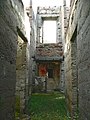
 Bunbeg - Ruins of large building - geograph.org.uk - 1354958.jpg 640 × 426; 123 KB
-
 Bunbeg Harbour - Boats - geograph.org.uk - 1176554.jpg 640 × 426; 256 KB
-
 Bunbeg Harbour - Boats - geograph.org.uk - 1176555.jpg 640 × 426; 204 KB
-
 Bunbeg Harbour - Ferry to Tory Island - geograph.org.uk - 1176556.jpg 640 × 426; 166 KB
-
 Bunbeg Harbour Road - Derelict buildings - geograph.org.uk - 1176546.jpg 639 × 426; 161 KB
-
 Bunbeg Harbour Road - Derelict house - geograph.org.uk - 1176547.jpg 640 × 426; 136 KB
-
-

-
 Bunbeg Harbour Road - Road scene - geograph.org.uk - 1176552.jpg 639 × 426; 222 KB
-
 Bunbeg Harbour Road - Road scene - geograph.org.uk - 1176553.jpg 640 × 426; 283 KB
-

-

-

-

-

-
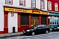
 Bundoran - Public Library - geograph.org.uk - 1351953.jpg 640 × 427; 76 KB
-

-
-
 Bundoran Public Library - geograph.org.uk - 1154558.jpg 640 × 426; 206 KB
-
 Cliffs of Annacoona - geograph.org.uk - 1150963.jpg 640 × 426; 247 KB
-
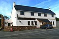 Crolly - Leo's Tavern - geograph.org.uk - 1174434.jpg 640 × 426; 186 KB
-
 Crolly - Leo's Tavern - geograph.org.uk - 1174465.jpg 640 × 426; 241 KB
-
 Crolly - Leo's Tavern - geograph.org.uk - 1174477.jpg 640 × 426; 255 KB
-
 Crolly - Leo's Tavern - geograph.org.uk - 1174502.jpg 640 × 426; 212 KB
-
 Crolly - Leo's Tavern - Pub portion - geograph.org.uk - 1174451.jpg 640 × 426; 262 KB
-
 Cruit (Critch) Island bridge - geograph.org.uk - 1168098.jpg 639 × 426; 313 KB
-

-

-
-

-

-

-

-

-

-

-

-

-
 Cruit Island - Homes - geograph.org.uk - 1168298.jpg 640 × 426; 235 KB
-

-
 Cruit Island - Last house at north end - geograph.org.uk - 1168321.jpg 640 × 426; 224 KB
-

-

-
 Cruit Island - NW coast along Rosses Bay - geograph.org.uk - 1168196.jpg 640 × 426; 258 KB
-
 Derelict cottage at Port - geograph.org.uk - 1156085.jpg 640 × 426; 222 KB
-
 Derelict cottages at Port - geograph.org.uk - 1156089.jpg 640 × 480; 283 KB
-

-

-
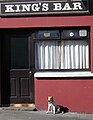 Dog waiting outside a bar in Clifden, Ireland.jpg 1,021 × 1,313; 178 KB
-
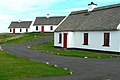
 Donegal Thatched Cottages - geograph.org.uk - 1168179.jpg 640 × 426; 297 KB
-
 Doolin pub McDermott's.jpg 1,024 × 768; 126 KB
-
 Doolin pub McGann's.jpg 1,024 × 768; 115 KB
-

-
 End of beach road a bit NW from Naran - geograph.org.uk - 1161351.jpg 640 × 426; 261 KB
-
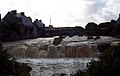
 Ennistymon Falls - geograph.org.uk - 325251.jpg 640 × 410; 125 KB
-
 Evening at Ennistymon, County Clare - geograph.org.uk - 325248.jpg 640 × 408; 69 KB
-
 Fields east of Trawmore Strand - geograph.org.uk - 1161325.jpg 640 × 426; 264 KB
-
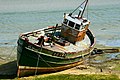 Fishing boat at Cruit Island near bridge - geograph.org.uk - 1168168.jpg 640 × 426; 271 KB
-
 Former Rochestown station, Cork - geograph.org.uk - 76747.jpg 640 × 479; 123 KB
-
 Glassagh - Beach along Gweedore Bay - geograph.org.uk - 1179427.jpg 640 × 426; 236 KB
-

-

-

-

-
 Glassagh - Shoes hanging on power wires - geograph.org.uk - 1179417.jpg 639 × 429; 112 KB
-

-

-

-

-

-

-

-
 Glassagh - teac Jack's Hotel pub - geograph.org.uk - 1179394.jpg 640 × 426; 253 KB
-

-
 Glassagh - Teac Jack's Hotel room - geograph.org.uk - 1179381.jpg 640 × 426; 192 KB
-

-

-

-
-
-
 Gleniff Horseshoe Drive - geograph.org.uk - 1150966.jpg 640 × 426; 225 KB
-
 Gleniff Horseshoe Drive - geograph.org.uk - 1350680.jpg 640 × 427; 95 KB
-
 Gleniff Horseshoe Drive - geograph.org.uk - 1350681.jpg 640 × 427; 87 KB
-
 Gleniff Horseshoe Drive - geograph.org.uk - 1350682.jpg 427 × 640; 97 KB
-
 Gleniff Horseshoe Drive - geograph.org.uk - 1350685.jpg 640 × 427; 101 KB
-
 Gleniff Horseshoe Drive - Roadscene - geograph.org.uk - 1351877.jpg 640 × 427; 110 KB
-
 Gleniff Horseshoe Drive - Roadscene - geograph.org.uk - 1351878.jpg 640 × 427; 92 KB
-
 Gleniff Horseshoe Drive - Roadscene - geograph.org.uk - 1351881.jpg 640 × 427; 97 KB
-
 Gleniff Horseshoe Drive - Stream - geograph.org.uk - 1350683.jpg 427 × 640; 127 KB
-
 Gleniff Horseshoe Drive in mist - geograph.org.uk - 1150962.jpg 640 × 426; 271 KB
-
 Gweebarra Bay from road through Port noo - geograph.org.uk - 1161350.jpg 640 × 426; 199 KB
-

-
 Gweedore - Derelict house at Brinlack - geograph.org.uk - 1354890.jpg 640 × 426; 105 KB
-
 Gweedore - Derelict house at Brinlack - geograph.org.uk - 1354895.jpg 640 × 427; 120 KB
-

-

-

-

-

-
 House near beach in Naran - geograph.org.uk - 1161357.jpg 640 × 426; 138 KB
-
 Inishfree Bay - Coastal Scenery - geograph.org.uk - 1172920.jpg 639 × 426; 260 KB
-
 Inishfree Bay - Tidal Pools - geograph.org.uk - 1172902.jpg 640 × 426; 270 KB
-
 Inishfree Bay - Tidal Pools - geograph.org.uk - 1172908.jpg 640 × 426; 298 KB
-

-
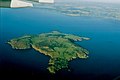
 Inishmore-Dun Aengus.jpg 2,402 × 1,790; 3.77 MB
-
-

-

-
 Inishsirrer, Co Donegal - geograph.org.uk - 242666.jpg 640 × 429; 90 KB
-
 Inishsirrer, Co Donegal - geograph.org.uk - 242667.jpg 640 × 320; 108 KB
-
 Inishsirrer, Co Donegal - geograph.org.uk - 242668.jpg 640 × 372; 126 KB
-
 Inishsirrer, Co Donegal - geograph.org.uk - 242669.jpg 429 × 640; 140 KB
-
 Jetty at Inishsirrer, Co Donegal - geograph.org.uk - 242670.jpg 640 × 350; 82 KB
-
 JimLarkin.JPG 1,712 × 2,288; 532 KB
-
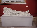 John Hogan Dead Christ Crawford Municipal Art Gallery Cork.jpg 1,280 × 960; 278 KB
-
 Knocknaree near Sligo - geograph.org.uk - 1653419.jpg 640 × 219; 51 KB
-
 Lambay Island - Reachrainn - geograph.org.uk - 1350641.jpg 640 × 427; 44 KB
-

-

-

-
 Maghera Sandhills - geograph.org.uk - 1157339.jpg 640 × 426; 248 KB
-
 Mountains at Maghera - geograph.org.uk - 1157332.jpg 640 × 426; 248 KB
-
 Mountainside at Maghera - geograph.org.uk - 1157340.jpg 640 × 426; 218 KB
-
 Mullaghderg Beach - geograph.org.uk - 1172878.jpg 640 × 426; 210 KB
-

-
 Mullaghmore - Seafood Restaurant - geograph.org.uk - 1350655.jpg 640 × 427; 93 KB
-

-
 Naran - Beach sign regarding low tide - geograph.org.uk - 1176542.jpg 639 × 426; 211 KB
-
 Pier at Annaghdown - geograph.org.uk - 308836.jpg 640 × 480; 59 KB
-

-

-

-

-

-

-

-
-

-
 Port - Derelict cottage interior - geograph.org.uk - 1354678.jpg 640 × 426; 105 KB
-
 Port - Derelict cottages on hillside - geograph.org.uk - 1354620.jpg 640 × 426; 139 KB
-
 Rathmullan, Co Donegal - geograph.org.uk - 242688.jpg 640 × 429; 54 KB
-

-
 River Feale Finuge Crossing 1.JPEG 1,600 × 1,200; 1.33 MB
-
 River Sneem - geograph.org.uk - 1021422.jpg 640 × 480; 55 KB
-

-

-
 Road from Falcarragh SE to R251 - geograph.org.uk - 1355078.jpg 640 × 426; 100 KB
-
 Road from Falcarragh SE to R251 - geograph.org.uk - 1355086.jpg 640 × 427; 87 KB
-

-


_-_geograph.org.uk_-_1351960.jpg)


_-_geograph.org.uk_-_1351958.jpg)
_-_geograph.org.uk_-_1351959.jpg)


_Island_bridge_-_geograph.org.uk_-_1168098.jpg)


_-_geograph.org.uk_-_1179374.jpg)


_-_geograph.org.uk_-_1351956.jpg)
_-_geograph.org.uk_-_1351957.jpg)