Category:Sender Weimar
Jump to navigation
Jump to search
| Object location | | View all coordinates using: OpenStreetMap |
|---|
 | |||||
| Upload media | |||||
| Instance of | |||||
|---|---|---|---|---|---|
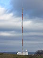
| Location | Weimar, Thuringia, Germany | ||||
 | |||||
Media in category "Sender Weimar"
The following 3 files are in this category, out of 3 total.
-
 Sender Weimar - Ehringsheim.JPG 3,456 × 4,608; 3.64 MB
-
 Sender Weimar 1.jpg 5,184 × 3,888; 4.3 MB
-
 Sender Weimar.JPG 1,536 × 2,048; 859 KB

