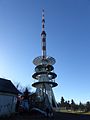
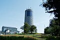
Category:Sender Inselsberg
Jump to navigation
Jump to search
| Object location | | View all coordinates using: OpenStreetMap |
|---|
 | |||||
| Upload media | |||||
| Instance of | |||||
|---|---|---|---|---|---|
| Named after | |||||
| Location | Großer Inselsberg, Bad Tabarz, Gotha, Thuringia, Germany | ||||
| Commissioned by | |||||
| Owned by | |||||
| Height |
| ||||
 | |||||
Media in category "Sender Inselsberg"
The following 26 files are in this category, out of 26 total.
-
 Alter Sendeturm Grosser Inselsberg10042018 1.JPG 3,372 × 5,058; 9.97 MB
-
 Bebauung großer inselsberg nov2014 04.jpg 3,672 × 4,896; 5.64 MB
-
 Fuss Neuer Sendeturm Grosser Inselsberg10042018 1.JPG 4,872 × 3,248; 9.45 MB
-
 GrInselsberg A01.jpg 1,717 × 2,576; 2.44 MB
-
 GrInselsberg A04.jpg 2,576 × 1,717; 2.22 MB
-
 GrInselsberg B01.jpg 1,463 × 2,194; 2.02 MB
-
 GrInselsberg B02.jpg 1,177 × 1,766; 1.38 MB
-
 GrInselsberg B03.jpg 1,716 × 2,574; 2.08 MB
-
 GrInselsberg B04.jpg 1,716 × 2,574; 1.8 MB
-
 GrInselsberg B05.jpg 1,716 × 2,574; 1.5 MB
-
 GrInselsberg C01.jpg 2,576 × 1,717; 1.86 MB
-
 GrInselsberg C02.jpg 1,717 × 2,576; 2.71 MB
-
 GrInselsberg C04.jpg 1,717 × 2,576; 2.84 MB
-
 GrInselsberg D01.jpg 2,576 × 1,717; 2.53 MB
-
 Inselsberg - panoramio (1).jpg 2,988 × 5,312; 3.97 MB
-
 Inselsberg - panoramio (3).jpg 2,988 × 5,312; 3.52 MB
-
 Inselsberg bebauung 01.JPG 3,672 × 4,896; 5.78 MB
-
 Inselsberg bebauung 02.JPG 3,672 × 4,896; 5.87 MB
-
 Inselsberg radio tower north view july 2022.jpg 5,180 × 3,454; 4.67 MB
-
 Inselsberg radio tower south view july 2022.jpg 5,472 × 3,648; 9.38 MB
-
 Neuer Sendeturm Grosser Inselsberg10042018 1.JPG 3,372 × 5,058; 8.58 MB
-
 Neuer Sendeturm Grosser Inselsberg10042018 2.JPG 2,821 × 5,022; 8.19 MB
-
 Neuer Sendeturm Grosser Inselsberg10042018 3.JPG 3,372 × 5,058; 9.81 MB
-
 Sender Inselsberg DAB.JPG 1,935 × 1,799; 827 KB
-
 Sender Inselsberg.jpg 550 × 1,000; 141 KB
-
 Sendeturm Grosser Inselsberg.jpeg 1,600 × 1,200; 143 KB


.jpg)
.jpg)


