Category:Sempringham
Jump to navigation
Jump to search
village in Lincolnshire  | |||||
| Upload media | |||||
| Instance of | |||||
|---|---|---|---|---|---|
| Location | Pointon and Sempringham, South Kesteven, Lincolnshire, East Midlands, England | ||||
 | |||||
Cymraeg: Pentref yn Swydd Lincoln, yn agos i Bourne, yw Sempringham. Erbyn heddiw mae eglwys, tŷ a ffynnon, sy'n cynnig dim cliwiau am yr hanes sydd ynghlwm a ffiniau'r blwyf. Mae'r rhan fwyaf o'r tai wedi eu gwasgaru o fewn milltir o'r eglwys ar y ffordd B1177, rhwng Pointon a Billingborough. Mae'r eglwys yn sefyll ar dir uwch na gweddill yr ardal, ar uchder o tua 16 medr, yng nghanol cordir gwastad. Mae ym mhlwyf Pointon a Sempringham, y prif dref yw Pointon. Mae'r plwyf hefyd yn cynnwys, Millthorpe a chorsydd Pointon, Neslam ac Aslackby a rhan o Hundred Fen yn Gosberton Clough. Roedd Birthorpe yn ran o blwyf Sempringham gynt ond erbyn hyn mae'n ran o Billingborough.
English: Sempringham is a hamlet in Lincolnshire, England that is located north of Bourne, on the Lincolnshire fen edge. Sempringham is now a very small hamlet consisting of a church, a house and a well, giving little clue to the history embodied within its parish boundary. Most of its houses are a kilometre from the church, scattered along the B1177 road, between Pointon and Billingborough. The church stands at an altitude of about sixteen metres, on land gently rising out of the flat fenland and the road turning to it is easily missed. Its civil parish is Pointon and Sempringham of which the main township is Pointon. It includes also, Millthorpe and the fens of Pointon, Neslam and Aslackby and a part of the Hundred Fen at Gosberton Clough. Formerly, Birthorpe, now part of Billingborough, was included in Sempringham parish.
Français : Situé au nord de Bourne, au bord du Fenland dans le Lincolnshire, Sempringham est maintenant un tout petit hameau composé d'une église, d'une maison et d'un puits, ce qui laisse mal imaginer toute l'histoire qui s'est déroulée dans les limites de cette paroisse. La plupart de ses maisons sont à un kilomètre de l'église, disséminées le long de la route B1177, entre Pointon et Billingborough. L'église se trouve à une altitude d'environ seize mètres, sur un terrain qui s'élève légèrement au-dessus de la platitude du Fenland, et il est facile de manquer la route qui fait un crochet vers elle. La paroisse civile s'appelle Pointon et Sempringham, et la principale agglomération est Pointon. Elle comprend également Millthorpe et les fens de Pointon, de Neslam et d'Aslackby ainsi qu'une partie des Cent Fens à Gosberton Clough. Autrefois Birthorpe, qui maintenant fait partie de Billingborough, était incluse dans la paroisse de Sempringham.
Italiano: Sempringham è una località britannica nella contea inglese di Lincolnshire, nei pressi della città di Bourne.
Subcategories
This category has the following 2 subcategories, out of 2 total.
A
Media in category "Sempringham"
The following 21 files are in this category, out of 21 total.
-

-
 Footpath by Cow Gate House - geograph.org.uk - 421424.jpg 640 × 427; 91 KB
-
 Moated site (geograph 4423539).jpg 1,024 × 683; 257 KB
-
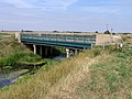 Neslam Bridge, Pointon, Lincs - geograph.org.uk - 215183.jpg 640 × 480; 351 KB
-

-
 Crown Farm Cottages, Pointon Fen - geograph.org.uk - 277967.jpg 640 × 480; 65 KB
-
 Farm buildings, Billingborough Fen, Lincs - geograph.org.uk - 215181.jpg 640 × 480; 326 KB
-
 Farmland, Neslam Fen, Pointon, Lincs - geograph.org.uk - 215161.jpg 640 × 480; 356 KB
-
 Farmland, Sempringham Fen, Lincs - geograph.org.uk - 215159.jpg 640 × 480; 318 KB
-
 Forty Foot Farm, Pointon Fen - geograph.org.uk - 277968.jpg 640 × 480; 72 KB
-
 Forty Foot Farm, Pointon Fen - geograph.org.uk - 278431.jpg 640 × 480; 66 KB
-

-
-
 Marsedyke - geograph.org.uk - 691254.jpg 640 × 480; 67 KB
-
 Mornington House Farm, Hundred Fen, Lincs - geograph.org.uk - 215193.jpg 640 × 480; 386 KB
-
 Neslam Farm and air strip, Neslam Fen - geograph.org.uk - 278425.jpg 640 × 480; 61 KB
-
 Neslam Farm, Neslam Fen - geograph.org.uk - 277961.jpg 640 × 480; 79 KB
-
 Neslam Road, Neslam Fen, Pointon, Lincs - geograph.org.uk - 215182.jpg 640 × 480; 257 KB
-

-

-
 Wheatfields, Sempringham, Lincs - geograph.org.uk - 215136.jpg 640 × 480; 292 KB


.jpg)


