Category:Semi-detached houses in the Metropolitan Borough of Calderdale
Jump to navigation
Jump to search
Subcategories
This category has only the following subcategory.
Media in category "Semi-detached houses in the Metropolitan Borough of Calderdale"
The following 49 files are in this category, out of 49 total.
-

-
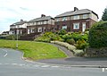
 Birdswell Avenue - Highmoor Crescent - geograph.org.uk - 3419449.jpg 640 × 480; 60 KB
-
 Burnley Hill Terrace - Hud Hill - geograph.org.uk - 1616302.jpg 640 × 480; 63 KB
-
 Clifton Avenue - Summergate Place - geograph.org.uk - 3804179.jpg 640 × 480; 54 KB
-
 Coley View - off Town Gate - geograph.org.uk - 3080237.jpg 640 × 458; 49 KB
-
 Coley View - off Town Gate - geograph.org.uk - 3080238.jpg 640 × 471; 58 KB
-
 Crest Road - Lindley Moor Road - geograph.org.uk - 4221661.jpg 640 × 480; 56 KB
-

-
 Elm Grove, Shelf - geograph.org.uk - 2219697.jpg 640 × 480; 62 KB
-
 Hazel Grove - Fairless Avenue - geograph.org.uk - 3010180.jpg 640 × 480; 51 KB
-
 Higher Brockwell, Sowerby - geograph.org.uk - 4638790.jpg 1,968 × 1,440; 669 KB
-
 Highfield Road in April - geograph.org.uk - 3420307.jpg 2,000 × 1,500; 1.12 MB
-

-

-
 Houses, Jerry Lane - geograph.org.uk - 3502356.jpg 2,000 × 1,473; 850 KB
-
 Houses, Pollit Avenue, Sowerby - geograph.org.uk - 2275155.jpg 2,000 × 1,414; 634 KB
-
 Houses, Rochdale Road - geograph.org.uk - 3847793.jpg 2,000 × 1,247; 1.03 MB
-
 Hunter Hill Road - Clough Lane - geograph.org.uk - 1913339.jpg 640 × 480; 59 KB
-

-
 Linton Grove - geograph.org.uk - 3420299.jpg 2,000 × 1,388; 838 KB
-

-
 Moorlands Avenue - Cousin Lane - geograph.org.uk - 1882279.jpg 640 × 480; 64 KB
-
 Moorlands Drive - Denfield Lane - geograph.org.uk - 1882327.jpg 640 × 480; 66 KB
-
 New houses, Slade Lane - geograph.org.uk - 6007678.jpg 2,000 × 1,305; 580 KB
-
 Newcombe Street, Elland - geograph.org.uk - 1841012.jpg 2,000 × 1,449; 598 KB
-
 Nos. 213 and 215 Smith House Lane - geograph.org.uk - 6016454.jpg 1,024 × 683; 181 KB
-
 Nos. 60 and 58 Garden Road - geograph.org.uk - 6312085.jpg 1,024 × 680; 190 KB
-

-
 Parklands Drive - Butterworth Lane - geograph.org.uk - 4302485.jpg 640 × 480; 54 KB
-
 Recreation ground - geograph.org.uk - 4206539.jpg 640 × 480; 74 KB
-
 Royd Avenue - St George's Avenue - geograph.org.uk - 4221666.jpg 640 × 480; 62 KB
-
 School Crescent - School Lane - geograph.org.uk - 3860861.jpg 640 × 480; 71 KB
-
 Semi-detached houses, Rochdale Road - geograph.org.uk - 3847792.jpg 2,000 × 1,190; 917 KB
-
 Semi-detached houses, Rochdale Road - geograph.org.uk - 3847800.jpg 2,000 × 1,341; 1.01 MB
-
 Shirley Grove - Fairless Avenue - geograph.org.uk - 3010178.jpg 640 × 480; 54 KB
-
 Smith Crescent - Highfield Road - geograph.org.uk - 3788927.jpg 640 × 480; 84 KB
-

-
 Sowerby Bridge FP98 alongside the Woodlands housing estate - geograph.org.uk - 4638708.jpg 2,048 × 1,536; 1.03 MB
-

-
 The Brook, Mytholmroyd - geograph.org.uk - 390073.jpg 469 × 640; 147 KB
-
 Thornhills Lane, Clifton - geograph.org.uk - 500058.jpg 640 × 422; 75 KB
-

-
 Waverley Crescent - Barfield Road - geograph.org.uk - 2988235.jpg 640 × 480; 56 KB
-

-
 Well Grove - Finkil Street - geograph.org.uk - 3225911.jpg 640 × 480; 59 KB
-
 West View at Stainland Road - geograph.org.uk - 3735254.jpg 2,000 × 1,333; 621 KB
-
 West View, Stainland - geograph.org.uk - 3735259.jpg 2,000 × 1,500; 913 KB
-
 Woodbrook Avenue, Mixenden - geograph.org.uk - 2713335.jpg 640 × 480; 77 KB
-
 ^24 Summerfield Avenue - geograph.org.uk - 6313077.jpg 683 × 1,024; 172 KB


