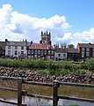
Category:Selby, North Yorkshire
Jump to navigation
Jump to search
town and civil parish in North Yorkshire, England  | |||||
| Upload media | |||||
| Instance of | |||||
|---|---|---|---|---|---|
| Location | Selby, North Yorkshire, Yorkshire and the Humber, England | ||||
| Population |
| ||||
| Area |
| ||||
| Different from | |||||
| Said to be the same as | Selby (Wikimedia duplicated page, civil parish) | ||||
| official website | |||||
 | |||||
Subcategories
This category has the following 12 subcategories, out of 12 total.
A
B
C
H
I
R
S
T
Media in category "Selby, North Yorkshire"
The following 200 files are in this category, out of 775 total.
(previous page) (next page)-
 "Maintain Social Distance" - geograph.org.uk - 6538053.jpg 3,752 × 4,848; 5.43 MB
-
 "The Three Swans" public house in Selby - geograph.org.uk - 3582399.jpg 2,649 × 3,311; 1.81 MB
-
 110-106 Gowthorpe, Selby - geograph.org.uk - 3797071.jpg 1,280 × 960; 248 KB
-
 120 and 122 Ousegate - geograph.org.uk - 5279124.jpg 1,024 × 742; 117 KB
-
 120-122 Ousegate - geograph.org.uk - 2745247.jpg 1,280 × 959; 261 KB
-
 136 Gowthorpe - geograph.org.uk - 3797047.jpg 1,280 × 960; 196 KB
-
 1811 Selby College - geograph.org.uk - 5611610.jpg 1,600 × 1,064; 521 KB
-
 1811 Selby College - geograph.org.uk - 5611615.jpg 1,600 × 1,064; 698 KB
-
 20^22 Millgate - geograph.org.uk - 3797521.jpg 1,280 × 960; 353 KB
-
 46-72 New Lane - geograph.org.uk - 2743686.jpg 1,280 × 959; 326 KB
-
 83 ^ 85 Millgate - geograph.org.uk - 3797485.jpg 1,280 × 960; 210 KB
-
 A Field does not come much Flatter - geograph.org.uk - 2627679.jpg 3,264 × 2,448; 1.72 MB
-
 A Golden Lion - geograph.org.uk - 3797512.jpg 960 × 1,280; 179 KB
-
 A Narrow Field - geograph.org.uk - 2627664.jpg 3,264 × 2,448; 2.01 MB
-
 A sculpture alongside the Selby canal - geograph.org.uk - 2152529.jpg 600 × 800; 355 KB
-
 A19 - geograph.org.uk - 4571312.jpg 640 × 426; 59 KB
-
 A63 crossing the River Ouse, east of Selby - geograph.org.uk - 5134470.jpg 1,024 × 768; 119 KB
-
 A63 Swing bridge - geograph.org.uk - 6127107.jpg 1,024 × 683; 445 KB
-
 Abandoned farm machinery - geograph.org.uk - 2348110.jpg 4,320 × 3,240; 4.78 MB
-
 Abandoned path - geograph.org.uk - 5278366.jpg 1,024 × 768; 244 KB
-
 Abbey across the Ouse - geograph.org.uk - 3568964.jpg 427 × 640; 102 KB
-
 Abbey House - geograph.org.uk - 2743735.jpg 1,280 × 959; 547 KB
-
 Abbey House, Abbey Place, Selby - geograph.org.uk - 1929495.jpg 1,024 × 768; 255 KB
-
 Abbey Place - geograph.org.uk - 2154536.jpg 640 × 427; 106 KB
-
 Abbey Place, Selby - geograph.org.uk - 1929508.jpg 1,024 × 768; 321 KB
-
 Abbey Place, Selby - geograph.org.uk - 5279178.jpg 1,024 × 768; 225 KB
-
 Abbey Walk, Selby - geograph.org.uk - 2641960.jpg 640 × 480; 65 KB
-
 Abbey Yard - James Street - geograph.org.uk - 4022859.jpg 640 × 480; 67 KB
-
 Abbot Hugh's pillar - geograph.org.uk - 2153829.jpg 427 × 640; 108 KB
-
 Abbot's Road, Selby - geograph.org.uk - 6383132.jpg 640 × 480; 84 KB
-
 Abbot's Road, Selby - geograph.org.uk - 6383877.jpg 4,963 × 3,360; 4.62 MB
-
 Across the Ouse at Selby - geograph.org.uk - 1854035.jpg 2,432 × 2,735; 1.35 MB
-
 Albion Vaults on The Crescent, Selby - geograph.org.uk - 4918420.jpg 1,200 × 799; 273 KB
-
 Albion Vaults on The Crescent, Selby - geograph.org.uk - 4918523.jpg 1,003 × 1,200; 311 KB
-
 Albion Vaults on The Crescent, Selby - geograph.org.uk - 4918528.jpg 799 × 1,200; 297 KB
-
 All buses turn right at Ousegate - geograph.org.uk - 3798083.jpg 1,280 × 960; 173 KB
-
 Alma Terrace - Millgate - geograph.org.uk - 4022870.jpg 640 × 480; 78 KB
-
 Almshouses, Gowthorpe - eastern court - geograph.org.uk - 3797065.jpg 1,280 × 924; 165 KB
-
 Almshouses, Gowthorpe - inscribed plaque - geograph.org.uk - 3797062.jpg 1,280 × 960; 196 KB
-
 Along Denison Road - geograph.org.uk - 6127097.jpg 683 × 1,024; 546 KB
-
 Along Sherburn Road - geograph.org.uk - 5182016.jpg 640 × 427; 83 KB
-
 Along Wistow Road - geograph.org.uk - 5182013.jpg 640 × 427; 128 KB
-
 Alongside the Abbey - geograph.org.uk - 2318034.jpg 640 × 480; 112 KB
-
 Annie Street, Selby - geograph.org.uk - 6383313.jpg 800 × 600; 102 KB
-
 Apartments beside the River Ouse - geograph.org.uk - 6385444.jpg 800 × 600; 121 KB
-
 Apartments off Shipyard Road, Selby - geograph.org.uk - 5882193.jpg 1,600 × 1,065; 737 KB
-
 Approach to Selby Abbey from the market square - geograph.org.uk - 5657155.jpg 1,024 × 768; 196 KB
-
 Approaching Crosshills Farm, west of Selby - geograph.org.uk - 5445434.jpg 1,600 × 1,200; 507 KB
-
 Approaching Elfhole Farm - geograph.org.uk - 5445432.jpg 1,600 × 1,200; 528 KB
-
 Approaching Oak Tree Farm - geograph.org.uk - 5443145.jpg 1,600 × 1,200; 400 KB
-

-
 Approaching the River Ouse - geograph.org.uk - 5336390.jpg 1,024 × 768; 255 KB
-
 Armoury Road, looking north - geograph.org.uk - 3796980.jpg 1,280 × 960; 293 KB
-
 Armoury Road, looking south - geograph.org.uk - 3796988.jpg 1,280 × 952; 294 KB
-

-
 Arriva depot, Selby - geograph.org.uk - 5745218.jpg 1,024 × 768; 135 KB
-
 Audus Almshouses, Gowthorpe - western court - geograph.org.uk - 3797058.jpg 1,280 × 890; 173 KB
-
 Audus Street, Selby - geograph.org.uk - 5612522.jpg 1,600 × 1,064; 636 KB
-
 Audus Street, Selby - geograph.org.uk - 5612639.jpg 1,600 × 1,064; 559 KB
-
 Bacchus at the Londesborough Hotel, Selby (6807020096).jpg 2,280 × 3,145; 4.91 MB
-
 Bainbridge Drive - Portholme Road - geograph.org.uk - 4022684.jpg 640 × 480; 57 KB
-
 Bales near Elfhole Farm - geograph.org.uk - 5182015.jpg 640 × 427; 112 KB
-
 Bales off Sherburn Road - geograph.org.uk - 5182017.jpg 640 × 427; 92 KB
-
 Bargain World, Gowthorpe, Selby - geograph.org.uk - 5657119.jpg 1,024 × 768; 162 KB
-
 Barley crop adjacent to B1223 - geograph.org.uk - 4052416.jpg 1,500 × 1,000; 1.25 MB
-
 Barwic Parade, Selby - geograph.org.uk - 6383169.jpg 5,184 × 3,888; 4.33 MB
-
 Bawtry Road (A1041), Selby - geograph.org.uk - 6382612.jpg 4,810 × 3,165; 2.83 MB
-

-
 Bawtry Road Bridge - geograph.org.uk - 5630640.jpg 4,000 × 3,000; 2.07 MB
-
 Bawtry Road bridge over Selby Canal - geograph.org.uk - 5132641.jpg 4,608 × 3,456; 3.6 MB
-
 Bawtry Road bridge, Selby - geograph.org.uk - 4723720.jpg 1,024 × 768; 100 KB
-
 Bawtry Road bridge, Selby Canal - geograph.org.uk - 3173046.jpg 2,048 × 1,536; 624 KB
-
 Bedded down for the winter - geograph.org.uk - 6015647.jpg 1,280 × 960; 366 KB
-
 Bench mark at Brooklands, Leeds Road - geograph.org.uk - 3797041.jpg 1,280 × 960; 358 KB
-
 Bench mark on Gowthorpe - geograph.org.uk - 3797074.jpg 1,280 × 960; 387 KB
-
 Bench mark, Doncaster Road-Westbourne Road - geograph.org.uk - 3796949.jpg 1,280 × 960; 315 KB
-
 Bench mark, Old School Lofts, Millgate - geograph.org.uk - 3797440.jpg 1,280 × 960; 227 KB
-
 Bench mark, Park Street Bridge - geograph.org.uk - 3798111.jpg 1,280 × 960; 368 KB
-
 Bench mark, Selby Abbey south aisle - geograph.org.uk - 3798150.jpg 1,280 × 960; 275 KB
-
 Bench mark, St Mary's Church - geograph.org.uk - 3797005.jpg 960 × 1,280; 283 KB
-
 Bench mark, The Museum Hall, Park Street - geograph.org.uk - 3798126.jpg 1,280 × 960; 257 KB
-
 Bench mark, ^1 Westbourne Terrace - geograph.org.uk - 3796968.jpg 1,280 × 960; 353 KB
-
 Bench mark, ^112 Ousegate - geograph.org.uk - 3798086.jpg 1,280 × 960; 386 KB
-
 Bench mark, ^13-15 Flaxley Road - geograph.org.uk - 3797432.jpg 1,280 × 960; 325 KB
-
 Bench mark, ^157 Millgate - geograph.org.uk - 3797475.jpg 1,280 × 904; 234 KB
-
 Bench mark, ^17 Finkle Street - geograph.org.uk - 3798161.jpg 1,280 × 960; 252 KB
-
 Bench mark, ^31 Armoury Road - geograph.org.uk - 3796974.jpg 1,280 × 960; 312 KB
-
 Bench mark, ^34 Armoury Road - geograph.org.uk - 3796983.jpg 960 × 1,280; 194 KB
-
 Bench mark, ^49 Gowthorpe - geograph.org.uk - 3798174.jpg 960 × 1,280; 465 KB
-
 Benchmark on "The Station", Ousegate - geograph.org.uk - 3798044.jpg 1,280 × 960; 335 KB
-
 Benchmark on the old railway warehouse, Ousegate - geograph.org.uk - 3798051.jpg 1,280 × 960; 430 KB
-
 Bend in the canal - geograph.org.uk - 5765522.jpg 640 × 427; 244 KB
-
 Bend in the Selby Canal - geograph.org.uk - 6385061.jpg 800 × 600; 116 KB
-
 Bend on Sherburn Road - geograph.org.uk - 5182021.jpg 640 × 427; 92 KB
-
 Betta Butties - geograph.org.uk - 2147668.jpg 800 × 600; 303 KB
-
 Black Fen Drain - geograph.org.uk - 5182005.jpg 640 × 427; 102 KB
-
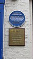
 Blue plaque on Quay House - geograph.org.uk - 3797540.jpg 1,280 × 960; 188 KB
-

-
 Boatyard on the Selby Canal - geograph.org.uk - 5132629.jpg 4,608 × 3,456; 3.38 MB
-
 Bondgate (B1223), Selby - geograph.org.uk - 6382288.jpg 4,356 × 3,225; 3.43 MB
-
 Bondgate (B1223), Selby - geograph.org.uk - 6382330.jpg 4,638 × 3,206; 3.02 MB
-
 Bowling Green at Selby Park, Selby - geograph.org.uk - 4158522.jpg 1,600 × 1,064; 708 KB
-
 Bridge abutment 1 (3557589894).jpg 2,560 × 1,920; 4.1 MB
-
 Bridge abutment 2 (3556774345).jpg 2,359 × 1,784; 4.18 MB
-
 Bridge House and Lock House, Selby Lock - geograph.org.uk - 6385433.jpg 800 × 600; 140 KB
-
 Bridge over the River Ouse - geograph.org.uk - 5995187.jpg 1,024 × 576; 81 KB
-
 Bringing home the bales three extra up front - geograph.org.uk - 5135146.jpg 4,606 × 3,452; 5.88 MB
-
 Brook Street - geograph.org.uk - 5773483.jpg 640 × 427; 212 KB
-
 Brooklands, Leeds Road - geograph.org.uk - 3797045.jpg 1,280 × 960; 456 KB
-
 Buildings on Ousegate - geograph.org.uk - 3798094.jpg 1,280 × 960; 263 KB
-
 Buildings on Ousegate, Selby - geograph.org.uk - 5134719.jpg 1,024 × 768; 158 KB
-
 Buildings on Park Street, Selby - geograph.org.uk - 4158469.jpg 1,600 × 1,064; 653 KB
-
 Bungalow, Fairways - geograph.org.uk - 4571319.jpg 640 × 344; 36 KB
-
 Bungalows on Barwic Parade, Selby - geograph.org.uk - 6385012.jpg 640 × 381; 44 KB
-
 Bus Station - Station Road - geograph.org.uk - 4022706.jpg 640 × 480; 68 KB
-
 Buttress with bench mark on St Mary's Church - geograph.org.uk - 3797003.jpg 960 × 1,280; 307 KB
-
 Canal beside Canal Road - geograph.org.uk - 5766570.jpg 640 × 427; 240 KB
-

-

-
 Canalside apartments. - geograph.org.uk - 3508567.jpg 640 × 480; 63 KB
-
 Canalside path. - geograph.org.uk - 3508562.jpg 640 × 480; 123 KB
-
 Canalside sculpture - geograph.org.uk - 2745269.jpg 930 × 1,280; 324 KB
-
 Carantan House - old people's home in Selby - geograph.org.uk - 3227581.jpg 4,128 × 2,949; 2.71 MB
-
 Chairs stacked on a trolley in Selby Abbey - geograph.org.uk - 6538070.jpg 3,545 × 4,826; 3.54 MB
-
 Chapel House Court, Brook Street, Selby - geograph.org.uk - 5657100.jpg 1,024 × 768; 148 KB
-
 Charity houses - Gawthorpe, Selby (built 1822) - geograph.org.uk - 3227841.jpg 4,151 × 2,491; 2.73 MB
-
 Chemical works, off East Common Lane, Selby - geograph.org.uk - 5134482.jpg 1,024 × 768; 129 KB
-
 Cholera Burial Ground (1) - geograph.org.uk - 2743728.jpg 1,280 × 959; 622 KB
-
 Cholera Burial Ground (2) - geograph.org.uk - 2743731.jpg 1,280 × 959; 411 KB
-
 Church Avenue - geograph.org.uk - 2154575.jpg 640 × 427; 125 KB
-
 Church Avenue - viewed from Church Lane - geograph.org.uk - 4022824.jpg 640 × 480; 112 KB
-
 Church Avenue and Abbey Place, Selby - geograph.org.uk - 6028085.jpg 2,560 × 1,920; 2.23 MB
-
 Church Avenue Selby - geograph.org.uk - 4921620.jpg 3,233 × 4,309; 3.57 MB
-
 Church Lane - geograph.org.uk - 2745169.jpg 1,280 × 959; 318 KB
-
 Church Lane, Selby - geograph.org.uk - 5279263.jpg 1,024 × 768; 160 KB
-
 Church of Jesus Christ of Latter-day Saints, Selby - geograph.org.uk - 5448134.jpg 1,600 × 1,200; 400 KB
-
 Clearing in Moss Hagg - geograph.org.uk - 5845631.jpg 1,024 × 768; 295 KB
-
 Clog Mill Gardens, Selby - geograph.org.uk - 5239657.jpg 1,200 × 799; 208 KB
-
 Co-op shop on Flaxley Road, Selby - geograph.org.uk - 5608416.jpg 1,600 × 1,048; 474 KB
-

-
 Concert Party flyer.jpg 2,802 × 3,918; 2.23 MB
-

-

-
 Corner of Ousegate, Selby - geograph.org.uk - 5097628.jpg 3,072 × 1,728; 2.92 MB
-
 Cottages on Flaxley Road - geograph.org.uk - 3797391.jpg 1,280 × 960; 232 KB
-
 Cottages on Ousegate, Selby - geograph.org.uk - 6384753.jpg 800 × 625; 118 KB
-

-
 Cross Hills Lane, Selby - geograph.org.uk - 5578691.jpg 5,376 × 3,024; 2.55 MB
-
 Crosshills Farm - geograph.org.uk - 5608419.jpg 1,600 × 1,064; 572 KB
-
 Crosshills Farm, Selby - geograph.org.uk - 5121675.jpg 1,600 × 1,065; 530 KB
-
 Crossing Ousegate - geograph.org.uk - 2745214.jpg 1,280 × 941; 233 KB
-
 CRT workboats on the River Ouse - geograph.org.uk - 5134485.jpg 1,024 × 768; 129 KB
-
 CRT workboats on the River Ouse at Selby - geograph.org.uk - 5134690.jpg 1,024 × 615; 83 KB
-
 Cut barley field on the Holmes - geograph.org.uk - 5851143.jpg 1,024 × 768; 184 KB
-
 Dam Lane near Thorpe Hall - geograph.org.uk - 3796044.jpg 1,280 × 960; 330 KB
-
 Dam Lane towards Thorpe Willoughby - geograph.org.uk - 2413818.jpg 1,600 × 1,200; 631 KB
-
 Dam Lane, Thorpe Willoughby - geograph.org.uk - 5577583.jpg 5,376 × 3,024; 3.09 MB
-
 Datestone on the old employment exchange - geograph.org.uk - 3797382.jpg 1,280 × 960; 341 KB
-
 Deal (^) flour mill Selby - geograph.org.uk - 805173.jpg 640 × 480; 70 KB
-
 Deeping Way, Selby - geograph.org.uk - 2511903.jpg 800 × 600; 246 KB
-
 Demolished paper mill, Selby - geograph.org.uk - 5379523.jpg 640 × 480; 57 KB
-
 Denison Road - geograph.org.uk - 6127096.jpg 1,024 × 683; 503 KB
-
 Denison Road, Selby - geograph.org.uk - 2359079.jpg 1,600 × 1,200; 374 KB
-
 Denison Road, Selby - geograph.org.uk - 3172899.jpg 2,048 × 1,536; 596 KB
-
 Denison Road, Selby - geograph.org.uk - 6382355.jpg 640 × 474; 66 KB
-
 Derelict former industrial site - geograph.org.uk - 5278400.jpg 1,024 × 744; 152 KB
-
 Dismantled Railway through fields - geograph.org.uk - 2627649.jpg 3,264 × 2,448; 1.89 MB
-
 Disused capstan, Selby Canal Basin - geograph.org.uk - 6028053.jpg 2,560 × 1,920; 2.4 MB
-
 Dobsons Row - geograph.org.uk - 3797456.jpg 1,280 × 960; 273 KB
-
 Doncaster Road (A19), Selby - geograph.org.uk - 6382306.jpg 640 × 471; 69 KB
-
 Doncaster Road (A19), Selby - geograph.org.uk - 6382541.jpg 640 × 480; 91 KB
-
 Doncaster Road at Westbourne Road - geograph.org.uk - 3796956.jpg 1,280 × 960; 256 KB
-
 Donkey Rides - geograph.org.uk - 5008330.jpg 640 × 480; 201 KB
-

-
 Doubtfire's Icecream Trailer on James Street, Selby - geograph.org.uk - 5885854.jpg 1,600 × 1,065; 718 KB
-

-
 Drain off Wistow Road (B1223) - geograph.org.uk - 6383323.jpg 640 × 480; 71 KB
-
 Drain on south-east side of A63 - geograph.org.uk - 5691656.jpg 1,500 × 1,001; 1.54 MB
-
 Drainage ditch - geograph.org.uk - 5101189.jpg 3,072 × 1,728; 4.75 MB
-
 Drainage ditch off Flaxley Road - geograph.org.uk - 2413423.jpg 1,600 × 1,200; 643 KB
-
 Drainage infrastructure, west bank, River Ouse - geograph.org.uk - 5134246.jpg 1,024 × 768; 160 KB
-
 East Common Lane - geograph.org.uk - 6127101.jpg 1,024 × 683; 633 KB
-

-
 Elfhole Farm south of Wistow - geograph.org.uk - 2627621.jpg 3,264 × 2,448; 1.99 MB
-

-
 Elizabeth II postbox on Bondgate, Selby - geograph.org.uk - 6382328.jpg 430 × 800; 107 KB
-

-

-
 Elizabeth II postbox on Leeds Road, Selby - geograph.org.uk - 6382343.jpg 2,045 × 3,567; 1.92 MB
-

-

-

-

-
 Elizabethan, Finkle Street - geograph.org.uk - 1317044.jpg 355 × 640; 183 KB
-

-
 Entering Selby on the A1238 - geograph.org.uk - 2397326.jpg 1,600 × 1,200; 360 KB
-
 Entering Selby speed limit 30 MPH - geograph.org.uk - 5135103.jpg 4,518 × 3,334; 5.31 MB
-
 Entrance lock to the Selby Canal - geograph.org.uk - 4651850.jpg 640 × 480; 72 KB
-
 Entrance lock to the Selby Canal - geograph.org.uk - 5630468.jpg 4,000 × 3,000; 2.41 MB
-
 Entrance to Royal Mail delivery office on Micklegate, Selby - geograph.org.uk - 6383904.jpg 4,614 × 3,316; 2.69 MB


.jpg)


,_Selby_-_geograph.org.uk_-_6382612.jpg)


,_Selby_-_geograph.org.uk_-_6382288.jpg)
,_Selby_-_geograph.org.uk_-_6382330.jpg)

.jpg)
.jpg)


_-_geograph.org.uk_-_2745295.jpg)


_-_geograph.org.uk_-_3227841.jpg)

_-_geograph.org.uk_-_2743728.jpg)
_-_geograph.org.uk_-_2743731.jpg)


_-_geograph.org.uk_-_2745191.jpg)


_flour_mill_Selby_-_geograph.org.uk_-_805173.jpg)


,_Selby_-_geograph.org.uk_-_6382306.jpg)
,_Selby_-_geograph.org.uk_-_6382541.jpg)


_-_geograph.org.uk_-_6383323.jpg)


