Category:Seisdon
Jump to navigation
Jump to search
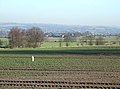
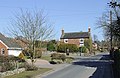
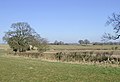
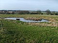
English: Seisdon is a rural village in the county of Staffordshire approximately six miles west of Wolverhampton.
Polski: Seisdon jest wioską w hrabstwie Staffordshire około 9,5 kilometra (6 mil) na zachód od Wolverhampton.

village in United Kingdom  | |||||
| Upload media | |||||
| Instance of | |||||
|---|---|---|---|---|---|
| Location | Trysull and Seisdon, South Staffordshire, Staffordshire, West Midlands, England | ||||
 | |||||
Subcategories
This category has only the following subcategory.
T
Media in category "Seisdon"
The following 135 files are in this category, out of 135 total.
-
 Access to a few houses - geograph.org.uk - 832902.jpg 640 × 480; 132 KB
-
 Access to The Beeches - geograph.org.uk - 832910.jpg 640 × 480; 59 KB
-
 Arable land near Seisdon, Staffordshire - geograph.org.uk - 1742403.jpg 800 × 500; 259 KB
-
 Arable land near Seisdon, Staffordshire - geograph.org.uk - 1751073.jpg 800 × 494; 283 KB
-
 Arable land near Seisdon, Staffordshire - geograph.org.uk - 1751245.jpg 800 × 526; 272 KB
-
 Arable land near Seisdon, Staffordshire - geograph.org.uk - 1751269.jpg 640 × 480; 141 KB
-

-

-

-

-
 Beaucoup de Spuds - geograph.org.uk - 690851.jpg 640 × 480; 177 KB
-
 Beside the A454 - geograph.org.uk - 1223405.jpg 600 × 450; 218 KB
-

-

-

-

-
-

-

-

-

-
 Ebstree Road Seisdon - geograph.org.uk - 685351.jpg 640 × 480; 72 KB
-
 Ebstree Road, Seisdon, Staffordshire - geograph.org.uk - 1747569.jpg 800 × 519; 302 KB
-
 Entrance to the sand pit - geograph.org.uk - 284677.jpg 500 × 375; 149 KB
-
 Farm land near Seisdon, Staffordshire - geograph.org.uk - 1750451.jpg 1,024 × 545; 313 KB
-
 Farm land near Seisdon, Staffordshire - geograph.org.uk - 1750456.jpg 800 × 544; 256 KB
-
 Farm land near Seisdon, Staffordshire - geograph.org.uk - 1751220.jpg 640 × 480; 136 KB
-

-

-

-
 Farm Pool - geograph.org.uk - 682839.jpg 640 × 480; 94 KB
-

-

-

-
-
 Farm track near Seisdon, Staffordshire - geograph.org.uk - 1750368.jpg 800 × 531; 306 KB
-
 Farm track near Seisdon, Staffordshire - geograph.org.uk - 1750377.jpg 640 × 450; 140 KB
-
 Farm track near Seisdon, Staffordshire - geograph.org.uk - 1750382.jpg 480 × 640; 144 KB
-
 Farm track near Seisdon, Staffordshire - geograph.org.uk - 1750491.jpg 640 × 448; 142 KB
-

-

-

-

-
 Farmland towards Seisdon, Staffordshire - geograph.org.uk - 693710.jpg 640 × 438; 142 KB
-
 Fields towards Trysull, Staffordshire - geograph.org.uk - 696406.jpg 640 × 480; 156 KB
-

-

-

-
 Garden Village - geograph.org.uk - 1272461.jpg 640 × 480; 45 KB
-
 Grazing by Wolmore Farm, Staffordshire - geograph.org.uk - 692758.jpg 640 × 640; 166 KB
-

-
 Landfill site for sale - geograph.org.uk - 284682.jpg 600 × 450; 241 KB
-
 Lanes Farm - geograph.org.uk - 285202.jpg 600 × 450; 208 KB
-

-
 Lone Tree - geograph.org.uk - 431801.jpg 640 × 480; 127 KB
-
 New house, Ebstree Road, Seisdon - geograph.org.uk - 2797360.jpg 640 × 480; 67 KB
-
 Oak Tree, Crops and Copse - Staffordshire - geograph.org.uk - 692154.jpg 640 × 640; 150 KB
-

-
 Poppies near Seisdon, Staffordshire - geograph.org.uk - 2476378.jpg 800 × 617; 385 KB
-
 Poppy field near Seisdon, Staffordshire - geograph.org.uk - 2476317.jpg 1,024 × 620; 406 KB
-
 Poppy field near Seisdon, Staffordshire - geograph.org.uk - 2476326.jpg 1,024 × 614; 430 KB
-

-
 Post Office Road, Seisdon, Staffordshire - geograph.org.uk - 1742322.jpg 800 × 489; 320 KB
-
 Post Office Road, Seisdon, Staffordshire - geograph.org.uk - 1747532.jpg 800 × 497; 268 KB
-
 Post Office, Stores and Off Licence - geograph.org.uk - 285236.jpg 400 × 533; 149 KB
-
-

-
 Public Way to Seisdon, Staffordshire - geograph.org.uk - 693671.jpg 640 × 434; 142 KB
-
 Public Way to Seisdon, Staffordshire - geograph.org.uk - 693680.jpg 480 × 640; 139 KB
-
 Right Turn on Staffordshire Way - geograph.org.uk - 687438.jpg 640 × 480; 98 KB
-
 Seisdon Bridge - geograph.org.uk - 685350.jpg 640 × 480; 137 KB
-
 Seisdon Common Road, Staffordshire - geograph.org.uk - 696434.jpg 640 × 456; 148 KB
-
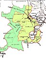 Seisdon Hundred parishes.jpg 1,574 × 2,013; 1.17 MB
-
 Seisdon Mill.jpg 1,600 × 1,200; 569 KB
-
 Seisdon Scene - geograph.org.uk - 2769535.jpg 800 × 600; 105 KB
-
 Smestow Brook - geograph.org.uk - 284709.jpg 600 × 450; 229 KB
-
 Smestow Brook 10 Seisdon.JPG 2,736 × 3,648; 1.38 MB
-

-

-
 Staffordshire Border - geograph.org.uk - 687476.jpg 640 × 480; 78 KB
-
 Staffordshire Farm Land near Seisdon - geograph.org.uk - 692785.jpg 640 × 640; 162 KB
-
 Staffordshire Farm Land near Seisdon - geograph.org.uk - 692793.jpg 640 × 419; 146 KB
-
 Staffordshire farmland near Trescott - geograph.org.uk - 1135566.jpg 640 × 419; 138 KB
-
 Staffordshire farmland towards Ebstree - geograph.org.uk - 1135525.jpg 640 × 436; 114 KB
-
 Staffordshire Farmland west of Seisdon - geograph.org.uk - 692753.jpg 640 × 480; 144 KB
-
 Staffordshire Way - geograph.org.uk - 687489.jpg 480 × 640; 140 KB
-
 Staffordshire Way at Seisdon - geograph.org.uk - 682842.jpg 640 × 480; 75 KB
-

-
 Staffs Way - geograph.org.uk - 687432.jpg 640 × 480; 69 KB
-
 Staffs Way Stile - geograph.org.uk - 682836.jpg 640 × 480; 89 KB
-

-

-

-
 The Bridgnorth Road - geograph.org.uk - 1272470.jpg 640 × 480; 79 KB
-
 The Hollybush at Ebstree, Staffordshire - geograph.org.uk - 1129688.jpg 1,280 × 906; 1.06 MB
-
 The Hollybush at Ebstree, Staffordshire - geograph.org.uk - 1129691.jpg 1,600 × 923; 1.31 MB
-
 The Hollybush at Ebstree, Staffordshire - geograph.org.uk - 1129695.jpg 1,440 × 1,028; 1.38 MB
-
 The Old Manor House, Seisdon - geograph.org.uk - 284701.jpg 600 × 450; 223 KB
-
 The Post Office at Seisdon - geograph.org.uk - 786076.jpg 640 × 480; 60 KB
-
 The quiet end of Seisdon - geograph.org.uk - 832908.jpg 640 × 480; 120 KB
-

-
 The Smithy at Seisdon, Staffordshire - geograph.org.uk - 1742062.jpg 800 × 531; 287 KB
-

-

-

-

-
 Tinker's Castle Road - geograph.org.uk - 691447.jpg 638 × 640; 117 KB
-

-
 View South west from the Way - geograph.org.uk - 687499.jpg 640 × 480; 99 KB
-
 Wild flowers near Seisdon, Staffordshire - geograph.org.uk - 2476374.jpg 640 × 640; 206 KB
-

-

-
 Wolmore Farm, Seisdon - geograph.org.uk - 2631120.jpg 1,142 × 857; 442 KB
-
 Wolmore Lane - geograph.org.uk - 687448.jpg 640 × 480; 72 KB
-

-
 Abbot's Castle Hill, Shropshire - geograph.org.uk - 692983.jpg 640 × 466; 141 KB
-
 Beech Hurst Farmhouse - geograph.org.uk - 284689.jpg 600 × 450; 227 KB
-
-
 Elm Croft - geograph.org.uk - 285642.jpg 600 × 450; 269 KB
-
 Farm Buildings at Wolmore, Staffordshire - geograph.org.uk - 692751.jpg 640 × 480; 118 KB
-

-
 Footpath, Abbot's Castle Hill, Shropshire - geograph.org.uk - 693469.jpg 640 × 480; 154 KB
-
 Holly Bush Inn - geograph.org.uk - 280510.jpg 600 × 450; 203 KB
-
 Lea Farm - geograph.org.uk - 285651.jpg 600 × 450; 226 KB
-
 Lealans Garden Centre - geograph.org.uk - 284730.jpg 600 × 450; 227 KB
-
 Pavilion Garden Centre - geograph.org.uk - 284717.jpg 600 × 450; 193 KB
-
 Pet Supplies - geograph.org.uk - 285666.jpg 600 × 450; 199 KB
-
 Seisdon House - geograph.org.uk - 285649.jpg 550 × 412; 249 KB
-
 Seven Stars - geograph.org.uk - 285248.jpg 600 × 436; 197 KB
-
 Smestow Brook in the Autumn Sunlight - geograph.org.uk - 364744.jpg 600 × 450; 289 KB
-

-
 The Cottage, Post Office Lane - geograph.org.uk - 285635.jpg 600 × 450; 293 KB
-
 The Elms - geograph.org.uk - 285212.jpg 600 × 450; 291 KB
-
 The Fox at Shipley - geograph.org.uk - 284724.jpg 600 × 450; 192 KB
-
 The Smithy - geograph.org.uk - 285659.jpg 600 × 450; 240 KB


