Category:Seghill
Jump to navigation
Jump to search
village in United Kingdom  | |||||
| Upload media | |||||
| Instance of | |||||
|---|---|---|---|---|---|
| Location | Seaton Valley, Northumberland, North East England, England | ||||
 | |||||
Main Wikipedia article: Seghill.
Subcategories
This category has the following 2 subcategories, out of 2 total.
S
T
- Holy Trinity Church, Seghill (2 F)
Media in category "Seghill"
The following 22 files are in this category, out of 22 total.
-
 AFC Seghill attempting to play a match in exceptional conditions.jpg 604 × 452; 70 KB
-
 Eat For England Spoon - geograph.org.uk - 711068.jpg 365 × 640; 68 KB
-
 Field behind High Farm - geograph.org.uk - 79189.jpg 640 × 507; 67 KB
-
 Footpath - geograph.org.uk - 277596.jpg 480 × 640; 146 KB
-
 Former Seghill Colliery pit yard - geograph.org.uk - 3131012.jpg 1,953 × 1,363; 625 KB
-
 Image-Seghill Welfare Field.jpg 3,264 × 2,448; 1.4 MB
-
 Main Street (A190) through Seghill - geograph.org.uk - 3060674.jpg 640 × 480; 56 KB
-
 Mineral Railway Near Mare Close, Seghill (geograph 6524298).jpg 1,600 × 1,200; 722 KB
-

-
 Primitive Methodist Church, Seghill - geograph.org.uk - 5652176.jpg 2,000 × 1,500; 364 KB
-
 Seghill - geograph.org.uk - 454345.jpg 640 × 480; 76 KB
-
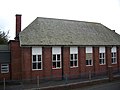 Seghill First School.JPG 3,264 × 2,448; 1.6 MB
-
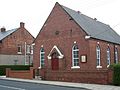
 Seghill Methodist Church - geograph.org.uk - 560558.jpg 640 × 480; 85 KB
-

-
 Seghill Primitive Methodist Church.jpg 3,264 × 2,448; 1.74 MB
-
 Shops in Seghill - geograph.org.uk - 3060673.jpg 640 × 480; 74 KB
-
 Signage At Railway Crossing Near Mare Close, Seghill (geograph 6524310).jpg 1,600 × 1,200; 777 KB
-
 Site of the Hotspur Brickworks - geograph.org.uk - 1735141.jpg 640 × 480; 144 KB
-
 Station House Store - geograph.org.uk - 107943.jpg 640 × 463; 110 KB
-
 Tyneside's industrial past - geograph.org.uk - 1735143.jpg 640 × 480; 142 KB
-
 Unmanned Level Crossing, Seghill (geograph 2757615).jpg 640 × 320; 66 KB
-
 Cramlington-Seghill footpath - geograph.org.uk - 454382.jpg 640 × 430; 89 KB


_through_Seghill_-_geograph.org.uk_-_3060674.jpg)
.jpg)


.jpg)


.jpg)
