Category:Sefton Village, Merseyside
Jump to navigation
Jump to search
village in the Metropolitan Borough of Sefton, in Merseyside, England  | |||||
| Upload media | |||||
| Instance of | |||||
|---|---|---|---|---|---|
| Location | Sefton, Merseyside, North West England, England | ||||
| Population |
| ||||
 | |||||

Subcategories
This category has the following 9 subcategories, out of 9 total.
!
- Valued images of Sefton Village (20 F)
H
L
- Lunt, Merseyside (13 F)
P
S
- Sefton Village War Memorial (7 F)
Media in category "Sefton Village, Merseyside"
The following 181 files are in this category, out of 181 total.
-
 A59 at Switch Island - geograph.org.uk - 2884701.jpg 638 × 449; 110 KB
-
 A59-M58 split, Switch Island - geograph.org.uk - 2884726.jpg 637 × 449; 114 KB
-
 Access to community woodland, Sefton - geograph.org.uk - 4594842.jpg 1,024 × 681; 190 KB
-
 Aintree and Bootle from the air - geograph.org.uk - 2354830.jpg 480 × 640; 143 KB
-
 All that remains of Sefton Hall Moat - geograph.org.uk - 2836756.jpg 640 × 480; 162 KB
-
 Altar St. Helen's Church - geograph.org.uk - 3166995.jpg 640 × 462; 89 KB
-
 Archaeology at Lunt Meadows - geograph.org.uk - 5418642.jpg 1,600 × 1,202; 1,020 KB
-

-
 B5422 at Sefton village boundary - geograph.org.uk - 3418221.jpg 640 × 481; 49 KB
-
 Barn Owl (Tyto alba) over rough grassland, Lunt - geograph.org.uk - 4594870.jpg 1,024 × 640; 140 KB
-
 Barn Owl (Tyto alba), Lunt - geograph.org.uk - 4594868.jpg 1,024 × 640; 78 KB
-
 Bird hide Lunt Meadow Nature Reserve - geograph.org.uk - 4723805.jpg 1,000 × 750; 799 KB
-

-

-
 Brick Wall - geograph.org.uk - 2764472.jpg 640 × 480; 110 KB
-
 Brickwall Lane crossed by Broom's Cross Road - geograph.org.uk - 4637503.jpg 1,000 × 750; 141 KB
-
 Brickwall Lane wall - geograph.org.uk - 3817236.jpg 1,000 × 750; 133 KB
-
 Bridge over the River Alt, Sefton Meadows - geograph.org.uk - 4597448.jpg 1,024 × 576; 140 KB
-
 Bridges Lane, Sefton - geograph.org.uk - 6136734.jpg 800 × 600; 89 KB
-
 Brook House Farm, Netherton - geograph.org.uk - 3710953.jpg 1,024 × 682; 259 KB
-
 Broom's Cross Road crossing Brickwall Lane - geograph.org.uk - 4637496.jpg 1,000 × 750; 189 KB
-
 Brown Hare (Lepus europaeus), Moor Lane, Lunt - geograph.org.uk - 4597395.jpg 1,024 × 639; 141 KB
-
 Bur reed (Sparganium sp.), Lunt Meadows NR - geograph.org.uk - 5064377.jpg 682 × 1,024; 77 KB
-
 Bus Stop on Lunt Road - geograph.org.uk - 6066205.jpg 1,600 × 1,200; 577 KB
-

-

-

-
 Community woodland, Sefton - geograph.org.uk - 4594845.jpg 1,024 × 681; 196 KB
-
 Community woodland, Sefton - geograph.org.uk - 4594849.jpg 1,024 × 681; 225 KB
-
 Concrete owl at Sefton Meadows - geograph.org.uk - 3710917.jpg 1,024 × 682; 337 KB
-
 Confluence of Dover's Brook with the River Alt - geograph.org.uk - 6066228.jpg 1,600 × 1,200; 466 KB
-
 Crop field off Lydiate Lane (A5207) - geograph.org.uk - 6136685.jpg 640 × 480; 69 KB
-
 Cross base on the coffin trail to Sefton Church - geograph.org.uk - 3521242.jpg 1,024 × 768; 320 KB
-
 Crossing Brooms Cross Road to Brookhouse Farm - geograph.org.uk - 6062259.jpg 1,024 × 683; 127 KB
-
 Dover's Bridge spanning Dover's Brook - geograph.org.uk - 2764528.jpg 640 × 480; 123 KB
-
 Dover's Brook - geograph.org.uk - 6136736.jpg 800 × 669; 173 KB
-
 Drainage system for Brooms Cross Road (A5758) - geograph.org.uk - 5798640.jpg 1,000 × 667; 188 KB
-
 Dunnings Bridge Road heading north - geograph.org.uk - 6445590.jpg 2,700 × 2,004; 260 KB
-
 End of motorway M57, Switch Island - geograph.org.uk - 2884690.jpg 583 × 450; 115 KB
-
 Entering Sefton Village - geograph.org.uk - 6136729.jpg 800 × 539; 106 KB
-
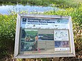
 Environment Agency sign at Showick Bridge, Lunt Meadows - geograph.org.uk - 5418517.jpg 1,600 × 1,200; 348 KB
-

-

-
 Fields off Lydiate Lane - geograph.org.uk - 4775491.jpg 4,334 × 2,111; 2.02 MB
-
 Footbridge over Netherton Brook - geograph.org.uk - 4472404.jpg 1,000 × 750; 320 KB
-
 Footpath across a field, from Sefton to Lydiate - geograph.org.uk - 4597399.jpg 1,024 × 681; 188 KB
-
 Glasshouses at Rushton Garden Centre, Thornton - geograph.org.uk - 4547608.jpg 1,024 × 681; 164 KB
-

-
 Graveyard Sefton Church - geograph.org.uk - 3702066.jpg 1,000 × 750; 296 KB
-

-

-
 Harrison's Brook - geograph.org.uk - 2695477.jpg 480 × 640; 103 KB
-
 Horse mounting block - geograph.org.uk - 3523430.jpg 640 × 480; 106 KB
-
 Houses on Mill Weir Gardens, Sefton - geograph.org.uk - 6136733.jpg 800 × 600; 106 KB
-
 Houses, Lunt - geograph.org.uk - 6136722.jpg 800 × 521; 103 KB
-
 Inside ASDA Aintree - geograph.org.uk - 6226260.jpg 1,600 × 900; 397 KB
-
 Jubilee Wood at Sefton Meadows - geograph.org.uk - 1411390.jpg 640 × 426; 79 KB
-
 Jubilee Wood at Sefton Meadows - geograph.org.uk - 3710955.jpg 1,024 × 682; 241 KB
-
 Jubilee Wood at Sefton Meadows - geograph.org.uk - 3710959.jpg 1,024 × 681; 219 KB
-
 Jubilee Wood on Sefton Meadows - geograph.org.uk - 3710921.jpg 1,024 × 682; 501 KB
-
 King's Church, Thornton - geograph.org.uk - 4942519.jpg 640 × 480; 401 KB
-
 Post box on Brickwall Lane, Sefton Village.jpg 3,462 × 5,198; 22.59 MB
-
 Large stone beside Brooms Cross Rd - geograph.org.uk - 6062265.jpg 1,024 × 683; 250 KB
-
 Longdale Lane - geograph.org.uk - 4121926.jpg 4,592 × 3,056; 7.45 MB
-
 Lunt Meadow Nature Reserve - geograph.org.uk - 4471136.jpg 1,000 × 750; 273 KB
-
 Lunt Meadows - geograph.org.uk - 4594864.jpg 1,024 × 642; 77 KB
-
 Lunt Meadows Nature Reserve - geograph.org.uk - 4544216.jpg 1,024 × 681; 183 KB
-
 Lunt Meadows Nature Reserve - geograph.org.uk - 4544310.jpg 1,024 × 681; 217 KB
-
 Lunt Meadows Nature Reserve - geograph.org.uk - 5418409.jpg 1,600 × 1,201; 623 KB
-
 Lunt Meadows Nature Reserve - geograph.org.uk - 5418690.jpg 1,600 × 1,200; 917 KB
-
 Lunt Road at Lunt village boundary - geograph.org.uk - 3418225.jpg 640 × 481; 41 KB
-
 Lunt Road, Lunt - geograph.org.uk - 6136723.jpg 800 × 600; 140 KB
-
 Lunt Road, Sefton Village.jpg 4,608 × 3,456; 3.42 MB
-
 Lych gate, Sefton church - geograph.org.uk - 4251013.jpg 1,000 × 750; 783 KB
-
 Lydiate Lane (A5207) - geograph.org.uk - 6136686.jpg 800 × 600; 126 KB
-
 Lytchgate. Sefton Church - geograph.org.uk - 3702061.jpg 1,000 × 750; 287 KB
-
 M57 motorway approaching Switch Island - geograph.org.uk - 2884668.jpg 639 × 452; 116 KB
-

-
 Mesolithic Site at Lunt Meadows - geograph.org.uk - 5418627.jpg 1,600 × 1,202; 697 KB
-
 Mill Dam Bridge - geograph.org.uk - 3942359.jpg 1,000 × 750; 157 KB
-
 Mill Dam Bridge at Sefton Meadows - geograph.org.uk - 3710947.jpg 1,024 × 682; 168 KB
-
 Mill House Sefton - geograph.org.uk - 2813094.jpg 640 × 448; 143 KB
-
 Mill Weir Gardens, Sefton Village.jpg 4,320 × 3,240; 3.48 MB
-
 Nertherton Brook passes under Brooms Cross Rd - geograph.org.uk - 6062268.jpg 1,024 × 683; 202 KB
-
 New housing estate and St. Helen's Church - geograph.org.uk - 3702055.jpg 1,024 × 472; 69 KB
-
 New housing estate, Sefton Village - geograph.org.uk - 3523416.jpg 640 × 480; 75 KB
-

-
 Notice board for Sefton Parish Council - geograph.org.uk - 4637522.jpg 1,000 × 750; 316 KB
-
 Notice for work's site for Broom's Cross Road - geograph.org.uk - 4637773.jpg 1,000 × 750; 162 KB
-
 Old Gate Posts for Lunt House - geograph.org.uk - 6066208.jpg 1,600 × 1,201; 556 KB
-
 Old gates, community woodland, Sefton - geograph.org.uk - 4597467.jpg 1,024 × 576; 185 KB
-
 Old pumping station on the River Alt at Lunt Meadows - geograph.org.uk - 5418414.jpg 1,600 × 1,200; 689 KB
-
 Outfall on the River Alt - geograph.org.uk - 6066221.jpg 1,600 × 1,200; 440 KB
-
 Path beside Harrison's Brook, Lunt - geograph.org.uk - 4705467.jpg 1,024 × 681; 195 KB
-

-
 Path in Jubilee Wood on Sefton Meadows - geograph.org.uk - 1411418.jpg 640 × 426; 109 KB
-
 Paths and drains at Lunt Meadows - geograph.org.uk - 5418686.jpg 1,600 × 1,200; 864 KB
-
 Pathway towards Jubilee Wood - geograph.org.uk - 2782904.jpg 640 × 480; 116 KB
-
 Pipeline over the River Alt East of Showrick Bridge - geograph.org.uk - 6066218.jpg 1,600 × 1,200; 621 KB
-
 Post box near Sefton Church - geograph.org.uk - 4637525.jpg 1,000 × 750; 416 KB
-
-
 Rakes Lane - geograph.org.uk - 2772867.jpg 640 × 480; 189 KB
-
 Rapeseed with Well Cottage on the skyline - geograph.org.uk - 3938866.jpg 1,000 × 750; 318 KB
-
 River Alt at Lunt Meadows - geograph.org.uk - 4544259.jpg 1,024 × 681; 194 KB
-
 River Alt at Sefton Meadows - geograph.org.uk - 3710933.jpg 1,024 × 682; 199 KB
-
 River Alt at Sefton Meadows - geograph.org.uk - 3710939.jpg 1,024 × 682; 196 KB
-
 River Alt at Sefton Meadows - geograph.org.uk - 3710951.jpg 1,024 × 682; 250 KB
-
 River Alt at Sefton Meadows - geograph.org.uk - 4597453.jpg 1,024 × 576; 139 KB
-

-

-
 Rivet Benchmark - geograph.org.uk - 2786973.jpg 640 × 480; 132 KB
-

-
 Roadside Rock with Plaque - geograph.org.uk - 3145290.jpg 3,908 × 2,740; 2.5 MB
-
 Rothwell's Cottages and New Cottages - geograph.org.uk - 2765739.jpg 800 × 600; 85 KB
-
 Roughley Wood, Lunt - geograph.org.uk - 4594855.jpg 1,024 × 681; 185 KB
-
 Roughley Wood, Lunt - geograph.org.uk - 4594862.jpg 1,024 × 681; 202 KB
-
 Roughley Wood, Lunt - geograph.org.uk - 4594876.jpg 1,024 × 681; 189 KB
-
 Rowans on the former Sefton Meadows - geograph.org.uk - 3710919.jpg 1,024 × 682; 338 KB
-

-
 Scarecrow. Sefton Meadows - geograph.org.uk - 3420931.jpg 1,024 × 713; 300 KB
-

-

-

-

-

-

-
 Sefton Church - geograph.org.uk - 3702076.jpg 1,000 × 1,333; 276 KB
-

-
 Sefton Mill House - geograph.org.uk - 3702070.jpg 640 × 463; 95 KB
-
 River Alt at Sefton - geograph.org.uk - 332378.jpg 640 × 424; 71 KB
-
 Sefton - Sunset.jpg 640 × 393; 25 KB
-
 Sefton Church - geograph.org.uk - 94998.jpg 640 × 481; 143 KB
-
 Sefton Mill - geograph.org.uk - 94986.jpg 640 × 481; 148 KB
-
 Sefton Mill House, Sefton Village - geograph.org.uk - 327567.jpg 540 × 405; 104 KB
-
 Sefton Village roadsign.jpg 4,608 × 3,456; 3.65 MB
-
 Sefton Village school.jpg 5,017 × 3,293; 13.79 MB
-
 Sefton War Memorial - geograph.org.uk - 6066123.jpg 1,600 × 1,200; 756 KB
-

-
 Showrick Bridge, Lunt - geograph.org.uk - 4594860.jpg 1,024 × 681; 160 KB
-
 Showrick Bridge, Lunt - geograph.org.uk - 4594865.jpg 1,024 × 681; 183 KB
-

-

-
 Speed limit sign Brooms Cross Rd - geograph.org.uk - 6062262.jpg 1,024 × 683; 179 KB
-
 St Helen's Church, Lunt Road, Sefton - geograph.org.uk - 6066267.jpg 1,600 × 1,201; 699 KB
-
 St Helen's Church, Sefton - geograph.org.uk - 4594816.jpg 682 × 1,024; 177 KB
-
 St Helen's Church, Sefton - geograph.org.uk - 4597491.jpg 681 × 1,024; 147 KB
-
 St Helen's Spire from Sefton Meadows - geograph.org.uk - 6066258.jpg 1,600 × 1,201; 310 KB
-
 St Helen's well - geograph.org.uk - 4123311.jpg 4,237 × 2,820; 7.92 MB
-
 St Helen's Well, Sefton - geograph.org.uk - 6066198.jpg 1,600 × 1,200; 825 KB
-
 St Helen's Well, Sefton - geograph.org.uk - 6066201.jpg 1,600 × 1,201; 542 KB
-
 St. Helen's Gutter - geograph.org.uk - 2695480.jpg 640 × 484; 123 KB
-
 Start of path around Lunt Meadow Nature Reserve - geograph.org.uk - 4471129.jpg 1,000 × 750; 243 KB
-
 Stone Owl - geograph.org.uk - 2764564.jpg 480 × 640; 96 KB
-
 Sunset over Lunt Meadows - geograph.org.uk - 4597421.jpg 1,024 × 681; 48 KB
-
 Sunset over Lunt Meadows - geograph.org.uk - 4597427.jpg 1,024 × 641; 45 KB
-
 Switch Island Junction - geograph.org.uk - 3145261.jpg 3,885 × 1,839; 1.72 MB
-
 Tanhouse Farm - geograph.org.uk - 2876581.jpg 640 × 480; 154 KB
-
 The bells. St. Helen's Church - geograph.org.uk - 3167014.jpg 640 × 480; 95 KB
-
 The Church of St Helen, Sefton - geograph.org.uk - 4121831.jpg 2,669 × 3,494; 5.98 MB
-
 The Church of St Helen, Sefton - geograph.org.uk - 6136730.jpg 600 × 800; 94 KB
-
 The graveyard at St Helens Church - geograph.org.uk - 4123246.jpg 4,357 × 2,900; 7.08 MB
-

-
 The new Broom's Cross Road - geograph.org.uk - 4637513.jpg 1,000 × 750; 140 KB
-
 The new section, Switch Island - geograph.org.uk - 2884695.jpg 638 × 452; 135 KB
-
 The Punch Bowl and St Helen's Church, Sefton - geograph.org.uk - 4594809.jpg 682 × 1,024; 170 KB
-
 The Punchbowl, Sefton Village - geograph.org.uk - 6136724.jpg 800 × 600; 122 KB
-
 The Punchbowl, Sefton Village - geograph.org.uk - 6136725.jpg 800 × 477; 80 KB
-
 The River Alt - geograph.org.uk - 6066214.jpg 1,600 × 1,200; 586 KB
-
 The River Alt Northwest of Showrick Bridge - geograph.org.uk - 5418423.jpg 1,600 × 1,200; 824 KB
-
 The site of St Helen's Well, Sefton - geograph.org.uk - 4594820.jpg 681 × 1,024; 276 KB
-
 The Stables, Chapel Lane - geograph.org.uk - 4473310.jpg 1,000 × 750; 193 KB
-

-
 Thornton Cemetery - geograph.org.uk - 3332168.jpg 4,567 × 2,301; 2.34 MB
-
 Thornton, Runnell's Lane - geograph.org.uk - 4942531.jpg 640 × 480; 351 KB
-
 Track at Sefton Meadows - geograph.org.uk - 4597462.jpg 1,024 × 576; 109 KB
-
 Traffic light sign Brooms Cross Rd - geograph.org.uk - 6062260.jpg 1,024 × 683; 167 KB
-

-
 Ty-Halyn cottage, Brickwall Lane - geograph.org.uk - 3523438.jpg 640 × 480; 76 KB
-
 War Memorial, Sefton - geograph.org.uk - 6136731.jpg 800 × 498; 169 KB
-
 Wetlands off Moor Lane, Lunt - geograph.org.uk - 6066210.jpg 1,600 × 1,200; 540 KB
-
 Windles Green, Edge Lane - geograph.org.uk - 4942527.jpg 640 × 427; 297 KB


,_Lunt_Meadows_NR_-_geograph.org.uk_-_5064326.jpg)

_over_rough_grassland,_Lunt_-_geograph.org.uk_-_4594870.jpg)
,_Lunt_-_geograph.org.uk_-_4594868.jpg)


,_Lunt_Meadows_NR_-_geograph.org.uk_-_5064317.jpg)


,_Moor_Lane,_Lunt_-_geograph.org.uk_-_4597395.jpg)
,_Lunt_Meadows_NR_-_geograph.org.uk_-_5064377.jpg)

_on_Lunt_Meadows_Nature_Reserve_-_geograph.org.uk_-_5064237.jpg)
,_Lunt_Meadows_NR_-_geograph.org.uk_-_5064287.jpg)
,_Lunt_Meadows_NR_-_geograph.org.uk_-_5064293.jpg)


_-_geograph.org.uk_-_6136685.jpg)


_-_geograph.org.uk_-_5798640.jpg)


_living_up_to_its_name,_Sefton_-_geograph.org.uk_-_4597413.jpg)


,_Lunt_Meadows_Nature_Reserve_-_geograph.org.uk_-_4544247.jpg)


_-_geograph.org.uk_-_6136686.jpg)


_-_geograph.org.uk_-_4472414.jpg)


_-_geograph.org.uk_-_3938875.jpg)


_Bridge_on_the_River_Alt_at_Lunt_Meadows_-_geograph.org.uk_-_5418428.jpg)


,_Lunt_Meadows_Nature_Reserve_-_geograph.org.uk_-_4544327.jpg)


