Category:Sedgeford
Jump to navigation
Jump to search
English: Sedgeford is a civil parish in the English county of Norfolk, about 6 km south of the North Sea and north east of Cambridge.
human settlement in United Kingdom  | |||||
| Upload media | |||||
| Instance of | |||||
|---|---|---|---|---|---|
| Location | King's Lynn and West Norfolk, Norfolk, East of England, England | ||||
| Population |
| ||||
| Area |
| ||||
 | |||||
Subcategories
This category has the following 4 subcategories, out of 4 total.
M
S
- Sedgeford railway station (5 F)
- Sedgeford Torc (4 F)
- Sedgeford War Memorial (1 F)
Media in category "Sedgeford"
The following 200 files are in this category, out of 239 total.
(previous page) (next page)-
 A few poppies by the side of Fring Road - geograph.org.uk - 4526716.jpg 1,024 × 768; 479 KB
-
 A minor road heading north - geograph.org.uk - 6231488.jpg 1,899 × 1,274; 431 KB
-

-
 Alongside Stormhill Plantation near Ringstead, Norfolk - geograph.org.uk - 2634830.jpg 4,320 × 3,240; 5.88 MB
-
 Approaching Sedgeford - geograph.org.uk - 6231477.jpg 1,822 × 1,205; 335 KB
-
 B1454 near East Hall - geograph.org.uk - 5574901.jpg 640 × 480; 64 KB
-
 B1454 towards Sedgeford - geograph.org.uk - 5574612.jpg 640 × 480; 52 KB
-
 B1454 towards Sedgeford - geograph.org.uk - 5574889.jpg 640 × 480; 32 KB
-
 B1454 towards Sedgeford - geograph.org.uk - 5574896.jpg 640 × 480; 61 KB
-
 Barn Cottages on the B1454 - geograph.org.uk - 5574887.jpg 640 × 480; 61 KB
-
 Blakeborough foundry, a street water pillar - geograph.org.uk - 5565293.jpg 2,592 × 3,456; 3.25 MB
-
 Bridge over dismantled railway line west of Docking, Norfolk - geograph.org.uk - 2634669.jpg 4,320 × 3,240; 5.68 MB
-
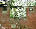 Building in Whin Close - geograph.org.uk - 4449345.jpg 640 × 523; 469 KB
-
 Building in Whin Close - geograph.org.uk - 4449349.jpg 640 × 480; 496 KB
-

-
 By the East Gate Lodge to Sedgeford Hall - geograph.org.uk - 4526705.jpg 1,024 × 768; 348 KB
-
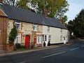
 Clematis on the Old Post Office in Sedgeford - geograph.org.uk - 4526697.jpg 1,024 × 768; 459 KB
-
 Conservation area by Beech Wood, Snettisham - geograph.org.uk - 6096788.jpg 3,264 × 2,448; 1.78 MB
-
 Copse of trees on the brow of the valley - geograph.org.uk - 4526715.jpg 1,024 × 768; 268 KB
-
 Cottages at Littleport, Sedgeford - geograph.org.uk - 6683024.jpg 5,184 × 2,912; 4.75 MB
-
 Cottages on Heacham Road, Sedgeford - geograph.org.uk - 5574970.jpg 640 × 480; 56 KB
-
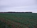
 Countryside east of Heacham, Norfolk - geograph.org.uk - 2115914.jpg 2,848 × 2,136; 3.09 MB
-
 Crop field by Burntstalk - geograph.org.uk - 4458781.jpg 640 × 480; 384 KB
-
 Crop field near Burntstalk - geograph.org.uk - 5574861.jpg 640 × 480; 48 KB
-
 Crop field near East Hall - geograph.org.uk - 5574902.jpg 640 × 480; 46 KB
-
 Crop field near Pump Cottages - geograph.org.uk - 5574890.jpg 640 × 480; 54 KB
-
 Crop field off Sedgeford Road - geograph.org.uk - 5574985.jpg 640 × 480; 56 KB
-
 Crop field towards New Plantation - geograph.org.uk - 5574633.jpg 640 × 480; 62 KB
-
 Crop fields by Burntstalk - geograph.org.uk - 4458788.jpg 640 × 573; 493 KB
-
 Crop fields south of Docking Road - geograph.org.uk - 4458790.jpg 640 × 480; 334 KB
-
 Decoy airfield control room (detail) - geograph.org.uk - 4449423.jpg 640 × 487; 596 KB
-
 Decoy airfield control room - geograph.org.uk - 4449410.jpg 640 × 480; 489 KB
-
 Decoy airfield control room - geograph.org.uk - 4449412.jpg 640 × 480; 440 KB
-
 Decoy airfield generator room (detail) - geograph.org.uk - 4452902.jpg 640 × 559; 534 KB
-
 Decoy airfield generator room - geograph.org.uk - 4449408.jpg 640 × 480; 446 KB
-

-

-
 Ears looking at ewe - geograph.org.uk - 2277816.jpg 2,848 × 2,136; 2.97 MB
-
 East Gate Lodge to Sedgeford Hall - geograph.org.uk - 4526706.jpg 640 × 480; 166 KB
-
 Entrance to East Hall Farmhouse, Sedgeford - geograph.org.uk - 2633714.jpg 4,320 × 3,240; 5.19 MB
-

-
 Excavation site in Whin Close - geograph.org.uk - 2562103.jpg 640 × 480; 279 KB
-
 Excavation site in Whin Close - geograph.org.uk - 2562107.jpg 480 × 640; 277 KB
-

-

-
 Farm track beside Beech Wood - geograph.org.uk - 5574982.jpg 640 × 480; 95 KB
-
 Farm track east of Sedgeford - geograph.org.uk - 5574893.jpg 640 × 480; 38 KB
-
 Farm track in Whin Close - geograph.org.uk - 4449295.jpg 640 × 480; 478 KB
-
 Farmland east of Sedgeford - geograph.org.uk - 5574891.jpg 640 × 480; 44 KB
-
 Farmland east of Whin Close, Sedgeford - geograph.org.uk - 2562110.jpg 640 × 480; 174 KB
-
 Farmland next to the Peddars Way - geograph.org.uk - 5456141.jpg 800 × 503; 139 KB
-
 Farmland west of Sedgeford - geograph.org.uk - 5574609.jpg 640 × 480; 52 KB
-
 Field Barn Cottage - geograph.org.uk - 2634666.jpg 4,320 × 3,240; 5.52 MB
-
 Field of cereal in Norfolk. - geograph.org.uk - 158430.jpg 640 × 480; 92 KB
-
 Fields by Burntstalk - geograph.org.uk - 4458791.jpg 640 × 480; 401 KB
-
 Fields by Sedgeford - geograph.org.uk - 4458782.jpg 640 × 565; 431 KB
-
 Fields east of Old Plantation, Sedgeford - geograph.org.uk - 2562071.jpg 640 × 480; 233 KB
-
 Fields east of Whin Close, Sedgeford - geograph.org.uk - 2562097.jpg 640 × 480; 233 KB
-
 Fields north of Fring Road - geograph.org.uk - 2562065.jpg 600 × 550; 137 KB
-
 Flint and Gingerbread cottages - geograph.org.uk - 4526703.jpg 1,024 × 768; 429 KB
-
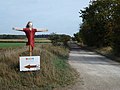
 Footpath marker on the Peddars Way - geograph.org.uk - 2562056.jpg 640 × 480; 264 KB
-
 Footpath opposite the cemetery in Sedgeford, Norfolk - geograph.org.uk - 2277802.jpg 2,848 × 2,136; 3.05 MB
-
 Former Great Eastern Railway - geograph.org.uk - 575692.jpg 480 × 640; 105 KB
-
-
 Former Railway Station, Sedgeford - geograph.org.uk - 2396668.jpg 1,536 × 1,024; 1.09 MB
-
 Fring Ford - geograph.org.uk - 3040455.jpg 3,872 × 2,592; 2.37 MB
-
 Fring Road at Sedgeford - geograph.org.uk - 5456174.jpg 800 × 556; 154 KB
-
 Fring Road towards Sedgeford - geograph.org.uk - 5450669.jpg 800 × 545; 123 KB
-
 Gap in field boundary hedge, Sedgeford - geograph.org.uk - 2562066.jpg 640 × 480; 224 KB
-
 Gate along the Peddars Way - geograph.org.uk - 5465411.jpg 800 × 656; 191 KB
-
 Going uphill on the B1454 - geograph.org.uk - 6231464.jpg 1,757 × 1,022; 325 KB
-
 Green belt on Sedgeford Road, Norfolk - geograph.org.uk - 2323130.jpg 2,848 × 2,136; 2.98 MB
-
 Harvest time. - geograph.org.uk - 158446.jpg 640 × 480; 96 KB
-
 Harvest time. - geograph.org.uk - 158449.jpg 640 × 479; 82 KB
-
 Harvested field beside the Peddars Way - geograph.org.uk - 2562061.jpg 640 × 480; 156 KB
-
 Heacham - Wells railway bridge - geograph.org.uk - 6511965.jpg 1,600 × 1,068; 894 KB
-
 Heacham - Wells railway bridge HWS1798 - geograph.org.uk - 6511969.jpg 1,024 × 684; 322 KB
-
 Heacham Road, Sedgeford - geograph.org.uk - 5574623.jpg 640 × 480; 54 KB
-

-
 Hedgerow and trackway - geograph.org.uk - 6096790.jpg 3,264 × 2,448; 1.6 MB
-
 Hedgerow beside the B1454 - geograph.org.uk - 5574608.jpg 640 × 480; 46 KB
-
 Houses on Heacham Road, Sedgeford - geograph.org.uk - 5574622.jpg 640 × 480; 77 KB
-

-

-
-

-
 Lady in red - Wild Luxury - geograph.org.uk - 2634621.jpg 4,320 × 3,240; 5.42 MB
-
 Lych gate, Sedgeford Cemetery - geograph.org.uk - 5574615.jpg 640 × 480; 95 KB
-
 MagazineCottage.jpg 1,920 × 2,560; 369 KB
-
 Minor road to Summerfield - geograph.org.uk - 4458777.jpg 640 × 480; 389 KB
-
 Minor road towards Summerfield - geograph.org.uk - 5574886.jpg 640 × 411; 57 KB
-
 National Cycle Route 1 - geograph.org.uk - 5574625.jpg 640 × 480; 56 KB
-
 National Cycle Route 1 - geograph.org.uk - 5574630.jpg 640 × 480; 73 KB
-
 National Cycle Route 1 - geograph.org.uk - 5574972.jpg 640 × 480; 59 KB
-
 National Cycle Route 1 - geograph.org.uk - 5574981.jpg 640 × 480; 47 KB
-
 National Cycle Route 1 beside Beech Wood - geograph.org.uk - 5574987.jpg 640 × 480; 102 KB
-

-
 North along the Peddars Way - geograph.org.uk - 5456157.jpg 800 × 648; 198 KB
-

-
 Old farm machinery along the Peddars Way - geograph.org.uk - 5436519.jpg 800 × 647; 151 KB
-
 Old trackway to the village of Fring - geograph.org.uk - 4458780.jpg 640 × 480; 383 KB
-
 On the Ringstead road - geograph.org.uk - 6231492.jpg 1,824 × 1,249; 1.46 MB
-
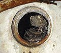
 Ordnance Survey Cut Mark - geograph.org.uk - 4291521.jpg 4,000 × 3,000; 2.72 MB
-
 Overgrown track near Burntstalk, Docking - geograph.org.uk - 2634733.jpg 4,320 × 3,240; 5.79 MB
-
 Passing through Sedgeford - geograph.org.uk - 6231481.jpg 1,904 × 1,194; 368 KB
-
 Path in Whin Close - geograph.org.uk - 4449270.jpg 640 × 480; 507 KB
-
 Peddars Way at Magazine Wood Sedgeford.jpg 360 × 480; 77 KB
-
 Peddars Way at Sedgeford Plantation - geograph.org.uk - 6683018.jpg 5,184 × 2,912; 5.07 MB
-
 Peddars Way crossing Fring Road - geograph.org.uk - 5456166.jpg 800 × 597; 169 KB
-
 Peddars Way crossing Fring Road - geograph.org.uk - 5466608.jpg 800 × 563; 144 KB
-

-
 Peddars Way in the Sedgeford Plantation - geograph.org.uk - 5456147.jpg 800 × 600; 184 KB
-
 Peddars Way next to Sedgeford Plantation - geograph.org.uk - 5436080.jpg 800 × 600; 189 KB
-
 Post Office Cottage, Sedgeford, Norfolk - geograph.org.uk - 2633713.jpg 4,320 × 3,240; 5.92 MB
-
 Relic from WW1 - geograph.org.uk - 4449307.jpg 480 × 640; 535 KB
-
 Ringstead Road - geograph.org.uk - 5574639.jpg 640 × 480; 36 KB
-
 Road to Field Barn - geograph.org.uk - 5574634.jpg 640 × 480; 64 KB
-

-
 Ruined building in Whin Close - geograph.org.uk - 4449342.jpg 640 × 480; 536 KB
-
 Sedgeford Cemetery - geograph.org.uk - 5574616.jpg 640 × 480; 81 KB
-
 Sedgeford cemetery - geograph.org.uk - 948077.jpg 3,008 × 2,000; 3.32 MB
-
 Sedgeford Historical and Archaeological Research Project - geograph.org.uk - 1994713.jpg 2,048 × 1,536; 710 KB
-
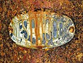
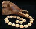 Sedgeford Hoard.jpg 227 × 183; 34 KB
-
 Sedgeford Road - geograph.org.uk - 5574977.jpg 640 × 480; 72 KB
-
 Sedgeford St Mary's church - geograph.org.uk - 2231770.jpg 640 × 480; 204 KB
-

-
 Sedgeford station - the entrance gate - geograph.org.uk - 1944480.jpg 640 × 572; 295 KB
-

-

-
 Sedgeford station - the signal box - geograph.org.uk - 1944473.jpg 552 × 640; 287 KB
-
 Sedgeford station - the station platform - geograph.org.uk - 1944477.jpg 640 × 513; 241 KB
-
 Sedgeford village sign - geograph.org.uk - 948069.jpg 2,304 × 3,072; 1.88 MB
-
 Sedgeford War Memorial - geograph.org.uk - 4526696.jpg 1,024 × 768; 548 KB
-
 Sedgeford, aerial 2013 - geograph.org.uk - 3673311.jpg 640 × 427; 68 KB
-
 Sedgeford, entrance to The Hall grounds - geograph.org.uk - 565710.jpg 640 × 426; 133 KB
-
-

-

-
 Straw stack near Glebe Belt north of Sedgeford - geograph.org.uk - 2634862.jpg 4,320 × 3,240; 5.94 MB
-

-
 Stubble field off Sedgeford Road - geograph.org.uk - 5574975.jpg 640 × 480; 50 KB
-
 The B1454 past Burntstalk - geograph.org.uk - 4458771.jpg 640 × 480; 313 KB
-
 The end of the bubble - geograph.org.uk - 2323084.jpg 2,848 × 2,136; 2.9 MB
-
 The entrance to Sedgeford cemetery, Norfolk - geograph.org.uk - 2277807.jpg 2,848 × 2,136; 3.09 MB
-
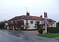
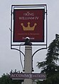
 The King William IV - geograph.org.uk - 5457435.jpg 800 × 466; 91 KB
-
 The lane from Ringstead to Sedgeford - geograph.org.uk - 1944455.jpg 640 × 480; 171 KB
-
 The Magazine Farm along the Peddars Way - geograph.org.uk - 5465418.jpg 800 × 627; 131 KB
-
 The Officers' quarters (detail) - geograph.org.uk - 4449367.jpg 480 × 640; 538 KB
-
 The Officers' quarters (interior) - geograph.org.uk - 4449372.jpg 640 × 514; 412 KB
-
 The Officers' quarters (interior) - geograph.org.uk - 4449373.jpg 640 × 589; 483 KB
-
 The Officers' quarters (interior) - geograph.org.uk - 4449376.jpg 633 × 640; 587 KB
-
 The Officers' quarters (interior) - geograph.org.uk - 4449379.jpg 628 × 640; 532 KB
-
 The Officers' quarters (interior) - geograph.org.uk - 4449383.jpg 640 × 480; 390 KB
-
 The Officers' quarters (interior) - geograph.org.uk - 4449384.jpg 640 × 574; 500 KB
-
 The Officers' quarters (interior) - geograph.org.uk - 4449387.jpg 533 × 640; 542 KB
-
 The Officers' quarters (interior) - geograph.org.uk - 4449391.jpg 640 × 484; 395 KB
-
 The Officers' quarters (interior) - geograph.org.uk - 4449393.jpg 640 × 510; 383 KB
-
 The Officers' quarters (interior) - geograph.org.uk - 4449395.jpg 640 × 480; 413 KB
-
 The Officers' quarters - geograph.org.uk - 4449361.jpg 640 × 480; 440 KB
-
 The Officers' quarters - geograph.org.uk - 4449362.jpg 640 × 480; 428 KB
-
 The Officers' quarters - geograph.org.uk - 4450225.jpg 640 × 535; 525 KB
-
 The Old Armoury, Magazine, Sedgeford - geograph.org.uk - 1120758.jpg 500 × 375; 206 KB
-
 The Peddars Way at Littleport - geograph.org.uk - 5465426.jpg 800 × 557; 164 KB
-

-
 The Peddars Way near Fring - geograph.org.uk - 5452641.jpg 800 × 523; 183 KB
-
 The Peddars Way north of Sedgeford - geograph.org.uk - 5465399.jpg 800 × 614; 143 KB
-
 The Peddars' Way crosses Fring Road - geograph.org.uk - 2633703.jpg 4,320 × 3,240; 5.61 MB
-
 The Ringstead road north of Sedgeford - geograph.org.uk - 4526693.jpg 1,024 × 768; 250 KB
-
 The site of a WW1 aircraft hangar - geograph.org.uk - 4449302.jpg 640 × 480; 444 KB
-
 The Technical store (detail) - geograph.org.uk - 4449326.jpg 561 × 640; 568 KB
-
 The Technical store (interior) - geograph.org.uk - 4449329.jpg 640 × 480; 383 KB
-
 The Technical store (interior) - geograph.org.uk - 4449332.jpg 640 × 480; 407 KB
-
 The Technical store - geograph.org.uk - 4449319.jpg 640 × 480; 466 KB
-
 The Technical store - geograph.org.uk - 4449321.jpg 640 × 480; 519 KB
-

-
 Track beside Beech Wood, off Sedgeford Road, Snettisham - geograph.org.uk - 6096784.jpg 3,264 × 2,448; 1.77 MB
-

-
 Track skirting Whin Close, Sedgeford - geograph.org.uk - 2562095.jpg 640 × 480; 221 KB
-
 Track to Docking Road - geograph.org.uk - 4458786.jpg 640 × 480; 347 KB
-
 Track to East Hall - geograph.org.uk - 5574899.jpg 640 × 480; 56 KB
-
 Track to Fring - geograph.org.uk - 4458794.jpg 640 × 480; 459 KB
-
 Track to Whin Close near Sedgeford, Norfolk - geograph.org.uk - 2634632.jpg 4,320 × 3,240; 5.43 MB
-
 Traditional buildings near Glover's Farm, Sedgeford, Norfolk - geograph.org.uk - 2633710.jpg 4,320 × 3,240; 5.86 MB
-
 Tree on Sedgeford Road, Norfolk - geograph.org.uk - 2323111.jpg 2,848 × 2,136; 2.98 MB
-
 Undulating farmland near Sedgeford - geograph.org.uk - 2562070.jpg 640 × 480; 245 KB
-

-
 Uphill track west of Sedgeford, Norfolk - geograph.org.uk - 2277791.jpg 2,848 × 2,136; 2.98 MB
-
 View along dismantled trailway trackbed - geograph.org.uk - 1944491.jpg 640 × 545; 260 KB
-
 View from Dovehill Wood, Sedgeford - geograph.org.uk - 2562084.jpg 640 × 480; 237 KB
-
 View into Whin Close - geograph.org.uk - 4449286.jpg 480 × 640; 521 KB
-

-

-
 Wheat crop field by Burntstalk - geograph.org.uk - 4458797.jpg 640 × 480; 446 KB
-

-
 Wild flowers on a field's edge - geograph.org.uk - 2562078.jpg 640 × 480; 227 KB
-
 Winter cereal crop near East Hall - geograph.org.uk - 5574898.jpg 640 × 480; 41 KB
-
 WW1 air raid shelter (interior) - geograph.org.uk - 4449356.jpg 480 × 640; 398 KB
-
 WW1 air raid shelter (interior) - geograph.org.uk - 4449357.jpg 480 × 640; 369 KB
-

-
 WW1 building in Whin Close - geograph.org.uk - 4449348.jpg 640 × 480; 482 KB


_-_geograph.org.uk_-_4449423.jpg)


_-_geograph.org.uk_-_4452902.jpg)


_west_of_Sedgeford_-_geograph.org.uk_-_5574613.jpg)
_towards_Docking_Road_-_geograph.org.uk_-_5574860.jpg)


_-_geograph.org.uk_-_5412099.jpg)


_-_geograph.org.uk_-_4449367.jpg)
_-_geograph.org.uk_-_4449372.jpg)
_-_geograph.org.uk_-_4449373.jpg)
_-_geograph.org.uk_-_4449376.jpg)
_-_geograph.org.uk_-_4449379.jpg)
_-_geograph.org.uk_-_4449383.jpg)
_-_geograph.org.uk_-_4449384.jpg)
_-_geograph.org.uk_-_4449387.jpg)
_-_geograph.org.uk_-_4449391.jpg)
_-_geograph.org.uk_-_4449393.jpg)
_-_geograph.org.uk_-_4449395.jpg)


_-_geograph.org.uk_-_4449326.jpg)
_-_geograph.org.uk_-_4449329.jpg)
_-_geograph.org.uk_-_4449332.jpg)


_-_geograph.org.uk_-_4449356.jpg)
_-_geograph.org.uk_-_4449357.jpg)

