Category:Sebastopol, Torfaen
Jump to navigation
Jump to search
village in Wales, United Kingdom  | |||||
| Upload media | |||||
| Instance of | |||||
|---|---|---|---|---|---|
| Location | Torfaen, Wales | ||||
 | |||||

English: Sebastopol is the southernmost suburb of Pontypool in the county borough of Torfaen, within the historic boundaries of Monmouthshire in South Wales. It is named in honour of the Russian city Sevastopol (also known as Sebastopol) that was taken during the Crimean War. It is a working-class area consisting of mainly privately-owned terraced houses and a substantial number of local authority/ex-local authority housing (known as the Kemys Fawr Estate).
Subcategories
This category has the following 7 subcategories, out of 7 total.
Media in category "Sebastopol, Torfaen"
The following 23 files are in this category, out of 23 total.
-
 Alma Place, Sebastopol, Pontypool - geograph.org.uk - 1577119.jpg 640 × 480; 80 KB
-
 Austin Road, Sebastopol - geograph.org.uk - 1594711.jpg 640 × 445; 70 KB
-
 Avondale Road, Pontypool - geograph.org.uk - 1577054.jpg 640 × 416; 66 KB
-
 Bevan's Lane, Sebastopol - geograph.org.uk - 1594719.jpg 640 × 480; 86 KB
-
 Central Garage, Sebastopol - geograph.org.uk - 1594714.jpg 640 × 330; 51 KB
-
 Crown Bridge, Sebastopol. Pontypool - geograph.org.uk - 1577134.jpg 640 × 480; 102 KB
-
 East Avenue, Sebastopol. Pontypool - geograph.org.uk - 1577167.jpg 640 × 480; 77 KB
-

-

-
 Newport to Abergavenny railway - geograph.org.uk - 399393.jpg 640 × 449; 102 KB
-
 Old Railway Line - geograph.org.uk - 961442.jpg 640 × 480; 112 KB
-

-
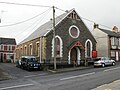 Penry Gospel Hall, Sebastopol - geograph.org.uk - 1577116.jpg 640 × 480; 75 KB
-

-

-
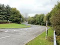
 Sebastopol - Griffithstown boundary - geograph.org.uk - 1577182.jpg 640 × 384; 69 KB
-

-
 South Street, Sebastopol, Pontypool - geograph.org.uk - 1577123.jpg 640 × 480; 69 KB
-

-

-

-

-
 X24 bus, Avondale Road, Pontypool - geograph.org.uk - 4321655.jpg 640 × 614; 84 KB


