Category:Sebastiansgarten und Träubelwiese
Jump to navigation
Jump to search
| Object location | | View all coordinates using: OpenStreetMap |
|---|
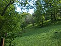
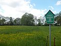
natural monument protected area in Groitzsch Municipality, Saxony, Germany  | |||||
| Upload media | |||||
| Instance of | |||||
|---|---|---|---|---|---|
| Part of | |||||
| Location | Groitzsch, Landkreis Leipzig, Saxony, Germany | ||||
| Heritage designation | |||||
| Start time |
| ||||
| Area |
| ||||
 | |||||
Media in category "Sebastiansgarten und Träubelwiese"
The following 4 files are in this category, out of 4 total.
-
 Sebastianspark1.JPG 3,648 × 2,736; 2.09 MB
-
 Sebastianspark2.JPG 3,602 × 2,685; 1.72 MB
-
 Sebastianspark3.JPG 3,648 × 2,736; 2.22 MB
-
 Träubelwiese-Groitzsch.JPG 3,648 × 2,736; 1.14 MB


