Category:Seattle-area transit maps
Jump to navigation
Jump to search
Subcategories
This category has the following 2 subcategories, out of 2 total.
S
- Sound Transit maps (26 F)
Media in category "Seattle-area transit maps"
The following 8 files are in this category, out of 8 total.
-
 1914 map of Puget Sound TLP Seattle Division.png 1,528 × 2,500; 5.39 MB
-
 Forward-Thrust-map.svg 864 × 1,152; 248 KB
-
 KC Metro RapidRide A Line Map.png 5,400 × 1,500; 289 KB
-
 Map of Seattle bus and streetcar lines (1941).png 3,156 × 4,284; 291 KB
-
 Seattle - West Spokane Street interchanges, 1961.jpg 956 × 601; 727 KB
-
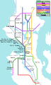 Seattle Monorail Project map (2004).svg 600 × 1,000; 93 KB
-
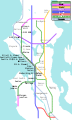 Seattle Monorail Project map.svg 600 × 1,000; 88 KB
-
 Swift BRT Line Map.svg 567 × 850; 128 KB


.png)

.svg)

