Category:Seaforde
Jump to navigation
Jump to search
English: Seaforde is a small village in County Down, Northern Ireland, soon to be renamed Clelandville. It is one mile (1.6 km) north of Clough on the main Ballynahinch to Newcastle road. It lies within the Down District Council area.
village in United Kingdom  | |||||
| Upload media | |||||
| Instance of | |||||
|---|---|---|---|---|---|
| Location | Northern Ireland | ||||
 | |||||
Subcategories
This category has the following 2 subcategories, out of 2 total.
S
Media in category "Seaforde"
The following 97 files are in this category, out of 97 total.
-
 A field of flax south of Seaforde Road - geograph.org.uk - 2502353.jpg 1,024 × 768; 222 KB
-

-
 A field of potatoes on the eastern outskirts of Clough - geograph.org.uk - 4406459.jpg 1,600 × 1,175; 285 KB
-
 A Georgian house at Creeghduff - geograph.org.uk - 2307986.jpg 1,024 × 716; 218 KB
-
 Cottage adjoining the former Seaforde RUC Station - geograph.org.uk - 4555945.jpg 1,600 × 1,185; 325 KB
-
 Country show - geograph.org.uk - 3708488.jpg 4,000 × 2,664; 2.49 MB
-
 Cropland north of Ballydugan Road - geograph.org.uk - 3858931.jpg 1,024 × 751; 136 KB
-
 Cropland north of the Ballydugan Road outside of Clough - geograph.org.uk - 5475060.jpg 4,000 × 3,000; 2.57 MB
-
 Cropland south of Seaforde Road - geograph.org.uk - 2502465.jpg 1,024 × 768; 235 KB
-
 Cropland west of Drumgooland Road - geograph.org.uk - 2508824.jpg 1,024 × 767; 111 KB
-
 Croplands beside Seaforde Road - geograph.org.uk - 3970038.jpg 1,024 × 768; 180 KB
-
 Croplands on the Seaforde Demesne - geograph.org.uk - 2508828.jpg 1,024 × 665; 111 KB
-
 Cumran Lane north of Cumran House - geograph.org.uk - 2509082.jpg 1,024 × 768; 384 KB
-

-
 Drumgooland Road, Creeghduff, Seaforde - geograph.org.uk - 1476517.jpg 640 × 480; 130 KB
-
 Drumgooland Road, Farranfad, Seaforde - geograph.org.uk - 1476483.jpg 640 × 480; 119 KB
-
 Dunnanew Road, Seaforde - geograph.org.uk - 1444395.jpg 640 × 480; 55 KB
-
 Farm access lane on the Ballydugan Road - geograph.org.uk - 3749752.jpg 1,024 × 744; 59 KB
-

-

-
 Farmland in the Townland of Cumran - geograph.org.uk - 2509737.jpg 1,024 × 768; 165 KB
-
 Farmland north of the A25 (Ballydugan Road) - geograph.org.uk - 3598946.jpg 1,024 × 750; 118 KB
-
 Farmland north of the Ballydugan Road - geograph.org.uk - 3598943.jpg 1,024 × 757; 112 KB
-
 Farmland north of the Downpatrick Road - geograph.org.uk - 2307975.jpg 1,024 × 768; 103 KB
-
 Farmland south of the A25 (Downpatrick Road) - geograph.org.uk - 4405584.jpg 1,600 × 1,194; 275 KB
-
 Farmland south of the A25 (Downpatrick Road) - geograph.org.uk - 4405591.jpg 1,600 × 1,200; 276 KB
-
 Farmland west of the Newcastle Road - geograph.org.uk - 2820789.jpg 1,024 × 751; 76 KB
-

-
 Farranfad Road near Seaforde - geograph.org.uk - 1476454.jpg 640 × 480; 65 KB
-
 Fields of grain east of Clough - geograph.org.uk - 3598945.jpg 1,024 × 634; 82 KB
-
 Fields of grain east of Clough - geograph.org.uk - 3749749.jpg 1,024 × 716; 105 KB
-
 Former estate houses, Seaforde - geograph.org.uk - 798310.jpg 640 × 435; 91 KB
-

-
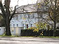
 Georgian villa at Seaforde - geograph.org.uk - 4744994.jpg 1,581 × 1,600; 566 KB
-
-
 House at Seaforde - geograph.org.uk - 2254802.jpg 640 × 480; 83 KB
-
 Houses at Forde Way and Forde Close, Seaforde - geograph.org.uk - 4381528.jpg 1,600 × 1,004; 281 KB
-
 Houses in Kennel Road, Seaforde - geograph.org.uk - 4744523.jpg 1,600 × 1,200; 381 KB
-
 Houses on Main Street, Seaforde, Co Down - geograph.org.uk - 3968659.jpg 1,024 × 768; 161 KB
-

-
 Houses on the south side of the village of Seaforde - geograph.org.uk - 4574262.jpg 1,600 × 1,085; 382 KB
-
 Ivy covered villa at Seaforde - geograph.org.uk - 2500765.jpg 1,024 × 728; 188 KB
-

-

-
 Kennel Road, Creeghduff, Seaforde - geograph.org.uk - 1476504.jpg 640 × 480; 85 KB
-
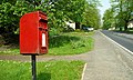 Letter box, Seaforde - geograph.org.uk - 798357.jpg 640 × 382; 93 KB
-
 Main Street, Seaforde - geograph.org.uk - 2820837.jpg 1,024 × 787; 150 KB
-
 Main Street, Seaforde - geograph.org.uk - 4555934.jpg 1,600 × 1,198; 308 KB
-

-

-
 Newcastle Road, Seaforde, Co Down - geograph.org.uk - 3212045.jpg 1,024 × 768; 389 KB
-
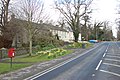
 North-bound bus stop at Seaforde - geograph.org.uk - 3871999.jpg 1,024 × 584; 155 KB
-

-
 Potato fields alongside Newcastle Road - geograph.org.uk - 4251741.jpg 1,600 × 1,200; 222 KB
-
 Potato fields south of the A25 near Clough - geograph.org.uk - 2502653.jpg 1,024 × 768; 207 KB
-

-
 Ripening grain on the Ballydugan Road - geograph.org.uk - 2752334.jpg 1,024 × 746; 91 KB
-

-
 Seaford Co Down - geograph.org.uk - 3708526.jpg 4,000 × 2,664; 2.81 MB
-
 Seaforde Bus Shelter - geograph.org.uk - 3968708.jpg 1,024 × 766; 257 KB
-
 Seaforde demesne, Seaforde. - geograph.org.uk - 71307.jpg 640 × 424; 156 KB
-

-
 Seaforde Young Farmers Clubs of Ulster - geograph.org.uk - 4573174.jpg 1,600 × 1,199; 285 KB
-
 Sign, Kennel Road, Seaforde - geograph.org.uk - 1476532.jpg 640 × 480; 135 KB
-
 Telecommunications Mast off Drumgooland Road - geograph.org.uk - 2502584.jpg 767 × 1,024; 182 KB
-
 Terraced row, Seaforde - geograph.org.uk - 2254804.jpg 640 × 480; 47 KB
-
 Terraces of houses facing Newcastle Road, Seaforde - geograph.org.uk - 4573176.jpg 1,600 × 1,200; 395 KB
-
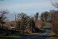
 The A24 (Belfast-Newcastle) road at Seaforde - geograph.org.uk - 3212033.jpg 1,024 × 740; 262 KB
-
 The A24 between Seaforde and Clough - geograph.org.uk - 4574257.jpg 1,600 × 1,194; 190 KB
-
 The Drumgooland Road junction on the A25 east of Clough - geograph.org.uk - 5387407.jpg 3,215 × 2,411; 1.15 MB
-
 The entrance to Seaforde House from the A24 - geograph.org.uk - 3212055.jpg 1,024 × 768; 260 KB
-
 The former RUC station at Seaforde - geograph.org.uk - 4105951.jpg 1,024 × 716; 135 KB
-
 The home of the East Down Hunt - geograph.org.uk - 2508842.jpg 1,024 × 768; 212 KB
-
 The junction of Main Street and Manse Road, Seaforde - geograph.org.uk - 4381523.jpg 1,600 × 1,200; 879 KB
-

-

-
 The junction of the Drumgooland Road and the A25 - geograph.org.uk - 2307969.jpg 1,024 × 768; 136 KB
-

-

-
 The Maze, Seaforde. - geograph.org.uk - 71309.jpg 640 × 424; 149 KB
-
 The Mulberry Tree Restaurant, Seaforde - geograph.org.uk - 4380719.jpg 1,600 × 1,371; 304 KB
-
 The Newcastle Road between Seaforde and Clough - geograph.org.uk - 3871987.jpg 1,024 × 767; 175 KB
-
 The northern section of Cumran Lane - geograph.org.uk - 2509744.jpg 1,024 × 768; 322 KB
-
 The Seaforde Almshouses, Seaforde, Co Down - geograph.org.uk - 3968695.jpg 1,024 × 768; 266 KB
-
 The Seaforde Young Farmers Club Hall - geograph.org.uk - 2820804.jpg 1,024 × 738; 133 KB
-
 The telephone exchange at Seaforde - geograph.org.uk - 2820827.jpg 1,024 × 731; 132 KB
-
 The village of Seaforde - geograph.org.uk - 740924.jpg 640 × 426; 88 KB
-
 The village of Seaforde - geograph.org.uk - 740925.jpg 640 × 426; 86 KB
-
 The western end of Seaforde Road, Seaforde - geograph.org.uk - 4744528.jpg 1,600 × 1,200; 347 KB
-

-
 Triangulation Pillar - geograph.org.uk - 740926.jpg 426 × 640; 118 KB
-
 View west along Main Street, Seaforde - geograph.org.uk - 4251729.jpg 1,600 × 1,137; 242 KB
-
 Wooded bog land between Clough and Seaforde - geograph.org.uk - 4572317.jpg 1,600 × 1,185; 299 KB
-
 Downpatrick-Clough road near Tullymurry - geograph.org.uk - 340552.jpg 640 × 426; 135 KB
-
 Parish church, Seaforde - geograph.org.uk - 340774.jpg 640 × 426; 186 KB
-
 Road Junction - geograph.org.uk - 199560.jpg 640 × 480; 111 KB
-
 The old Belfast road near Seaforde - geograph.org.uk - 427993.jpg 640 × 426; 156 KB


_-_geograph.org.uk_-_3598946.jpg)


_-_geograph.org.uk_-_4405584.jpg)
_-_geograph.org.uk_-_4405591.jpg)


_-_geograph.org.uk_-_3968735.jpg)


_road_at_Seaforde_-_geograph.org.uk_-_3212033.jpg)


_at_Seaforde_-_geograph.org.uk_-_2500778.jpg)

_Road_-_geograph.org.uk_-_2502648.jpg)


