Category:SeaWiFS images
Jump to navigation
Jump to search
These satellite images are created using GeoEye's SeaWiFS instrument.
satellite-borne sensor designed to collect global ocean biological data | |||||
| Upload media | |||||
| Instance of | |||||
|---|---|---|---|---|---|
| Part of |
| ||||
| |||||
Use this category as an alternative to Category:Satellite pictures.
Subcategories
This category has the following 2 subcategories, out of 2 total.
Media in category "SeaWiFS images"
The following 102 files are in this category, out of 102 total.
-
 11R 2001-06-21 0852Z.png 980 × 1,300; 1.8 MB
-
 2000-Feb-26 NASA SeaWiFS African Dust Storm.jpg 2,880 × 1,944; 1.76 MB
-
 Alaska Snow Storm mar 18 2002.jpg 2,355 × 2,203; 1.94 MB
-
 AlaskaDust S2002103 lrg.jpg 2,087 × 1,714; 1.51 MB
-
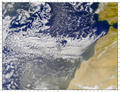
 Arabian Peninsula dust SeaWiFS-2.jpg 2,504 × 2,286; 867 KB
-
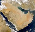 Arabian Peninsula dust SeaWiFS.jpg 2,504 × 2,286; 853 KB
-
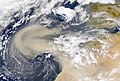
 Asia dust 2000-04-07.jpg 3,319 × 2,750; 2.31 MB
-
 Asian Dust, NASA aerospace photography.jpg 2,460 × 2,300; 1.66 MB
-
 Baikal-S1998162044804.jpg 564 × 300; 60 KB
-
 Baikal-S1999276045323.png 1,220 × 858; 1.9 MB
-
 BeringSea.jpg 1,800 × 2,200; 2.41 MB
-
 Blooms around Ireland (4441096624).png 622 × 1,039; 1.4 MB
-
 Bristol Bay in bloom.jpg 1,000 × 800; 203 KB
-
 Canary and Madeira Island Wakes - April 11, 1999.png 591 × 915; 1.02 MB
-
 Central america winter2001 chlorophyll.jpg 360 × 218; 34 KB
-
 ChaleurBay23.jpg 300 × 202; 11 KB
-
 Chilean coastal blooms.JPG 694 × 1,558; 1.23 MB
-
 ChinaDustOverEastAsia.jpg 2,100 × 2,100; 877 KB
-
 Coccolithophore Bloom Southwest of Ireland (4441096572).png 597 × 900; 1.02 MB
-
 Coccolithophore bloom.jpg 694 × 768; 138 KB
-
 DeltaOkawango.jpg 790 × 636; 113 KB
-
 Denman Island highlight a.jpg 500 × 500; 117 KB
-
 Dera2001.jpg 1,395 × 1,527; 1.04 MB
-
 Dust storm in Oman.jpg 2,445 × 2,806; 748 KB
-
 Dust storm over Iran, Iraq.jpg 2,000 × 1,836; 1.03 MB
-

-
 Erika 1997-09-06 1608Z.png 302 × 358; 209 KB
-
 European winter storm dec 16 2001.jpg 4,160 × 2,600; 3.67 MB
-
 Feb 05 1999 argentina.jpg 540 × 467; 61 KB
-
 Floyd Sept 14 1999.png 1,355 × 1,586; 3.66 MB
-
 Frances 2004-08-31 1650Z.jpg 833 × 884; 1.3 MB
-
 GaspePeninsula23.jpg 300 × 271; 15 KB
-
 Global Tropospheric Methane for August 2005-de.jpg 6,444 × 4,670; 4.5 MB
-
 Global Tropospheric Methane for August 2005.jpg 6,444 × 5,172; 1.21 MB
-
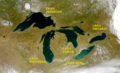
 Great Lakes from space crop labeled.jpg 792 × 469; 96 KB
-
 Great Lakes from space-ES-Grandes Lagos Norteamerica.png 900 × 546; 1,007 KB
-
 Great Lakes from space.jpg 900 × 546; 147 KB
-
 Gulf of Oman (SeaWiFS).jpg 736 × 487; 41 KB
-
 Haida Eddy.png 1,442 × 886; 2.66 MB
-
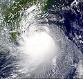
 Hurricane Alberto Aug 12, 2000.jpg 1,550 × 1,792; 1.55 MB
-
 Hurricane Aletta 2000.jpg 1,200 × 900; 172 KB
-
 Hurricane Dennis Aug 30 1999.png 1,929 × 2,497; 8.1 MB
-
 Hurricane Felix 2001 (Color.jpg 600 × 279; 40 KB
-
 Hurricane Michael of 2000.JPG 1,102 × 998; 635 KB
-
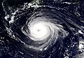
 Hurricane olga 2001.jpg 2,000 × 2,000; 1.84 MB
-
 HurricaneFelix 2001.jpg 946 × 440; 224 KB
-
 Iris 2001-10-08 1755Z.jpg 675 × 683; 254 KB
-
 Jelawat2000.jpg 1,753 × 1,207; 794 KB
-
 Lake Ontario - Southwick Beach SP locator.jpg 653 × 379; 91 KB
-
 LakeBalkhash-EO.jpg 478 × 297; 27 KB
-
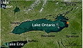
 Lakes Erie and Ontario - satellite.jpg 976 × 705; 166 KB
-
 Location of Mount St. Helens.png 1,001 × 801; 1.8 MB
-
 Low Pressure System off Australia feb 20 2002.jpg 4,260 × 3,700; 3.12 MB
-
 May1803 Canada L1A.jpg 1,848 × 2,600; 1.75 MB
-
 Methane Leaking through the Cracks - NASA Earth Observatory.jpg 1,440 × 960; 993 KB
-
 Mitch 1998-10-25 1711Z.png 980 × 1,300; 1.92 MB
-
 Mundo Maya, Meso-America.png 1,793 × 1,488; 4.76 MB
-
 Mweru Wantipa from space.jpg 325 × 198; 15 KB
-
 NASA - Visible Earth, Lakes of the African Rift Valley.jpg 1,000 × 654; 127 KB
-
 New Caledonia - S199828000484.jpg 734 × 870; 180 KB
-
 Newfoundland OSE2002210.jpg 540 × 564; 125 KB
-
 Nova Scotia from space.jpg 544 × 554; 85 KB
-
 Okavangodelta.png 976 × 926; 1.1 MB
-
 Phytoplankton Kalifornien.jpg 540 × 760; 98 KB
-
 PNW-straits.jpg 336 × 396; 128 KB
-
 S2001080041432.L1A HJMS.ChinaDust md.jpg 600 × 600; 40 KB
-
 S2001148132454.L1A HMAS.Madeira.Canary.IslandWakes.png 813 × 1,155; 1.94 MB
-
 S2001199133848.L1A HCAN.MadeiraIsland.VortexStreet.png 2,600 × 2,000; 8.3 MB
-
 S2004341153052.L2 HCHL.MalvinasCurrent.jpg 2,711 × 3,117; 1.76 MB
-
 SA Sites.png 801 × 732; 1.03 MB
-
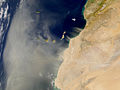
 Sahara dust plume Nov 1998.jpg 4,449 × 3,156; 5.06 MB
-
 Sahara stof.jpg 1,822 × 1,368; 1.76 MB
-
 Sandstorm big.jpg 1,280 × 934; 261 KB
-
 Satellite image of Marshall Islands in March 1999.jpg 687 × 891; 226 KB
-
 Satellite View of Japan 1999.jpg 1,638 × 2,092; 1.04 MB
-
SeaWiFS Chesapeake Bay Zoom in (SVS165).webm 37 s, 640 × 480; 8.62 MB
-
SeaWiFS East Coast Zoom (SVS167).webm 37 s, 640 × 480; 8.92 MB
-
SeaWiFS Galapagos Island Zoom Showing Before and During El Niño (SVS168).webm 17 s, 640 × 480; 4.48 MB
-
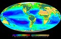
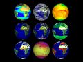
 Seawifs global biosphere 2002.png 1,434 × 717; 1.5 MB
-
 Seawifs global biosphere Centered on the Pacific.jpg 720 × 450; 60 KB
-
 Seawifs global biosphere.jpg 1,280 × 819; 491 KB
-
 SeaWiFS Image of Great Lakes from Space.png 1,440 × 1,058; 2.75 MB
-
SeaWiFS Indonesian Smoke (SVS170).webm 23 s, 640 × 480; 5.56 MB
-
 SeaWiFS, The Pacific Northwest.png 1,001 × 801; 1.92 MB
-
 Sirocco from Libya.jpg 996 × 796; 128 KB
-
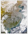 Smog over China.jpg 2,360 × 2,800; 1.59 MB
-
 Super Typhoon Bills at peak intensity Aug 22 2000.jpg 1,184 × 1,249; 957 KB
-
 Terra 9-Globe Dataset (5277460813).jpg 1,536 × 1,152; 172 KB
-
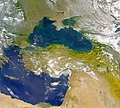 The Danube Spills into the Black Sea.jpg 2,080 × 1,865; 1.07 MB
-
 The Ocean Chromatic.jpg 1,977 × 1,483; 210 KB
-
 Toraji2001.jpg 326 × 310; 58 KB
-
 Tropical Cyclone Dina jan 24 2002.jpg 1,848 × 3,275; 2.47 MB
-
 TropicalStormDean 2001.jpg 2,500 × 2,500; 2.34 MB
-
 Typhoon Chaba 26804.jpg 1,848 × 2,935; 1.75 MB
-
 Typhoon Jelawat Aug 9 2000.jpg 1,399 × 1,202; 907 KB
-
 Typhoon Prapiroon China sedimentation 1 Sept 2000.png 1,116 × 906; 2.33 MB
-
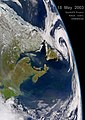
 US extratropical low May 11 2003.jpg 3,000 × 1,849; 4.06 MB
-
 Velika jezera.jpg 900 × 546; 173 KB
-
 White Island plume.png 257 × 365; 230 KB
-
 Великі Озера.jpg 900 × 546; 222 KB
-
 Великие озёра.jpg 900 × 546; 221 KB
-
 شبه الجزيرة العربية.jpg 757 × 600; 88 KB


.png)


.png)


.png)


.jpg)


.jpg)


