Category:Scurf Dike
Jump to navigation
Jump to search
Media in category "Scurf Dike"
The following 44 files are in this category, out of 44 total.
-
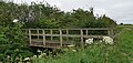
 Bridge on Scurf Dike - geograph.org.uk - 730406.jpg 640 × 479; 80 KB
-
 Bridge over Scurf Dike (geograph 5558825).jpg 1,024 × 768; 199 KB
-
 Bridge over Scurf Dyke (geograph 5547677).jpg 1,024 × 768; 219 KB
-
 Dyke side bush reflected in water (geograph 5276784).jpg 3,456 × 4,608; 5.75 MB
-
 Foodbridge over Scurf Dike - geograph.org.uk - 1453917.jpg 640 × 480; 142 KB
-
 Footbridge across Scurf Dyke (geograph 6516399).jpg 3,648 × 1,744; 3.45 MB
-
 Footbridge across Scurf Dyke (geograph 6517085).jpg 3,648 × 1,744; 3.24 MB
-
 Footbridge near Swinekeld Chalk Pit (geograph 5948171).jpg 1,600 × 1,064; 1,013 KB
-
 Footbridge over Scurf Dike (geograph 6496435).jpg 5,456 × 3,632; 3.21 MB
-
 Footbridge over Scurf Dike - geograph.org.uk - 236739.jpg 640 × 482; 161 KB
-
 Footpath alongside the Scurf Dike (geograph 5924795).jpg 1,024 × 768; 186 KB
-
 Footpath, ditch and hedge (geograph 5436263).jpg 640 × 426; 75 KB
-
 Hunting Bridge over Scurf Dike - geograph.org.uk - 257871.jpg 482 × 640; 159 KB
-
 No sign of Hunting Bridge (geograph 6516426).jpg 3,648 × 1,744; 2.46 MB
-
 Path beside Scurf Dyke (geograph 6516417).jpg 3,648 × 1,744; 2.48 MB
-
 Path leading to the A164 (geograph 6496449).jpg 5,456 × 3,632; 3.54 MB
-
 Path leading to the A164 (geograph 6496457).jpg 5,456 × 3,632; 3.1 MB
-
 Path leading to the A164 (geograph 6496553).jpg 5,456 × 3,632; 2.54 MB
-
 Path leading to the A164 south of Hutton Cranswick (geograph 6493962).jpg 5,456 × 3,632; 3.27 MB
-
 Power lines above Scurf Dyke (geograph 6516414).jpg 3,648 × 1,744; 1.88 MB
-
 Scurf Dike (geograph 5404066).jpg 640 × 426; 46 KB
-
 Scurf Dike (geograph 5935296).jpg 1,024 × 768; 156 KB
-
 Scurf Dike (geograph 5935304).jpg 1,024 × 768; 182 KB
-
 Scurf Dike - geograph.org.uk - 1410136.jpg 640 × 480; 133 KB
-
 Scurf Dike - geograph.org.uk - 1453911.jpg 640 × 480; 126 KB
-
 Scurf Dike - geograph.org.uk - 1453950.jpg 640 × 480; 107 KB
-
 Scurf Dike - geograph.org.uk - 1453958.jpg 640 × 480; 116 KB
-
 Scurf Dike - geograph.org.uk - 78095.jpg 640 × 480; 108 KB
-
 Scurf Dike after the storm (geograph 6292200).jpg 1,024 × 768; 201 KB
-
 Scurf Dike and footpath to Cranswick (geograph 5924790).jpg 1,024 × 768; 271 KB
-
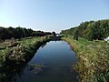
 Scurf Dike and the old course of the River Hull (geograph 5936028).jpg 1,024 × 768; 173 KB
-
 Scurf Dike near the River Hull - geograph.org.uk - 730418.jpg 640 × 480; 72 KB
-
 Scurf Dike south of Common Farm (geograph 6493960).jpg 5,456 × 3,632; 5.85 MB
-
 Scurf Dike with Hunting Bridge - geograph.org.uk - 257874.jpg 640 × 475; 98 KB
-
 Scurf Dyke (geograph 5547686).jpg 1,024 × 783; 119 KB
-
 Scurf Dyke (geograph 5547691).jpg 1,024 × 768; 149 KB
-
 Scurf Dyke (geograph 5557698).jpg 1,024 × 768; 164 KB
-
 Scurf Dyke Farm (geograph 6516404).jpg 3,648 × 1,744; 2.92 MB
-
 Scurf Dyke looking towards River Hull New cut (geograph 4804576).jpg 3,143 × 4,190; 2.65 MB
-
 Sluice near the end of the Scurf Dyke (geograph 5554671).jpg 1,024 × 768; 216 KB
-
 Walking east on Scurf Dyke with reflection (geograph 5276772).jpg 2,250 × 3,033; 1.98 MB
-
 Where Scurf Dike meets the River Hull - geograph.org.uk - 730414.jpg 640 × 480; 94 KB
-
 Whinnyforth Farm - geograph.org.uk - 78102.jpg 640 × 480; 114 KB
-
 Winding gear (geograph 5558819).jpg 1,024 × 768; 187 KB

.jpg)
.jpg)
.jpg)

.jpg)
.jpg)
.jpg)
.jpg)

.jpg)
.jpg)

.jpg)
.jpg)
.jpg)
.jpg)
.jpg)
.jpg)
.jpg)
.jpg)
.jpg)
.jpg)


.jpg)
.jpg)
.jpg)

.jpg)

.jpg)
.jpg)
.jpg)
.jpg)
.jpg)
.jpg)
.jpg)


.jpg)