Category:Scotland photographs taken on 2008-05-02
Jump to navigation
Jump to search
Constituent countries of the United Kingdom: England · Northern Ireland · Scotland · Wales – British Crown dependencies: Isle of Man

Media in category "Scotland photographs taken on 2008-05-02"
The following 75 files are in this category, out of 75 total.
-
 A lichen - Pseudevernia furfuracea - geograph.org.uk - 1073683.jpg 480 × 640; 80 KB
-
 A moss - Polytrichum piliferum - geograph.org.uk - 974857.jpg 640 × 480; 60 KB
-
 Arbory Hill - geograph.org.uk - 785798.jpg 640 × 480; 54 KB
-
 Boulders on Cladach beach - geograph.org.uk - 814371.jpg 421 × 640; 101 KB
-
 Boundary Marker^ - geograph.org.uk - 790120.jpg 427 × 640; 320 KB
-

-
 Brae cemetery - geograph.org.uk - 786806.jpg 640 × 426; 80 KB
-
 Brodick Castle - geograph.org.uk - 814326.jpg 427 × 640; 112 KB
-
 Cairn at Lochan Vataleois - geograph.org.uk - 787588.jpg 640 × 480; 92 KB
-
 Carn a' Bhreabadair Ridge - geograph.org.uk - 806176.jpg 640 × 361; 47 KB
-
 Carnethy Hill from above the Logan Burn - geograph.org.uk - 790084.jpg 640 × 427; 217 KB
-
 Cladach beach - geograph.org.uk - 814356.jpg 640 × 421; 74 KB
-
 Cyclist in Green Cleugh - geograph.org.uk - 790098.jpg 640 × 427; 266 KB
-
 Daffodils - geograph.org.uk - 786858.jpg 640 × 426; 44 KB
-
 Dalveen Pass - geograph.org.uk - 786402.jpg 640 × 480; 64 KB
-
 Dam at Threipmuir Reservoir - geograph.org.uk - 790125.jpg 434 × 640; 299 KB
-
 Deer Fence - geograph.org.uk - 874334.jpg 640 × 480; 108 KB
-
 Dornoch - panoramio.jpg 3,008 × 2,000; 2.78 MB
-
 Driving range, Turnhouse Golf Club - geograph.org.uk - 790501.jpg 640 × 360; 51 KB
-
 Edge of Bar Hill Woods - geograph.org.uk - 1480013.jpg 640 × 467; 128 KB
-
 Edinburgh International Climbing Arena - geograph.org.uk - 786344.jpg 640 × 480; 115 KB
-
 Entrance to Acairseid Mhor - geograph.org.uk - 787647.jpg 640 × 426; 113 KB
-
 Entrance to Boturich Estate - geograph.org.uk - 1083498.jpg 640 × 480; 118 KB
-
 Fare Stage and Milestone - geograph.org.uk - 786334.jpg 640 × 480; 125 KB
-
 Glenbuchat Castle 20080502 01.jpg 800 × 495; 202 KB
-
 Glenbuchat Castle 20080502 02.jpg 800 × 576; 213 KB
-
 Glenbuchat Castle 20080502 03.jpg 479 × 768; 190 KB
-
 Glenbuchat Castle 20080502 04.jpg 768 × 624; 307 KB
-

-
 Green Cleugh - geograph.org.uk - 790092.jpg 640 × 427; 260 KB
-
 Green Cleugh - geograph.org.uk - 790111.jpg 640 × 427; 275 KB
-
 Griana-sgeir - geograph.org.uk - 787640.jpg 640 × 425; 82 KB
-
 Griana-sgeir - geograph.org.uk - 787714.jpg 640 × 427; 108 KB
-
 Harlaw Reservoir - geograph.org.uk - 790127.jpg 640 × 427; 271 KB
-
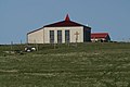 Haroldswick Methodist Church - geograph.org.uk - 786848.jpg 640 × 426; 57 KB
-
 Heather and bushes - geograph.org.uk - 874346.jpg 640 × 480; 125 KB
-

-
 Holly with yellow berries - geograph.org.uk - 1073755.jpg 640 × 480; 63 KB
-
 Inver Beach - geograph.org.uk - 787629.jpg 640 × 427; 118 KB
-
 Knockbarrie Farm - geograph.org.uk - 790325.jpg 640 × 480; 84 KB
-

-
 Loch Fraochach in Distance - geograph.org.uk - 806204.jpg 640 × 480; 66 KB
-
 Lochan na Stairne - geograph.org.uk - 786619.jpg 640 × 480; 84 KB
-
 Lochans Galore - geograph.org.uk - 806255.jpg 640 × 480; 58 KB
-
 Lochans joined by bog - geograph.org.uk - 806233.jpg 640 × 480; 66 KB
-

-
 MillbraeCrescent.jpg 2,496 × 1,664; 1.86 MB
-
 Near the top of the hill - geograph.org.uk - 1480050.jpg 640 × 455; 121 KB
-
 North Warrackston Farmhouse - geograph.org.uk - 1162933.jpg 640 × 427; 108 KB
-

-

-
 Old Byre bunkhouse in Camusluinie - geograph.org.uk - 874370.jpg 640 × 480; 93 KB
-

-
 Pannanich Wells Inn - geograph.org.uk - 786927.jpg 640 × 428; 122 KB
-
 Path is completely non-existent - geograph.org.uk - 874352.jpg 640 × 480; 120 KB
-
 Peel Ring of Lumphanan 20080502.jpg 768 × 437; 167 KB
-
 Red Deer on path to Coire Odhar - geograph.org.uk - 798993.jpg 640 × 480; 91 KB
-
 Red Gate - geograph.org.uk - 790072.jpg 640 × 427; 250 KB
-

-
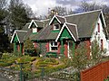
 Rona Lodge - geograph.org.uk - 787717.jpg 640 × 480; 145 KB
-
 Ruin at Lamberton Skerrs - geograph.org.uk - 789835.jpg 640 × 480; 109 KB
-
 The Crathie to Gairnshiel road - geograph.org.uk - 786939.jpg 640 × 428; 109 KB
-
 The King's Hotel - geograph.org.uk - 788485.jpg 640 × 457; 127 KB
-
 The Kips - geograph.org.uk - 790087.jpg 640 × 427; 205 KB
-
 The Kips and Scald Law from near Red Gate - geograph.org.uk - 790078.jpg 640 × 427; 250 KB
-
 Threipmuir Farm - geograph.org.uk - 790122.jpg 640 × 427; 269 KB
-
 Threipmuir Reservoir - geograph.org.uk - 790066.jpg 640 × 427; 246 KB
-
 Threipmuir Reservoir - geograph.org.uk - 790118.jpg 640 × 393; 221 KB
-

-
 Waterfall on the Logan Burn - geograph.org.uk - 790106.jpg 640 × 427; 277 KB
-
 West coast of Rona - geograph.org.uk - 787643.jpg 640 × 427; 109 KB
-
 West Kip - geograph.org.uk - 790083.jpg 640 × 427; 234 KB
-
 Woodend Farm - geograph.org.uk - 785528.jpg 633 × 475; 120 KB
-
 Abington Cottages - geograph.org.uk - 786393.jpg 640 × 480; 119 KB
-
 Approaching Loch Fraochach from South - geograph.org.uk - 806196.jpg 640 × 480; 92 KB


,_Norwick_-_geograph.org.uk_-_786853.jpg)


