Category:Scotland photographs taken on 2005-11-22
Jump to navigation
Jump to search
Subcategories
This category has the following 2 subcategories, out of 2 total.
Media in category "Scotland photographs taken on 2005-11-22"
The following 44 files are in this category, out of 44 total.
-
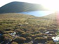
 A view from Beinn Clach an Fheadain - geograph.org.uk - 83209.jpg 640 × 480; 65 KB
-
 A view from Beinn Clach an Fheadain - geograph.org.uk - 83211.jpg 640 × 480; 33 KB
-
 A view from Beinn Clach an Fheadain - geograph.org.uk - 83212.jpg 640 × 480; 26 KB
-
 A view from Beinn Clach an Fheadain - geograph.org.uk - 83213.jpg 640 × 480; 40 KB
-
 A view from Beinn Clach an Fheadain - geograph.org.uk - 83215.jpg 640 × 480; 87 KB
-
 A view from Beinn Clach an Fheadain - geograph.org.uk - 83223.jpg 640 × 480; 80 KB
-
 A view from Beinn Clach an Fheadain - geograph.org.uk - 83228.jpg 640 × 480; 98 KB
-
 Achnangart Vodafone - O2 Tower - geograph.org.uk - 86470.jpg 450 × 600; 83 KB
-
 Buckies, Glenquiech - geograph.org.uk - 425564.jpg 640 × 480; 71 KB
-
 Chesterhill. - geograph.org.uk - 83034.jpg 640 × 480; 112 KB
-
 Cliffs at Cowie - geograph.org.uk - 106228.jpg 640 × 480; 79 KB
-
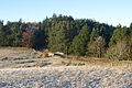
 Dalfaber Holiday Lodges and Golf Course - geograph.org.uk - 1242673.jpg 640 × 480; 299 KB
-
 Glenalmond College, near Perth - geograph.org.uk - 84257.jpg 640 × 480; 63 KB
-
 Hedgerow, Peaston Farm. - geograph.org.uk - 82970.jpg 640 × 480; 86 KB
-
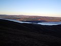
 Loch Beag from Beinn Clach an Fheadain - geograph.org.uk - 83245.jpg 640 × 480; 39 KB
-
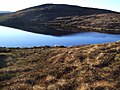 Loch Beag from Beinn Clach an Fheadain - geograph.org.uk - 83259.jpg 640 × 480; 101 KB
-
 Meikle Law - geograph.org.uk - 83040.jpg 640 × 492; 56 KB
-
 Perth Depot - geograph.org.uk - 404588.jpg 640 × 480; 94 KB
-
 The Saddle at 1010metres - geograph.org.uk - 86469.jpg 600 × 450; 86 KB
-
 Timber lorry, Woodcote Mains. - geograph.org.uk - 83044.jpg 639 × 465; 69 KB
-
 Woodcote Mains. - geograph.org.uk - 83042.jpg 640 × 453; 74 KB
-
 Aikieside Hill - geograph.org.uk - 83118.jpg 636 × 455; 77 KB
-
 Allt Muigh bhlaraidh runs down here. - geograph.org.uk - 83235.jpg 640 × 480; 74 KB
-
 At the foot of Beinn Clach an Fheadain - geograph.org.uk - 83204.jpg 640 × 480; 126 KB
-
 Bridge over Allan Water - geograph.org.uk - 82940.jpg 640 × 427; 133 KB
-
 Kidlaw. - geograph.org.uk - 83123.jpg 640 × 480; 92 KB
-
 Loch Beag from Beinn Clach an Fheadain - geograph.org.uk - 83248.jpg 640 × 480; 92 KB
-
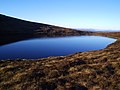 Loch Beag from Beinn Clach an Fheadain - geograph.org.uk - 83255.jpg 640 × 480; 69 KB
-
-

-
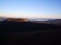
 Low lying fog - geograph.org.uk - 82935.jpg 640 × 427; 51 KB
-
 Low lying fog - geograph.org.uk - 82937.jpg 640 × 427; 82 KB
-
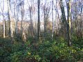 Petersmuir Wood. - geograph.org.uk - 83126.jpg 640 × 480; 147 KB
-
 Ploughed field, Leaston. - geograph.org.uk - 83065.jpg 640 × 480; 129 KB
-
 River Tweed - geograph.org.uk - 82941.jpg 640 × 427; 105 KB
-
 Sheep, Aikeyside Farm. - geograph.org.uk - 83121.jpg 640 × 420; 79 KB
-
 Southern Upland Way - geograph.org.uk - 82944.jpg 640 × 427; 133 KB
-
 Southern Upland Way - geograph.org.uk - 82946.jpg 640 × 427; 110 KB
-
 Southern Upland Way near Yair - geograph.org.uk - 82943.jpg 640 × 427; 169 KB
-
 Stobshiel Mains. - geograph.org.uk - 83076.jpg 640 × 480; 71 KB
-
 Three Brethren and trig pillar - geograph.org.uk - 82948.jpg 640 × 427; 93 KB
-
 Windymains Sawmill. - geograph.org.uk - 82973.jpg 640 × 304; 29 KB
-
 Winter crops, Bughtknowe. - geograph.org.uk - 83068.jpg 640 × 480; 76 KB
-
 Woods, Stobshiel . - geograph.org.uk - 83077.jpg 640 × 480; 125 KB


