Category:Scotland Road, Liverpool
Jump to navigation
Jump to search
| Object location | | View all coordinates using: OpenStreetMap |
|---|

part of the A59 in the Vauxhall area of north Liverpool, England | |||||
| Upload media | |||||
| Instance of | |||||
|---|---|---|---|---|---|
| Location | Vauxhall, Liverpool, Merseyside, North West England, England | ||||
 | |||||
Subcategories
This category has the following 10 subcategories, out of 10 total.
A
D
- Derby Cinema, Liverpool (3 F)
E
J
- Juvenal Street underpass (3 F)
P
- The Parrot, Liverpool (4 F)
T
- Throstle's Nest, Liverpool (8 F)
Media in category "Scotland Road, Liverpool"
The following 21 files are in this category, out of 21 total.
-
 286 - 316 Scotland Road.jpg 1,998 × 1,316; 1.79 MB
-
 Along Scotland Road 2020.jpg 3,462 × 4,652; 18.71 MB
-
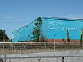 Bestway cash & carry, Liverpool.JPG 1,280 × 960; 542 KB
-
 Byrom Street, towards Scotland Road (130257392).jpg 593 × 480; 151 KB
-
 Into the city centre on Scotland Road.jpg 4,992 × 2,988; 17.48 MB
-
 John Moores Byrom Street.jpg 640 × 480; 59 KB
-
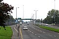
 Kingsway Tunnel approach, Liverpool 1.jpg 4,613 × 2,863; 5.32 MB
-
 McDonald's, Jennifer Avenue.jpg 4,717 × 3,002; 12.27 MB
-
 Scotland Road at Boundary Street.jpg 4,551 × 3,435; 9.28 MB
-
 Scotland Road at Stanley Road.jpg 4,494 × 3,402; 10.3 MB
-

-
 Scotland Road from Bevington Bush.jpg 5,150 × 3,398; 22.97 MB
-
 Scotland Road from Leeds Street.jpg 5,011 × 2,974; 18.35 MB
-
 Scotland Road from St John's Beacon.jpg 3,456 × 5,184; 10.2 MB
-
 Scotland Road Sign July 26 2010.jpg 3,072 × 2,304; 1.2 MB
-
 Scotland Road, Liverpool - geograph.org.uk - 2860401.jpg 640 × 426; 70 KB
-
 Shell petrol station, Scotland Road.jpg 2,215 × 1,078; 1.3 MB
-
 Shops on Scottie Road, Liverpool L5.JPG 1,280 × 960; 587 KB
-
 Small Lucy box, Scotland Road.jpg 2,913 × 4,461; 7.7 MB
-
 Start of Scotland Road.jpg 2,560 × 1,920; 1.23 MB
-
 Towards Scotland Road.jpg 5,096 × 3,368; 6.9 MB


.jpg)


