Category:Schuurkerk (Oudewater)
Jump to navigation
Jump to search
| Object location | | View all coordinates using: OpenStreetMap |
|---|
 | |||||
| Upload media | |||||
| Instance of | |||||
|---|---|---|---|---|---|
| Location | Oudewater, Utrecht, Netherlands | ||||
| Street address |
| ||||
| Located on street | |||||
| Heritage designation |
| ||||
 | |||||
|
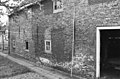
This is a category about rijksmonument number 32041
|
| Address |
|
Media in category "Schuurkerk (Oudewater)"
The following 8 files are in this category, out of 8 total.
-
 Gevel - Oudewater - 20179840 - RCE.jpg 1,200 × 811; 219 KB
-
 Interieur - Oudewater - 20179841 - RCE.jpg 795 × 1,200; 180 KB
-
 Interieur - Oudewater - 20179842 - RCE.jpg 809 × 1,200; 154 KB
-
 Interieur - Oudewater - 20179843 - RCE.jpg 822 × 1,200; 182 KB
-
 Interieur - Oudewater - 20179846 - RCE.jpg 784 × 1,200; 222 KB
-
 RM32041 Oudewater - Kromme Haven 2.jpg 2,592 × 1,944; 1.34 MB
-
 Zijgevel - Oudewater - 20179844 - RCE.jpg 1,200 × 786; 290 KB
-
 Zijgevel - Oudewater - 20179845 - RCE.jpg 1,200 × 786; 271 KB


