Category:Schutzschleuse Weener
Jump to navigation
Jump to search
| Object location | | View all coordinates using: OpenStreetMap |
|---|
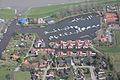
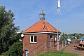
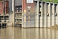
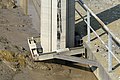
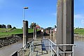
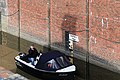
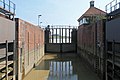
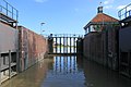
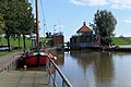
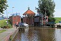
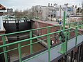
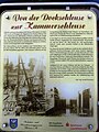
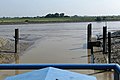
Deutsch: Die Schutzschleuse Weener verbindet den Hafen von Weener mit der Tidenems.
English: The so called Weener lock is a tidal lock in Lower Saxony.
 | |||||
| Upload media | |||||
| Instance of | |||||
|---|---|---|---|---|---|
| Location | Weener, Leer, Lower Saxony, Germany | ||||
| Located in or next to body of water |
| ||||
 | |||||
Subcategories
This category has the following 2 subcategories, out of 2 total.
S
- Schleusendenkmal Weener (8 F)
V
- Views from Schutzschleuse Weener (25 F)
Media in category "Schutzschleuse Weener"
The following 73 files are in this category, out of 73 total.
-
 2013-05-03 Fotoflug Leer Papenburg DSCF7034.jpg 2,500 × 1,673; 2.76 MB
-
 2013-05-03 Fotoflug Leer Papenburg DSCF7038.jpg 2,500 × 1,673; 2.81 MB
-
 2013-05-03 Fotoflug Leer Papenburg DSCF7039.jpg 2,500 × 1,673; 2.98 MB
-
 2013-05-03 Fotoflug Leer Papenburg DSCF7040.jpg 2,500 × 1,673; 2.78 MB
-
 2013-05-03 Fotoflug Leer Papenburg DSCF7041.jpg 2,500 × 1,673; 3.1 MB
-
 2013-05-03 Fotoflug Nordholz Papenburg HP 2420.JPG 5,760 × 3,840; 7.46 MB
-
 2013-05-03 Fotoflug Nordholz Papenburg HP 2421.JPG 5,760 × 3,840; 7.59 MB
-
 2013-05-03 Fotoflug Nordholz Papenburg HP 2422.JPG 5,760 × 3,840; 7.52 MB
-
 2013-05-03 Fotoflug Nordholz Papenburg HP 2423.JPG 5,760 × 3,840; 6.3 MB
-
 Eems, Weener-sluis buitenzijde.JPG 1,024 × 681; 113 KB
-
 Luftaufnahmen Nordseekueste 2013 05 by-RaBoe tele 66.jpg 2,600 × 1,727; 3.71 MB
-
 Luftaufnahmen Nordseekueste 2013 05 by-RaBoe tele 67.jpg 2,600 × 1,727; 3.91 MB
-
 Luftaufnahmen Nordseekueste 2013 05 by-RaBoe tele 68.jpg 2,600 × 1,727; 3.86 MB
-
 Luftaufnahmen Nordseekueste 2013 05 by-RaBoe tele 70.jpg 2,600 × 1,727; 4.06 MB
-
 Luftaufnahmen Nordseekueste 2013 05 by-RaBoe tele 71.jpg 2,600 × 1,727; 3.72 MB
-
 Schutzschleuse Weener 01.jpg 4,000 × 3,000; 6.11 MB
-
 Schutzschleuse Weener 02.jpg 4,000 × 3,000; 6.04 MB
-
 Schutzschleuse Weener 03.jpg 4,000 × 3,000; 5.69 MB
-
 Weener - Schleusenweg + Schutzschleuse 01 ies.jpg 5,616 × 3,744; 21.49 MB
-
 Weener - Schleusenweg - Schleuse 25 ies.jpg 5,616 × 3,744; 18.2 MB
-
 Weener - Schleusenweg - Schutzschleuse 01 ies.jpg 5,616 × 3,744; 20.86 MB
-
 Weener - Schleusenweg - Schutzschleuse 02 ies.jpg 5,616 × 3,744; 18 MB
-
 Weener - Schleusenweg - Schutzschleuse 03 ies.jpg 5,616 × 3,744; 17.26 MB
-
 Weener - Schleusenweg - Schutzschleuse 04 ies.jpg 5,616 × 3,744; 18.01 MB
-
 Weener - Schleusenweg - Schutzschleuse 05 ies.jpg 5,616 × 3,745; 17.9 MB
-
 Weener - Schleusenweg - Schutzschleuse 06 ies.jpg 5,616 × 3,743; 17.4 MB
-
 Weener - Schleusenweg - Schutzschleuse 07 ies.jpg 5,616 × 3,745; 18.87 MB
-
 Weener - Schleusenweg - Schutzschleuse 08 ies.jpg 5,616 × 3,744; 20.21 MB
-
 Weener - Schleusenweg - Schutzschleuse 09 ies.jpg 5,616 × 3,744; 17.48 MB
-
 Weener - Schleusenweg - Schutzschleuse 10 ies.jpg 5,616 × 3,746; 18.48 MB
-
 Weener - Schleusenweg - Schutzschleuse 11 ies.jpg 5,616 × 3,745; 18.03 MB
-
 Weener - Schleusenweg - Schutzschleuse 12 ies.jpg 5,616 × 3,744; 22.82 MB
-
 Weener - Schleusenweg - Schutzschleuse 13 ies.jpg 5,616 × 3,744; 25.88 MB
-
 Weener - Schleusenweg - Schutzschleuse 14 ies.jpg 5,616 × 3,744; 17.89 MB
-
 Weener - Schleusenweg - Schutzschleuse 15 ies.jpg 5,616 × 3,744; 19.53 MB
-
 Weener - Schleusenweg - Schutzschleuse 16 ies.jpg 5,616 × 3,744; 18.18 MB
-
 Weener - Schleusenweg - Schutzschleuse 17 ies.jpg 5,616 × 3,744; 14.13 MB
-
 Weener - Schleusenweg - Schutzschleuse 18 ies.jpg 5,616 × 3,744; 17.79 MB
-
 Weener - Schleusenweg - Schutzschleuse 19 ies.jpg 5,616 × 3,744; 21.03 MB
-
 Weener - Schleusenweg - Schutzschleuse 20 ies.jpg 5,616 × 3,745; 17.35 MB
-
 Weener - Schleusenweg - Schutzschleuse 21 ies.jpg 5,616 × 3,746; 17.61 MB
-
 Weener - Schleusenweg - Schutzschleuse 22 ies.jpg 5,616 × 3,744; 20.14 MB
-
 Weener - Schleusenweg - Schutzschleuse 23 ies.jpg 5,616 × 3,744; 19.64 MB
-
 Weener - Schleusenweg - Schutzschleuse 24 ies.jpg 3,743 × 5,616; 18.47 MB
-
 Weener - Schleusenweg - Schutzschleuse 26 ies.jpg 5,616 × 3,744; 19.96 MB
-
 Weener - Schleusenweg - Schutzschleuse 27 ies.jpg 5,616 × 3,744; 16.33 MB
-
 Weener - Schleusenweg - Schutzschleuse 28 ies.jpg 5,616 × 3,744; 15.05 MB
-
 Weener - Schleusenweg - Schutzschleuse 29 ies.jpg 5,616 × 3,744; 16.51 MB
-
 Weener - Schleusenweg - Schutzschleuse 30 ies.jpg 5,616 × 3,745; 16.02 MB
-
 Weener - Schleusenweg - Schutzschleuse 31 ies.jpg 5,616 × 3,743; 15.92 MB
-
 Weener - Zum Schöpfwerk + Alter Hafen + Schutzschleuse 01 ies.jpg 5,616 × 3,744; 18.3 MB
-
 Weener - Zum Schöpfwerk + Schutzschleuse + Schleusenweg 01 ies.jpg 5,616 × 3,744; 17.35 MB
-
 Weener - Zum Schöpfwerk + Schutzschleuse 01 ies.jpg 5,616 × 3,743; 18.07 MB
-
 Weener - Zum Schöpfwerk + Schutzschleuse 02 ies.jpg 5,616 × 3,744; 16.9 MB
-
 Weener - Zum Schöpfwerk - Schutzschleuse 01 ies.jpg 5,616 × 3,744; 24.05 MB
-
 Weener - Zum Schöpfwerk - Schutzschleuse 02 ies.jpg 5,616 × 3,744; 20.88 MB
-
 Weener - Zum Schöpfwerk - Schutzschleuse 03 ies.jpg 5,616 × 3,744; 22.4 MB
-
 Weener - Zum Schöpfwerk - Schutzschleuse 04 ies.jpg 5,616 × 3,744; 22.67 MB
-
 Weener - Zum Schöpfwerk - Schutzschleuse 05 ies.jpg 5,616 × 3,745; 18.65 MB
-
 Weener - Zum Schöpfwerk - Schutzschleuse 06 ies.jpg 5,616 × 3,744; 20.87 MB
-
 Weener lock 1.JPG 4,416 × 3,312; 6.11 MB
-
 Weener lock 2.JPG 1,511 × 1,026; 382 KB
-
 Weener lock 5924.jpg 2,158 × 2,877; 1.57 MB
-
 Weener lock 5925.jpg 2,338 × 3,117; 1.8 MB
-
 Weener lock 5929.jpg 3,262 × 2,258; 1.48 MB
-
 Weener lock 6115.jpg 3,057 × 2,117; 1.37 MB
-
 Weener lock 6116.jpg 2,448 × 3,264; 1.96 MB
-
 Weener lock 6117.jpg 3,262 × 2,258; 1.4 MB
-
 Weener+Westoverledingen - Schutzschleuse + Ems (Schutzschleuse Weener) 01 ies.jpg 5,616 × 3,746; 16.71 MB
-
 Weener+Westoverledingen - Schutzschleuse + Ems (Schutzschleuse Weener) 02 ies.jpg 5,616 × 3,744; 18.15 MB
-
 Weener+Westoverledingen - Schutzschleuse + Ems + Freya (Schutzschleuse Weener) 01 ies.jpg 5,616 × 3,745; 17.65 MB
-
 Westoverledingen+Weener - Zum Schöpfwerk - Ems 01 ies.jpg 5,616 × 3,745; 20.86 MB
-
 Westoverledingen+Weener - Zum Schöpfwerk - Ems 03 ies.jpg 5,616 × 3,744; 20.78 MB


_01_ies.jpg)
_02_ies.jpg)
_01_ies.jpg)

