Category:Schulstraße 22 (Frankfurt)
Jump to navigation
Jump to search
| Object location | | View all coordinates using: OpenStreetMap |
|---|
Media in category "Schulstraße 22 (Frankfurt)"
The following 4 files are in this category, out of 4 total.
-
 Frankfurt, Schulstraße 22-26.jpg 4,169 × 4,169; 10.75 MB
-
 Frankfurt, Schulstraße 22.jpg 3,190 × 5,830; 10.16 MB
-
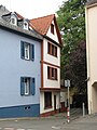 Schulstraße 22, 2, Sachsenhausen, Frankfurt am Main.jpg 2,592 × 3,456; 3.48 MB
-
 Schulstraße 26-22, 1, Sachsenhausen, Frankfurt am Main.jpg 3,456 × 2,592; 3.4 MB


