Category:Schulhaus Auhof
Jump to navigation
Jump to search
| Object location | | View all coordinates using: OpenStreetMap |
|---|
| NO WIKIDATA ID FOUND! Search for Schulhaus Auhof on Wikidata | |
| Upload media |
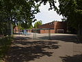
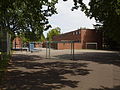
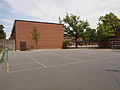
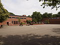
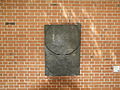
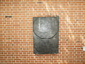
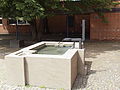
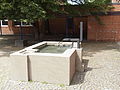
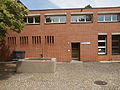
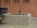
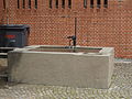
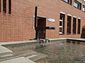
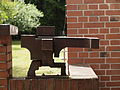
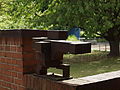
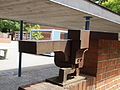
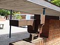
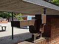
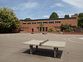
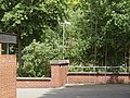
Deutsch: Das Schulhaus bzw. die Schulanlage Auhof wurde zusammen mit dem Freibad Auhof 1958 erbaut. Es steht im öffentlichen Grünzug zwischen Aubrugg und Schwamendigerplatz in Zürich. Architekt war Ernst Gisel.
Media in category "Schulhaus Auhof"
The following 56 files are in this category, out of 56 total.
-
 Schulhaus Auhof 6228701.JPG 4,032 × 3,024; 8.56 MB
-
 Schulhaus Auhof 6228702.JPG 4,032 × 3,024; 8.42 MB
-
 Schulhaus Auhof 6228704.JPG 4,032 × 3,024; 7.63 MB
-
 Schulhaus Auhof 6228705.JPG 4,032 × 3,024; 7.03 MB
-
 Schulhaus Auhof 6228706.JPG 4,032 × 3,024; 6.97 MB
-
 Schulhaus Auhof 6228707.JPG 4,032 × 3,024; 6.96 MB
-
 Schulhaus Auhof 6228708.JPG 4,032 × 3,024; 7.33 MB
-
 Schulhaus Auhof 6228709.JPG 4,032 × 3,024; 7.56 MB
-
 Schulhaus Auhof 6228710.JPG 4,032 × 3,024; 7.59 MB
-
 Schulhaus Auhof 6228711.JPG 4,032 × 3,024; 7.09 MB
-
 Schulhaus Auhof 6228712.JPG 4,032 × 3,024; 7.36 MB
-
 Schulhaus Auhof 6228713.JPG 4,032 × 3,024; 8.07 MB
-
 Schulhaus Auhof 6228714.JPG 4,032 × 3,024; 8.01 MB
-
 Schulhaus Auhof 6228715.JPG 4,032 × 3,024; 7.84 MB
-
 Schulhaus Auhof 6228716.JPG 4,032 × 3,024; 7.35 MB
-
 Schulhaus Auhof 6228717.JPG 4,032 × 3,024; 8.53 MB
-
 Schulhaus Auhof 6228718.JPG 4,032 × 3,024; 8.03 MB
-
 Schulhaus Auhof 6228719.JPG 3,024 × 4,032; 7.78 MB
-
 Schulhaus Auhof 6228720.JPG 4,032 × 3,024; 8.91 MB
-
 Schulhaus Auhof 6228721.JPG 4,032 × 3,024; 8.85 MB
-
 Schulhaus Auhof 6228722.JPG 4,032 × 3,024; 8.76 MB
-
 Schulhaus Auhof 6228723.JPG 4,032 × 3,024; 8.02 MB
-
 Schulhaus Auhof 6228724.JPG 4,032 × 3,024; 8.86 MB
-
 Schulhaus Auhof 6228725.JPG 4,032 × 3,024; 7.84 MB
-
 Schulhaus Auhof 6228726.JPG 4,032 × 3,024; 7.19 MB
-
 Schulhaus Auhof 6228727.JPG 4,032 × 3,024; 8.17 MB
-
 Schulhaus Auhof 6228728.JPG 4,032 × 3,024; 8.06 MB
-
 Schulhaus Auhof 6228729.JPG 4,032 × 3,024; 8 MB
-
 Schulhaus Auhof 6228730.JPG 4,032 × 3,024; 7.48 MB
-
 Schulhaus Auhof 6228731.JPG 4,032 × 3,024; 6.7 MB
-
 Schulhaus Auhof 6228732.JPG 4,032 × 3,024; 6.46 MB
-
 Schulhaus Auhof 6228734.JPG 4,032 × 3,024; 6.54 MB
-
 Schulhaus Auhof 6228735.JPG 4,032 × 3,024; 7.13 MB
-
 Schulhaus Auhof 6228736.JPG 4,032 × 3,024; 7.21 MB
-
 Schulhaus Auhof 6228737.JPG 4,032 × 3,024; 7.24 MB
-
 Schulhaus Auhof 6228738.JPG 4,032 × 3,024; 7.64 MB
-
 Schulhaus Auhof 6228739.JPG 4,032 × 3,024; 6.65 MB
-
 Schulhaus Auhof 6228740.JPG 4,032 × 3,024; 6.21 MB
-
 Schulhaus Auhof 6228741.JPG 4,032 × 3,024; 6.25 MB
-
 Schulhaus Auhof 6228742.JPG 4,032 × 3,024; 7.68 MB
-
 Schulhaus Auhof 6228743.JPG 4,032 × 3,024; 6.42 MB
-
 Schulhaus Auhof 6228744.JPG 4,032 × 3,024; 6.32 MB
-
 Schulhaus Auhof 6228745.JPG 4,032 × 3,024; 6.67 MB
-
 Schulhaus Auhof 6228746.JPG 4,032 × 3,024; 6.66 MB
-
 Schulhaus Auhof 6228747.JPG 4,032 × 3,024; 7.49 MB
-
 Schulhaus Auhof 6228748.JPG 4,032 × 3,024; 7.4 MB
-
 Schulhaus Auhof 6228749.JPG 4,032 × 3,024; 7.74 MB
-
 Schulhaus Auhof 6228750.JPG 4,032 × 3,024; 7.68 MB
-
 Schulhaus Auhof 6228751.JPG 4,032 × 3,024; 8.17 MB
-
 Schulhaus Auhof 6228752.JPG 4,032 × 3,024; 7.67 MB
-
 Schulhaus Auhof 6228753.JPG 3,024 × 4,032; 7.72 MB
-
 Schulhaus Auhof 6228754.JPG 3,024 × 4,032; 7.19 MB
-
 Schulhaus Auhof 6228755.JPG 4,032 × 3,024; 8.06 MB
-
 Schulhaus Auhof 6228756.JPG 4,032 × 3,024; 8.33 MB
-
 Schulhaus Auhof 6228757.JPG 4,032 × 3,024; 7.91 MB
-
 Schulhaus Auhof 6228758.JPG 4,032 × 3,024; 8.48 MB


