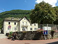
Category:School of Argis
Jump to navigation
Jump to search
| Object location | | View all coordinates using: OpenStreetMap |
|---|
 | |||||
| Upload media | |||||
| Instance of | |||||
|---|---|---|---|---|---|
| Industry |
| ||||
| Location | Argis, Ain, Auvergne-Rhône-Alpes, Metropolitan France, France | ||||
| Street address |
| ||||
| Owned by | |||||
| Inception |
| ||||
 | |||||
Media in category "School of Argis"
This category contains only the following file.
-
 L'école d'Argis.JPG 3,338 × 2,552; 4.78 MB