Category:Schlummerstube (Bahren)
Jump to navigation
Jump to search
| Object location | | View all coordinates using: OpenStreetMap |
|---|
natural monument protected area in Grimma Municipality, Saxony, Germany _-_Br%C3%BCckenblick.jpg) | |||||
| Upload media | |||||
| Instance of | |||||
|---|---|---|---|---|---|
| Part of | |||||
| Location | Bahren, Grimma, Landkreis Leipzig, Saxony, Germany | ||||
| Heritage designation | |||||
| Start time |
| ||||
| Area |
| ||||
 | |||||
Media in category "Schlummerstube (Bahren)"
The following 19 files are in this category, out of 19 total.
-
 Blick vom Schloss Döben auf Muldeschleife und Schlummerstube Bahren.jpg 4,608 × 3,456; 15.68 MB
-
 Blick vom Schloss Döben auf Muldetal mit Papierfabrik Golzern und Schlummerstube Bahren.jpg 4,032 × 3,024; 5.25 MB
-
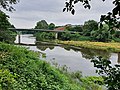 Schlummerstube (Bahren) - Brückenblick.jpg 4,032 × 3,024; 6.08 MB
-
 Schlummerstube (Bahren) - Gartenhaus am Eichenwald.jpg 4,032 × 3,024; 9.23 MB
-
 Schlummerstube (Bahren) - Hochwassersäule.jpg 3,024 × 4,032; 7.97 MB
-
 Schlummerstube (Bahren) - Loreleyzugang.jpg 4,032 × 3,024; 11.71 MB
-
 Schlummerstube (Bahren) - Muldeblick mit Papierfabrik.jpg 4,032 × 3,024; 6.43 MB
-
 Schlummerstube (Bahren) - Muldeblick.jpg 4,032 × 3,024; 8.05 MB
-
 Schlummerstube (Bahren) - Muldeinsel mit Papierfabrik.jpg 4,032 × 3,024; 6.48 MB
-
 Schlummerstube (Bahren) - Muldeinsel mit Wehr.jpg 4,608 × 3,456; 7.43 MB
-
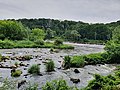
 Schlummerstube (Bahren) - Muldeschnelle.jpg 4,608 × 3,456; 8.02 MB
-
 Schlummerstube (Bahren) - Muldewehr.jpg 4,032 × 3,024; 6.07 MB
-
 Schlummerstube (Bahren) - Ufereiche.jpg 4,608 × 3,456; 7.7 MB
-
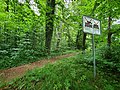 Schlummerstube (Bahren) - Uferschild.jpg 4,608 × 3,456; 9.14 MB
-
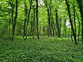 Schlummerstube (Bahren) - Uferwald.jpg 4,032 × 3,024; 8.7 MB
-
 Schlummerstube (Bahren) - Uferweg.jpg 4,608 × 3,456; 8.58 MB
-
 Schlummerstube (Bahren) - Waldpodest.jpg 4,032 × 3,024; 8.15 MB
-
 Schlummerstube (Bahren) - Weg zum Gartenhaus.jpg 4,032 × 3,024; 9.28 MB
-
 Schlummerstube (Bahren) - Weg zum Muldeufer.jpg 3,024 × 4,032; 8.35 MB


_-_Gartenhaus_am_Eichenwald.jpg)
_-_Hochwassers%C3%A4ule.jpg)
_-_Loreleyzugang.jpg)
_-_Muldeblick_mit_Papierfabrik.jpg)
_-_Muldeblick.jpg)
_-_Muldeinsel_mit_Papierfabrik.jpg)
_-_Muldeinsel_mit_Wehr.jpg)
_-_Muldeschnelle.jpg)
_-_Muldewehr.jpg)
_-_Ufereiche.jpg)
_-_Uferschild.jpg)
_-_Uferwald.jpg)
_-_Uferweg.jpg)
_-_Waldpodest.jpg)
_-_Weg_zum_Gartenhaus.jpg)
_-_Weg_zum_Muldeufer.jpg)