Category:Schlosslinde Wermsdorf
Jump to navigation
Jump to search
| Object location | | View all coordinates using: OpenStreetMap |
|---|
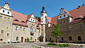
Lime tree in the courtyard of the hunting castle Wermsdorf  | |||||
| Upload media | |||||
| Instance of | |||||
|---|---|---|---|---|---|
| Located in protected area | |||||
| Location | Wermsdorf, Nordsachsen, Saxony, Germany | ||||
| Heritage designation | |||||
 | |||||
Media in category "Schlosslinde Wermsdorf"
The following 16 files are in this category, out of 16 total.
-
 04401-Wermsdorf-1903-Jagdschloß-Brück & Sohn Kunstverlag.jpg 1,509 × 1,000; 601 KB
-
 13019-Wermsdorf-1911-Königliches Jagdschloß-Brück & Sohn Kunstverlag.jpg 1,511 × 1,000; 577 KB
-
 15408-Wermsdorf-1913-Jagdschloß-Brück & Sohn Kunstverlag.jpg 1,531 × 1,000; 683 KB
-
 20040516640DR Wermsdorf Altes Jagdschloß.jpg 2,560 × 1,700; 2.58 MB
-
 20110308320MDR Wermsdorf Altes Jagdschloß und Kirche.jpg 3,828 × 1,988; 7.33 MB
-
 23603-Wermsdorf-1926-Jagdschloß-Brück & Sohn Kunstverlag.jpg 1,536 × 1,000; 629 KB
-
 24837-Wermsdorf-1929-Jagdschloß-Brück & Sohn Kunstverlag.jpg 1,521 × 1,000; 532 KB
-
 25709-Wermsdorf-1931-Jagdschloß-Brück & Sohn Kunstverlag.jpg 1,531 × 1,000; 560 KB
-
 27215-Wermsdorf-1938-Schloß-Brück & Sohn Kunstverlag.jpg 1,533 × 1,000; 381 KB
-
 27677-Wermsdorf-1941-Reit- und Fahrschule-Brück & Sohn Kunstverlag.jpg 1,530 × 1,000; 592 KB
-
 27816-Wermsdorf-1942-Reit- und Fahrschule-Brück & Sohn Kunstverlag.jpg 1,519 × 1,000; 632 KB
-
 Altes Jagdschloss Wermsdorf 1.JPG 2,560 × 1,920; 2.87 MB
-
 Altes Jagdschloss Wermsdorf 3.JPG 4,320 × 2,432; 4.51 MB
-
 Schlosslinde Wermsdorf 2020.jpg 3,096 × 4,128; 3.87 MB
-
 Wermsdorf-Kirche-und-Altes-Jagdschloss.jpg 1,024 × 680; 326 KB
-
 Wermsdorf-Panorama.jpg 1,024 × 352; 49 KB


