Category:Schildgasse (Erfurt)
Jump to navigation
Jump to search
| Object location | | View all coordinates using: OpenStreetMap |
|---|
street in Erfurt, Thuringia, Germany | |||||
| Upload media | |||||
| Instance of | |||||
|---|---|---|---|---|---|
| Location | Erfurt, Thuringia, Germany | ||||
 | |||||
Subcategories
This category has the following 10 subcategories, out of 10 total.
- Schildgasse 1 (Erfurt) (8 F)
- Schildgasse 2 (Erfurt) (7 F)
- Schildgasse 3 (Erfurt) (9 F)
- Schildgasse 4 (Erfurt) (1 F)
- Schildgasse 5 (Erfurt) (1 F)
- Schildgasse 6 (Erfurt) (2 F)
- Schildgasse 7 (Erfurt) (9 F)
- Schildgasse 7a (Erfurt) (1 F)
- Schildgasse 8 (Erfurt) (1 F)
- Schildgasse 9 (Erfurt) (2 F)
Media in category "Schildgasse (Erfurt)"
The following 27 files are in this category, out of 27 total.
-
 Erfurt Gera-am-Dämmchen Feb-2012 SL276791.JPG 3,072 × 2,304; 2.61 MB
-
 Erfurt Gera-nach-Schildchensmühle Feb-2012 SL276797SL276801.JPG 3,072 × 2,304; 2.79 MB
-
 Erfurt Gera-vor-Schildchensmühle Feb-2012 SL276797.JPG 3,072 × 2,304; 2.73 MB
-
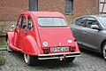
 Erfurt Citroen 2CV 1.jpg 5,184 × 3,456; 8.78 MB
-
 Erfurt Citroen 2CV 2.jpg 5,184 × 3,456; 7.69 MB
-
 Erfurt, Haus an der Furthmühlengasse.jpg 4,272 × 2,848; 3.06 MB
-
 Erfurt, Mühlenkomplex Schildchensmühle, Bild 2.jpg 4,165 × 2,828; 2.84 MB
-
 Erfurt, Mühlenkomplex Schildchensmühle, Bild 4.jpg 4,094 × 2,842; 3.11 MB
-
 Erfurt-Schildchensmühle-1.JPG 4,288 × 2,848; 5.79 MB
-
 Erfurt-Schildchensmühle-2.JPG 4,288 × 2,848; 6 MB
-
 Erfurt-Schildchensmühle-3.JPG 2,848 × 4,288; 5.62 MB
-
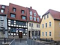
 J24 048 Comthur-, Ecke Schildgasse.jpg 5,658 × 3,772; 4.87 MB
-
 Schildgasse1 erfurt2.JPG 3,672 × 4,896; 6.21 MB
-
 Schildgasse 2 Erfurt 20200904 113.jpg 3,776 × 5,675; 11.5 MB
-
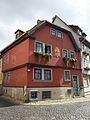
 Erfurt, Fachwerkhaus Schildgasse 3.jpg 3,776 × 2,847; 3.15 MB
-
 Schildgasse3 erfurt.JPG 3,672 × 4,896; 6.29 MB
-
 Schildgasse4 erfurt.JPG 3,672 × 4,896; 6.33 MB
-
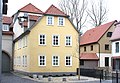
 Erfurt, Haus Schildgasse 6.jpg 4,139 × 2,835; 2.65 MB
-
 Erfurt, Hütergasse 2.jpg 3,744 × 5,616; 7.06 MB
-
 Schottengasse 6, Erfurt.jpg 4,928 × 3,264; 4.48 MB
-
 Erfurt, Mühlenkomplex Schildchensmühle, Bild 1.jpg 4,104 × 2,839; 3.03 MB
-
 Schildgasse8 erfurt.JPG 3,672 × 4,896; 5.95 MB
-
 Erfurt dom Schildgasse 9.jpg 5,184 × 3,456; 9.29 MB
-
 Erfurt, Mühlenkomplex Schildchensmühle, Bild 3.jpg 4,182 × 2,837; 3.81 MB
-
 Erfurt, Schildgasse 9.jpg 6,000 × 4,000; 7.25 MB
-
 Schildgasse7 erfurt.JPG 4,896 × 3,672; 6.86 MB
-
 Schildgasse7a erfurt.JPG 3,672 × 4,896; 6.16 MB


