Category:Schifpot
Jump to navigation
Jump to search
| Object location | | View all coordinates using: OpenStreetMap |
|---|
village in the Netherlands | |||||
| Upload media | |||||
| Instance of | |||||
|---|---|---|---|---|---|
| Location |
| ||||
 | |||||
Nederlands: Schifpot is een gehucht in de Groninger gemeente Winsum. Formeel valt het onder Feerwerd.
Media in category "Schifpot"
The following 8 files are in this category, out of 8 total.
-
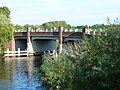
 Bocht in het Aduarderdiep - panoramio.jpg 2,048 × 1,536; 678 KB
-
 Feerwerd Klokkenstoel.JPG 4,000 × 3,000; 5.1 MB
-
 Koepon ingang.jpg 3,998 × 2,398; 3.11 MB
-
 Schifpot - brievenbussen woonbootbewoners.jpg 3,492 × 2,619; 3.11 MB
-
 Schifpot - Frouketil.jpg 4,000 × 3,000; 4.96 MB
-
 Schifpot - huis aan noordzijde Aduarderdiep.jpg 4,000 × 3,000; 3.78 MB
-
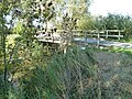
 Schifpot - Torensmabrug.jpg 3,124 × 2,343; 2.34 MB
-
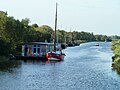 Schifpot - woonboten.jpg 3,064 × 2,298; 2.06 MB


