Category:Schiehallion
Jump to navigation
Jump to search
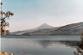
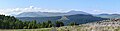
Schiehallion (Scottish Gaelic: Sìdh Chailleann) is a prominent mountain in Perth and Kinross, Scotland. Schiehallion has a rich botanical life, interesting archaeology, and a unique place in scientific history for an 18th-century experiment in 'weighing the world' by the Astronomer Royal Nevil Maskelyne.
mountain in Perth and Kinross, Scotland, UK  | |||||
| Upload media | |||||
| Instance of | |||||
|---|---|---|---|---|---|
| Location |
| ||||
| Mountain range | |||||
| Topographic prominence |
| ||||
| Elevation above sea level |
| ||||
| Parent peak | |||||
 | |||||
Media in category "Schiehallion"
The following 142 files are in this category, out of 142 total.
-
 A distant view of Schiehallion - geograph.org.uk - 872389.jpg 640 × 250; 45 KB
-
 A rainbow frames Schiehallion - geograph.org.uk - 3164708.jpg 979 × 734; 397 KB
-
 A'Bhuidheanach Bheag - geograph.org.uk - 31197.jpg 640 × 480; 48 KB
-
 Access to Schiehallion - geograph.org.uk - 3047422.jpg 1,024 × 768; 153 KB
-
 Approaching the summit of Schiehallion - geograph.org.uk - 3899857.jpg 640 × 480; 151 KB
-

-
 Ascending Schiehallion - geograph.org.uk - 3714518.jpg 4,608 × 3,456; 5.91 MB
-
 Ascent of Schiehallion - geograph.org.uk - 3714517.jpg 4,608 × 3,456; 5.7 MB
-
 Below the summit of Schiehallion - geograph.org.uk - 672106.jpg 640 × 480; 59 KB
-
 Ben Vrackie (worldofjan).jpg 2,592 × 1,944; 1.12 MB
-
 Billy on top^ - geograph.org.uk - 547993.jpg 640 × 480; 91 KB
-
 Boulder on northern slopes of Schiehallion - geograph.org.uk - 2526169.jpg 1,500 × 1,125; 363 KB
-

-
 Car park for Schiehallion - geograph.org.uk - 2849414.jpg 640 × 480; 95 KB
-
 Carn Mairg , Munro No 91 - geograph.org.uk - 222367.jpg 640 × 480; 127 KB
-
 Climbing the east ridge of Schiehallion - geograph.org.uk - 3899853.jpg 640 × 480; 140 KB
-
 Creag nam Mial - geograph.org.uk - 31297.jpg 640 × 480; 79 KB
-
 Creek In The Sun - panoramio.jpg 1,280 × 960; 559 KB
-
 Druim Mòr - geograph.org.uk - 1513396.jpg 640 × 359; 86 KB
-
 Drystone wall heads up Schiehallion - geograph.org.uk - 2526447.jpg 1,500 × 1,125; 387 KB
-
 Duntanlich, Loch Tummel, and Schiehallion - geograph.org.uk - 4121375.jpg 1,024 × 681; 148 KB
-
 East ridge of Schiehallion - geograph.org.uk - 3047453.jpg 1,024 × 768; 186 KB
-
 East ridge of Schiehallion - geograph.org.uk - 3195111.jpg 1,500 × 1,125; 1.42 MB
-
 Eastern ridge of Schiehallion - geograph.org.uk - 2132713.jpg 640 × 436; 97 KB
-
 Esquema do Experimento de Maskelyne.JPG 812 × 562; 53 KB
-
 Flickr - don macauley - On Schiehallion.jpg 2,925 × 1,775; 1.83 MB
-
 Frost shattering - geograph.org.uk - 306202.jpg 480 × 640; 23 KB
-
 Heather slopes west of Schiehallion - geograph.org.uk - 2525792.jpg 1,600 × 1,200; 534 KB
-
 Loch Rannoch Landscape.jpg 7,157 × 3,614; 9.37 MB
-
 Loch Rannoch.jpg 432 × 621; 48 KB
-
 Loch Tummel from Schiehallion - geograph.org.uk - 3714530.jpg 4,608 × 3,456; 4.96 MB
-
 Look back down the path going up Schiehallion - geograph.org.uk - 3714510.jpg 4,608 × 3,456; 4.59 MB
-
 Look back up Schiehallion - geograph.org.uk - 3714533.jpg 4,608 × 3,456; 6.38 MB
-
 Looking down the Schiehallion Path - geograph.org.uk - 1498671.jpg 640 × 480; 90 KB
-

-
 Looking towards Schiehallion - geograph.org.uk - 1440021.jpg 640 × 497; 68 KB
-
 Looking towards Schiehallion - geograph.org.uk - 3174214.jpg 640 × 427; 448 KB
-
 Looking up the Schiehallion Path - geograph.org.uk - 1498637.jpg 640 × 480; 92 KB
-

-
 Misty summit ridge of Schiehallion - geograph.org.uk - 3714531.jpg 4,608 × 3,456; 4.14 MB
-
 Nearing the boulder field on Shiehallion - geograph.org.uk - 1439579.jpg 640 × 480; 139 KB
-
 North shore of Loch Rannoch - geograph.org.uk - 2223159.jpg 1,500 × 1,125; 719 KB
-
 Ordnance Survey One-inch Sheet 48 Loch Tay, Published 1956.jpg 8,597 × 10,687; 19.07 MB
-
 Path on east ridge of Schiehallion - geograph.org.uk - 3196014.jpg 1,500 × 1,125; 1.78 MB
-
 Path to Schiehallion - geograph.org.uk - 1439465.jpg 640 × 480; 123 KB
-
 Path to Schiehallion - geograph.org.uk - 1534114.jpg 640 × 480; 187 KB
-
 Quartzite boulderfield, Schiehallion - geograph.org.uk - 649372.jpg 640 × 480; 95 KB
-
 Resting place on Schiehallion - geograph.org.uk - 2849421.jpg 640 × 480; 86 KB
-
 Road from Glen Fender to Blair Atholl - geograph.org.uk - 771118.jpg 640 × 483; 61 KB
-
 Rock Art or Vandalism^ - geograph.org.uk - 465809.jpg 640 × 480; 66 KB
-
 Rock Seats - geograph.org.uk - 3047430.jpg 1,024 × 768; 203 KB
-
 Rocks by Schiehallion path - geograph.org.uk - 1436917.jpg 640 × 480; 130 KB
-
 Rocks on east ridge of Schiehallion - geograph.org.uk - 3192130.jpg 1,500 × 1,125; 1.71 MB
-
 Rocks on Schiehallion - geograph.org.uk - 1439566.jpg 640 × 480; 161 KB
-
 Schehallien Sketch Hutton 1779.jpg 7,061 × 4,916; 9.68 MB
-
 Schiehallion - Flickr - Graham Grinner Lewis (1).jpg 2,048 × 1,536; 650 KB
-
 Schiehallion - Flickr - Graham Grinner Lewis.jpg 4,000 × 3,000; 1.86 MB
-
 Schiehallion - geograph.org.uk - 1005071.jpg 640 × 480; 80 KB
-
 Schiehallion - geograph.org.uk - 1156736.jpg 640 × 480; 86 KB
-
 Schiehallion - geograph.org.uk - 2752125.jpg 640 × 480; 70 KB
-
 Schiehallion - geograph.org.uk - 3734994.jpg 640 × 480; 174 KB
-
 Schiehallion - geograph.org.uk - 610916.jpg 640 × 480; 53 KB
-
 Schiehallion - geograph.org.uk - 677629.jpg 640 × 480; 37 KB
-
 Schiehallion - sarniebill1.jpg 640 × 395; 72 KB
-
 Schiehallion 01.jpg 3,072 × 2,048; 4.59 MB
-
 Schiehallion above Kinloch Rannoch (geograph 5326804).jpg 1,024 × 678; 163 KB
-
-
 Schiehallion angles.svg 600 × 500; 15 KB
-
 Schiehallion East Aspect.jpg 12,782 × 1,815; 2.67 MB
-

-
 Schiehallion from Carn Mairg.jpg 1,986 × 1,410; 270 KB
-
 Schiehallion from Griffin Forest - geograph.org.uk - 1156710.jpg 640 × 480; 129 KB
-
 Schiehallion from Kinloch Rannoch - geograph.org.uk - 4121884.jpg 1,024 × 681; 179 KB
-
 Schiehallion from Loch Rannoch - geograph.org.uk - 9414.jpg 453 × 640; 54 KB
-
 Schiehallion from Meall a' Bhealaich - geograph.org.uk - 2394340.jpg 800 × 530; 146 KB
-
 Schiehallion from the S.E. Panorama.jpg 14,002 × 3,574; 5.35 MB
-
 Schiehallion from the S.E.jpg 6,000 × 4,000; 10.98 MB
-
 Schiehallion from the south - geograph.org.uk - 2810496.jpg 640 × 480; 61 KB
-
 Schiehallion from the south - geograph.org.uk - 611092.jpg 640 × 480; 53 KB
-
 Schiehallion hillpath - geograph.org.uk - 3047444.jpg 1,024 × 768; 180 KB
-
 Schiehallion near Dunalastair - geograph.org.uk - 2688082.jpg 1,600 × 1,200; 605 KB
-
 Schiehallion Northern Slopes - geograph.org.uk - 315562.jpg 640 × 458; 74 KB
-
 Schiehallion NW ridge.jpg 640 × 464; 121 KB
-
 Schiehallion over Loch Tummel - geograph.org.uk - 102634.jpg 640 × 480; 36 KB
-
 Schiehallion path - geograph.org.uk - 1439555.jpg 640 × 480; 127 KB
-
 Schiehallion path - geograph.org.uk - 2849431.jpg 640 × 480; 70 KB
-
 Schiehallion ridge - geograph.org.uk - 2849435.jpg 640 × 480; 118 KB
-
 Schiehallion ridge - geograph.org.uk - 673602.jpg 640 × 480; 47 KB
-
 Schiehallion Road - geograph.org.uk - 641645.jpg 640 × 480; 55 KB
-
 Schiehallion Summit - geograph.org.uk - 315522.jpg 640 × 455; 83 KB
-
 Schiehallion Summit - geograph.org.uk - 3899867.jpg 640 × 480; 176 KB
-
 Schiehallion summit and Cairn - geograph.org.uk - 1439592.jpg 640 × 480; 129 KB
-
 Schiehallion summit ridge - geograph.org.uk - 3714523.jpg 4,608 × 3,456; 3.91 MB
-
 Schiehallion summit rocks - geograph.org.uk - 3714527.jpg 4,608 × 3,456; 4.14 MB
-
 Schiehallion trig point - geograph.org.uk - 649386.jpg 480 × 640; 93 KB
-
 Schiehallion View - geograph.org.uk - 3211529.jpg 2,592 × 1,944; 1.51 MB
-
 Schiehallion's west ridge - geograph.org.uk - 3465760.jpg 1,024 × 625; 95 KB
-
 Schiehallion, near the summit - geograph.org.uk - 649484.jpg 640 × 480; 65 KB
-
 Schiehallion.svg 600 × 300; 22 KB
-
 SchiehallionSummit(wfmillar)Jun1998.jpg 640 × 450; 86 KB
-
 Schotland Schiehallion 8-05-2010 11-16-57.JPG 3,216 × 2,136; 4.78 MB
-
 Schotland Tummel en Schiehallion 8-05-2010 11-24-04.JPG 2,240 × 1,490; 2.17 MB
-

-
 Steep path up Schiehallion - geograph.org.uk - 3714513.jpg 4,608 × 3,456; 5.8 MB
-
 Stob na Cruaiche - geograph.org.uk - 1537854.jpg 640 × 480; 124 KB
-
 Stone shelter part way up Schiehallion - geograph.org.uk - 3714502.jpg 4,608 × 3,456; 4.31 MB
-
 Summit area, Schiehallion - geograph.org.uk - 4365124.jpg 900 × 675; 679 KB
-
 Summit boulders, Schiehallion - geograph.org.uk - 2849442.jpg 640 × 480; 80 KB
-
 Summit of Schiehallion (1083m) - geograph.org.uk - 1018629.jpg 640 × 480; 53 KB
-
 Summit of Schiehallion - geograph.org.uk - 2166376.jpg 800 × 521; 74 KB
-
 Summit of Schiehallion - geograph.org.uk - 3047492.jpg 1,024 × 768; 138 KB
-
 Summit ridge of Schiehallion - geograph.org.uk - 3465766.jpg 838 × 1,024; 144 KB
-
 Summit View from Schiehallion - geograph.org.uk - 1498790.jpg 640 × 480; 74 KB
-

-
 The new Schiehallion path - geograph.org.uk - 641807.jpg 640 × 480; 63 KB
-
 The new Schiehallion path - geograph.org.uk - 816261.jpg 640 × 480; 71 KB
-
 The new Schiehallion path - geograph.org.uk - 823159.jpg 640 × 398; 59 KB
-
 The northern slopes of Schiehallion - geograph.org.uk - 2525813.jpg 1,500 × 1,125; 341 KB
-
 The old Schiehallion path - geograph.org.uk - 823950.jpg 640 × 480; 83 KB
-
 Top rocks of Schiehallion - geograph.org.uk - 548027.jpg 640 × 480; 45 KB
-
 Traversing the Schiehallion ridge - geograph.org.uk - 3714524.jpg 4,608 × 3,456; 4 MB
-
 Upper slopes of Schiehallion - geograph.org.uk - 649381.jpg 640 × 480; 84 KB
-

-
 View of Schiehallion from the banks of Loch Rannoch - panoramio.jpg 3,264 × 2,448; 2.53 MB
-
 View south from Schiehallion - geograph.org.uk - 2132720.jpg 434 × 640; 63 KB
-

-
 Walkers leaving Schiehallion summit - geograph.org.uk - 673601.jpg 640 × 480; 59 KB
-

-
 Water break in path to Schiehallion - geograph.org.uk - 1439521.jpg 640 × 480; 123 KB
-
 Well-constructed path leading up to Schiehallion - geograph.org.uk - 3714506.jpg 4,608 × 3,456; 6.02 MB
-
 Wind shelter on Schiehallion - geograph.org.uk - 3714520.jpg 4,608 × 3,456; 5.36 MB
-
 Wood mover with Schiehallion - geograph.org.uk - 2297131.jpg 560 × 420; 58 KB
-
 Approaching the top of Schiehallion - geograph.org.uk - 102637.jpg 640 × 480; 91 KB
-
 Beinn a Ghlo from Schiehallion - geograph.org.uk - 102635.jpg 640 × 480; 47 KB
-

-
 Coire nan Gabhar - geograph.org.uk - 1430258.jpg 640 × 480; 101 KB
-
 Geal Charn - geograph.org.uk - 649473.jpg 640 × 480; 41 KB
-
 Millennium path on Schiehallion - geograph.org.uk - 206052.jpg 480 × 640; 84 KB
-
 Schiehallion from Geal Charn - geograph.org.uk - 610936.jpg 640 × 480; 50 KB
-
 Schiehallion from Hotel car park - geograph.org.uk - 43253.jpg 640 × 427; 73 KB
-
 Schiehallion in the distance - geograph.org.uk - 633010.jpg 640 × 480; 52 KB
-
 The rolling Monadh Ghaig - geograph.org.uk - 660266.jpg 640 × 480; 65 KB


.jpg)


.jpg)


.jpg)


Jun1998.jpg)


_-_geograph.org.uk_-_1018629.jpg)


