Category:Schaumbergturm
Jump to navigation
Jump to search
| Object location | | View all coordinates using: OpenStreetMap |
|---|
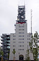
tower in Saarland   | |||||
| Upload media | |||||
| Instance of | |||||
|---|---|---|---|---|---|
| Named after | |||||
| Made from material | |||||
| Location | Tholey, St. Wendel, Saarland, Germany | ||||
| Inception |
| ||||
| Height |
| ||||
| Elevation above sea level |
| ||||
 | |||||
Media in category "Schaumbergturm"
The following 21 files are in this category, out of 21 total.
-
 2020 08 Schaumbergturm Ausstellung.jpg 3,195 × 2,130; 3.08 MB
-
 2020 08 Schaumbergturm.jpg 1,684 × 3,255; 2.21 MB
-
 20200607Schaumberg13.jpg 6,032 × 4,032; 8.95 MB
-
 German french peace memorial on Schaumberg (upper part).jpg 3,072 × 2,304; 2.16 MB
-
 German french peace memorial on Schaumberg, lower part.jpg 3,072 × 2,304; 3.29 MB
-
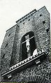
 Kapelle u. Altar im Durchbruch des Schaumbergturms.jpg 1,333 × 2,000; 2.16 MB
-
 Schaumbergplateau von Suedwesten.jpg 5,333 × 3,555; 10.48 MB
-
 Schaumbergturm (3).JPG 2,776 × 3,968; 2.43 MB
-
 Schaumbergturm (nach Umbau von 2010 bis 2013).jpg 1,275 × 2,000; 1.78 MB
-
 Schaumbergturm 2014-3.JPG 2,112 × 2,816; 1.21 MB
-
 Schaumbergturm 20150803.JPG 2,624 × 3,818; 3.19 MB
-
 SchaumbergTurm alt.jpg 1,381 × 2,250; 890 KB
-
 Schaumbergturm von Norden.jpg 5,001 × 3,334; 9.58 MB
-
 Schaumbergturm-01.JPG 3,240 × 4,320; 4.59 MB
-
 Schaumbergturm-02-Infotafel.JPG 4,320 × 3,240; 5.45 MB
-
 Schaumbergturm-03-Zugang.JPG 3,240 × 4,320; 5.14 MB
-
 Schaumbergturm-04-Etagen.JPG 3,240 × 4,320; 4.83 MB
-
 Schaumbergturm-05-Außentreppen.JPG 3,240 × 4,320; 4.81 MB
-
 Schaumbergturm-06-Plattform.JPG 4,320 × 3,240; 4.67 MB
-
 Schaumbergturm-07-Stahlgerüst.JPG 4,320 × 3,240; 5.39 MB
-
 Tholey 310bea.jpg 4,608 × 3,456; 14.91 MB


.jpg)


.JPG)
.jpg)


Categories:
- Schaumberg
- Buildings in Tholey
- Observation towers in Saarland
- Antenna towers and masts in Saarland
- Mobile phone base stations in Germany
- War memorials in Landkreis St. Wendel
- Built in Saarland in 1976
- Stone towers in Saarland
- Concrete towers in Saarland
- Tetragonal towers in Saarland
- 52-meter-tall buildings in Germany