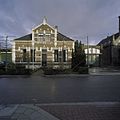
Category:Scharwoude
Jump to navigation
Jump to search
human settlement in Koggenland, Netherlands | |||||
| Upload media | |||||
| Instance of | |||||
|---|---|---|---|---|---|
| Location |
| ||||
| Located in or next to body of water | |||||
| Population |
| ||||
 | |||||
Subcategories
This category has the following 2 subcategories, out of 2 total.
R
S
Media in category "Scharwoude"
The following 13 files are in this category, out of 13 total.
-
Atlas Schoemaker-WESTFRIESLAND-DEEL4-1131-Noord-Holland, Scharwoude.jpeg 1,046 × 1,672; 378 KB
-
Dutch panorama at the Markermeer dike near Scharwoude - panoramio.jpg 4,928 × 3,264; 6.97 MB
-
Gemaal Westerkogge, Scharwoude.jpg 3,888 × 2,592; 3.82 MB
-
Interieur naar de preekstoel - Scharwoude - 20195339 - RCE.jpg 960 × 1,200; 212 KB
-
Interieur naar de torenwand - Scharwoude - 20195340 - RCE.jpg 960 × 1,200; 182 KB
-
Scharwoude wapen.svg 389 × 464; 64 KB
-
Scharwoude.jpg 2,736 × 3,648; 891 KB
-
Westgevel toren - Scharwoude - 20195337 - RCE.jpg 2,462 × 3,100; 1.81 MB
-
Zuid Scharwoude 1997 (27002099201).jpg 5,073 × 7,109; 6.57 MB
-
Zuid-Scharwoude 1865 (26693851515).jpg 3,228 × 2,413; 1.48 MB
-
Zuidgevel - Scharwoude - 20195338 - RCE.jpg 2,444 × 3,077; 1.68 MB


