Category:Schafberg (Hüttertal)
Jump to navigation
Jump to search
| Upload media | |||||
| Instance of | |||||
|---|---|---|---|---|---|
| Location |
| ||||
| Elevation above sea level |
| ||||
 | |||||
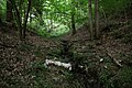
Der Schafberg ist eine ca. 285 Meter hohe Erhebung im Landschaftsschutzgebiet Hüttertal zwischen Radeberg und Wallroda. Topografisch befindet sich der Schafberg in der Gemarkung Arnsdorf.
Media in category "Schafberg (Hüttertal)"
The following 3 files are in this category, out of 3 total.
-
 Felixturm 2012.jpg 1,000 × 667; 973 KB
-
 Hüttertal Schafberg Ringweg Felixturm.jpg 1,000 × 667; 940 KB
-
 Hüttertal Schafbornbach.jpg 1,000 × 667; 272 KB


