Category:Scargill
Jump to navigation
Jump to search
village in the United Kingdom  | |||||
| Upload media | |||||
| Instance of | |||||
|---|---|---|---|---|---|
| Location | County Durham, North East England, England | ||||
| Population |
| ||||
 | |||||
English: Scargill is a hamlet in the Pennines of England, situated close to the River Greta. It was historically located in the North Riding of Yorkshire but along with the rest of the former Startforth Rural District it was transferred to County Durham for administrative and ceremonial purposes on 1 April 1974, under the provisions of the Local Government Act 1972.
Subcategories
This category has the following 2 subcategories, out of 2 total.
C
- Scargill Castle (3 F)
R
- Rutherford Bridge (8 F)
Media in category "Scargill"
The following 114 files are in this category, out of 114 total.
-
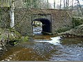 18thC Gillbeck Bridge - geograph.org.uk - 3401976.jpg 4,000 × 3,000; 3.26 MB
-
 A road bridge at Thwaite - geograph.org.uk - 2391715.jpg 1,667 × 1,211; 822 KB
-
 Barn at Scargill - geograph.org.uk - 136725.jpg 640 × 427; 73 KB
-
 Black Gutter - geograph.org.uk - 3759003.jpg 2,035 × 2,990; 1.84 MB
-
 Blocked gate into the Stang Forest - geograph.org.uk - 2226714.jpg 3,840 × 3,000; 1.57 MB
-
 Bow Hill - geograph.org.uk - 5887865.jpg 2,048 × 1,536; 997 KB
-
 Bridleway heading north towards Scargill Farm - geograph.org.uk - 4404082.jpg 1,500 × 1,125; 1.49 MB
-
 Bridleway north to Thwaite - geograph.org.uk - 1247293.jpg 640 × 480; 68 KB
-
 Bridleway south of Scargill - geograph.org.uk - 1255172.jpg 576 × 640; 103 KB
-
 Burned Heather - geograph.org.uk - 1349759.jpg 640 × 451; 76 KB
-
 Cattle and sheep at Farewell - geograph.org.uk - 3886308.jpg 1,500 × 1,125; 1.67 MB
-
 Chapel at Thwaite - geograph.org.uk - 3339687.jpg 640 × 480; 110 KB
-
 Cotron Seat - geograph.org.uk - 5110628.jpg 1,260 × 900; 1.33 MB
-
 Country road - geograph.org.uk - 4733233.jpg 640 × 480; 50 KB
-
 Declining woodland - geograph.org.uk - 1247185.jpg 640 × 576; 99 KB
-
 Dense woodland above Gill Beck - geograph.org.uk - 6340776.jpg 5,184 × 3,888; 6.2 MB
-
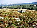 Derelict Shelter - geograph.org.uk - 577334.jpg 640 × 480; 130 KB
-
 Dry stone wall crossing heather moorland - geograph.org.uk - 2284155.jpg 1,500 × 843; 1.05 MB
-
 Dryad's Saddle - geograph.org.uk - 569688.jpg 640 × 480; 166 KB
-
 Drystone wall crossing Citron Seat - geograph.org.uk - 2123339.jpg 2,000 × 1,208; 1.84 MB
-
 Eller Beck on Scargill Low Moor - geograph.org.uk - 1542922.jpg 576 × 640; 118 KB
-
 Faggergill Moss - geograph.org.uk - 3049279.jpg 1,500 × 843; 1.07 MB
-
 Farm access road - geograph.org.uk - 4733243.jpg 640 × 480; 56 KB
-
 Farm road in field north from Chapel Road - geograph.org.uk - 4403504.jpg 1,500 × 1,125; 1.83 MB
-
 Fence and gate at limit of access land - geograph.org.uk - 6516862.jpg 2,000 × 1,236; 2.38 MB
-
 Fence line descending to Stang Forest - geograph.org.uk - 3049355.jpg 1,500 × 843; 1.55 MB
-
 Fenceline Beech tree - geograph.org.uk - 1542947.jpg 640 × 500; 108 KB
-
 Field at Thwaite Green - geograph.org.uk - 3533601.jpg 1,500 × 1,000; 1.38 MB
-
 Field north of road close to Thwaite Farm - geograph.org.uk - 4403071.jpg 1,500 × 920; 1.58 MB
-
 Field on south side of River Greta - geograph.org.uk - 3533631.jpg 1,500 × 1,000; 1.45 MB
-
 Footbridge at Rutherford - geograph.org.uk - 1542971.jpg 480 × 640; 119 KB
-
 Footbridge by the River Greta - geograph.org.uk - 3339709.jpg 640 × 480; 133 KB
-
 Footbridge in Hening Wood - geograph.org.uk - 3339716.jpg 640 × 480; 124 KB
-
 Footbridge over Eller Beck - geograph.org.uk - 3882485.jpg 1,500 × 1,030; 1.31 MB
-
 Footpath above Hening Wood - geograph.org.uk - 1247156.jpg 480 × 640; 99 KB
-
 Footpath from Rutherford Lane to Green Gill Farm and beyond - geograph.org.uk - 2764989.jpg 3,648 × 2,736; 2.32 MB
-
 Footpath near Spanham - geograph.org.uk - 5887851.jpg 2,048 × 1,536; 877 KB
-
 Footpath to Garnthwaite farm and beyond - geograph.org.uk - 2764983.jpg 3,648 × 2,736; 1.88 MB
-
 Ford , Woodclose Gill , Hope Plantation - geograph.org.uk - 145584.jpg 640 × 479; 135 KB
-
 Ford on Eller Beck - geograph.org.uk - 713734.jpg 640 × 480; 140 KB
-
 Garnathwaite Pasture - geograph.org.uk - 3120687.jpg 3,888 × 2,592; 1.25 MB
-
 Gate in dry stone wall on Bent Hill - geograph.org.uk - 2123365.jpg 2,000 × 1,123; 1.88 MB
-
 Gate in dry stone wall on Scargill Low Moor - geograph.org.uk - 3883607.jpg 1,500 × 1,125; 1.41 MB
-
 Gill Beck Foot - geograph.org.uk - 1251532.jpg 640 × 480; 138 KB
-
 Gillbeck Bridge - geograph.org.uk - 2391618.jpg 1,824 × 1,368; 1.14 MB
-
 Gillbeck Bridge - geograph.org.uk - 2664641.jpg 640 × 480; 132 KB
-
 Gillbeck Bridge - geograph.org.uk - 3401969.jpg 3,952 × 2,295; 2.48 MB
-
 Gillbeck Foot - geograph.org.uk - 3339741.jpg 640 × 480; 139 KB
-
 Green Gill - geograph.org.uk - 3120699.jpg 3,202 × 1,981; 1.2 MB
-
 Grouse Butts along Eller Beck - geograph.org.uk - 4413093.jpg 3,910 × 1,527; 1.86 MB
-
 Gutters - geograph.org.uk - 1247249.jpg 640 × 480; 158 KB
-
 Gutters Bridge - geograph.org.uk - 5887895.jpg 2,048 × 1,536; 1.43 MB
-
 Gutters front doors - geograph.org.uk - 1247261.jpg 640 × 480; 116 KB
-
 Hazel Bush Hill - geograph.org.uk - 1919871.jpg 640 × 480; 90 KB
-
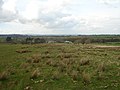
 Heather moorland amid cultivated land - geograph.org.uk - 5193148.jpg 1,500 × 677; 719 KB
-
 Jingle Pot, Swallow Hole - geograph.org.uk - 3759001.jpg 2,204 × 3,920; 2.9 MB
-
 Lodge Farm, Thwaite - geograph.org.uk - 1255099.jpg 640 × 480; 91 KB
-
 Lone tree with sheep - geograph.org.uk - 3883627.jpg 1,500 × 851; 1.05 MB
-
 Low Walls ^ Spoil - geograph.org.uk - 3759097.jpg 3,920 × 2,204; 2.71 MB
-
 Mill Wood - geograph.org.uk - 3339671.jpg 640 × 480; 81 KB
-
 Mill Wood - geograph.org.uk - 4405821.jpg 1,500 × 1,125; 1.71 MB
-
 Mine spoil at Scargill Mine - geograph.org.uk - 3532910.jpg 1,500 × 829; 1.1 MB
-
 Moorhouse Cottage - geograph.org.uk - 365903.jpg 640 × 480; 105 KB
-
 Moorland Track on Barningham Moor - geograph.org.uk - 528136.jpg 640 × 359; 55 KB
-
 More stile than utility - geograph.org.uk - 1247108.jpg 640 × 480; 106 KB
-
 Near Gutters - geograph.org.uk - 5887882.jpg 2,048 × 1,536; 1.1 MB
-
 Near Gutters 2 - geograph.org.uk - 5887893.jpg 2,048 × 1,536; 1,016 KB
-
 Near Spanham - geograph.org.uk - 5887857.jpg 2,048 × 1,536; 926 KB
-
 North side of Garnathwaite Pasture - geograph.org.uk - 3533567.jpg 1,500 × 1,000; 1.28 MB
-
 On Pinlow Hill - geograph.org.uk - 1919875.jpg 640 × 480; 92 KB
-
 On The Border - geograph.org.uk - 5068638.jpg 1,920 × 1,280; 534 KB
-
 Public footsplash - geograph.org.uk - 1251495.jpg 640 × 480; 151 KB
-
 Puddles on farm road heading north towards Scargill - geograph.org.uk - 4403516.jpg 1,500 × 986; 1.26 MB
-
 River Greta from Rutherford Bridge - geograph.org.uk - 3339697.jpg 640 × 480; 109 KB
-
 Road junction near Thwaite - geograph.org.uk - 2391736.jpg 1,745 × 1,072; 586 KB
-
 Rocks at Bleakhow Flakes - geograph.org.uk - 2123377.jpg 2,000 × 1,189; 1.66 MB
-
-
 Ruin at Thwaite - geograph.org.uk - 1247305.jpg 640 × 576; 100 KB
-
 Ruined building on N side of Stang Forest - geograph.org.uk - 3532876.jpg 1,500 × 1,027; 1.52 MB
-
 Rutherford - geograph.org.uk - 3120711.jpg 3,576 × 1,677; 678 KB
-
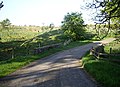
 Rutherford Bridge - geograph.org.uk - 4733221.jpg 640 × 480; 72 KB
-
 Rutherford Bridge - geograph.org.uk - 5615017.jpg 3,086 × 2,700; 1.69 MB
-
 Rutherford Bridge - geograph.org.uk - 6088770.jpg 1,600 × 1,067; 373 KB
-
 Rutherford Ford - geograph.org.uk - 5718901.jpg 4,032 × 3,024; 5.23 MB
-
 Rutherford gauging weir on the River Greta, low water - geograph.org.uk - 2157464.jpg 5,700 × 2,150; 2.07 MB
-
 Rutherford Lane - geograph.org.uk - 3120708.jpg 3,888 × 2,592; 1.41 MB
-
 Scargill Chapel - geograph.org.uk - 3401931.jpg 3,833 × 2,199; 2.32 MB
-
 Scargill Farm - geograph.org.uk - 2391680.jpg 1,711 × 1,199; 928 KB
-
 Scargill Moor - geograph.org.uk - 5887861.jpg 2,048 × 1,536; 990 KB
-
 Seavy Sike - geograph.org.uk - 2226690.jpg 3,840 × 2,100; 1.71 MB
-
 Spanham - geograph.org.uk - 3120685.jpg 3,752 × 2,324; 865 KB
-
 Spanham - geograph.org.uk - 3882441.jpg 1,500 × 1,125; 1.39 MB
-
 Spanham Farm - geograph.org.uk - 2225917.jpg 3,200 × 2,800; 1,019 KB
-
 Spanham Farm - geograph.org.uk - 713566.jpg 640 × 480; 82 KB
-
 Spanham West Hill - geograph.org.uk - 3882428.jpg 1,500 × 1,125; 1.22 MB
-
 Stang Lane at Scargill Beck - geograph.org.uk - 5783061.jpg 2,592 × 1,944; 1.84 MB
-
 Stang Lane heading north - geograph.org.uk - 3533501.jpg 1,500 × 955; 1.08 MB
-
 Stone bridge at Thwaite - geograph.org.uk - 1247313.jpg 640 × 480; 124 KB
-
 Stone Close House - geograph.org.uk - 3120692.jpg 3,635 × 1,995; 974 KB
-
 The ascent to Scargill High Moor - geograph.org.uk - 2225972.jpg 4,000 × 3,000; 2.22 MB
-
 The old road - geograph.org.uk - 5887870.jpg 2,048 × 1,536; 1.14 MB
-
 The River Greta - geograph.org.uk - 2391773.jpg 1,824 × 1,368; 1.19 MB
-
 The River Greta at Brignall Banks - geograph.org.uk - 75577.jpg 640 × 427; 167 KB
-
 The road to Spanham Farm - geograph.org.uk - 366227.jpg 640 × 480; 64 KB
-
 The track to Spanham Farm - geograph.org.uk - 2225935.jpg 4,320 × 3,240; 5.35 MB
-
 Thwaite - geograph.org.uk - 5887876.jpg 2,048 × 1,536; 912 KB
-
 Track to Low Swinston - geograph.org.uk - 1247271.jpg 640 × 480; 88 KB
-
 Wall Corner - geograph.org.uk - 5068647.jpg 1,920 × 1,280; 540 KB
-
 Wall Crossing Eller Beck - geograph.org.uk - 4413097.jpg 2,645 × 1,907; 1.76 MB
-
 Walling on Scargill High Moor - geograph.org.uk - 3882414.jpg 1,500 × 1,052; 1.3 MB
-
 West Ling gate - geograph.org.uk - 1542934.jpg 640 × 500; 112 KB
-
 Armorial , Hawstead Farm - geograph.org.uk - 145498.jpg 640 × 479; 122 KB
-
 Gill Beck joins the River Greta - geograph.org.uk - 569668.jpg 640 × 480; 148 KB
-
 Hut on Scargill Low Moor - geograph.org.uk - 365536.jpg 640 × 480; 72 KB


