Category:Scampston
Jump to navigation
Jump to search
village in North Yorkshire, England, United Kingdom .jpg) | |||||
| Upload media | |||||
| Instance of | |||||
|---|---|---|---|---|---|
| Location | Ryedale, North Yorkshire, Yorkshire and the Humber, England | ||||
| Population |
| ||||
 | |||||
Subcategories
This category has the following 2 subcategories, out of 2 total.
S
Media in category "Scampston"
The following 200 files are in this category, out of 294 total.
(previous page) (next page)-
 3 butterfly species on one plant - geograph.org.uk - 4080107.jpg 1,281 × 1,600; 665 KB
-
 A blaze of poppies - geograph.org.uk - 4022851.jpg 1,166 × 1,600; 746 KB
-
 A cultivated strip alongside Outgang Road into Scampston - geograph.org.uk - 5966019.jpg 4,504 × 3,314; 6.48 MB
-
 A farming scene at East Knapton - geograph.org.uk - 4568162.jpg 4,606 × 3,454; 4.78 MB
-
 A tranquil spot - geograph.org.uk - 4023054.jpg 2,000 × 1,500; 904 KB
-
 A64 and bridleway to the right - geograph.org.uk - 5966044.jpg 4,602 × 3,448; 7.56 MB
-
 A64 approaching Scampston Bridge - geograph.org.uk - 1979247.jpg 640 × 480; 98 KB
-
 A64 eastbound towards Scarborough - geograph.org.uk - 1979274.jpg 640 × 480; 60 KB
-
 A64 eastbound towards Scarborough - geograph.org.uk - 1979315.jpg 640 × 480; 54 KB
-
 Access road from Ochre Farm to Malton Road - geograph.org.uk - 4568021.jpg 4,598 × 3,444; 4.76 MB
-
 Access road to Ochre Farm - geograph.org.uk - 4567987.jpg 3,064 × 2,291; 2.23 MB
-
 Access road to The Firs - geograph.org.uk - 5965946.jpg 3,291 × 2,383; 2.82 MB
-
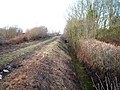
 Access track crossing dismantled railway line - geograph.org.uk - 5963247.jpg 4,608 × 3,456; 6.38 MB
-
 Animals grazing near Scampston village - geograph.org.uk - 3503012.jpg 1,024 × 734; 407 KB
-
 Approaching Difford Bridge - geograph.org.uk - 3932106.jpg 1,600 × 1,084; 611 KB
-

-

-

-
 Arable fields near Low Scampton crossing - geograph.org.uk - 4022777.jpg 2,000 × 1,500; 1 MB
-
 Art installation by the Wolds Way - geograph.org.uk - 6090501.jpg 1,024 × 637; 135 KB
-
 Artwork on the Yorkshire Wolds Way - geograph.org.uk - 5327442.jpg 2,300 × 1,722; 1.38 MB
-
 Avenue of trees in Scampton Park - geograph.org.uk - 5968532.jpg 1,024 × 768; 806 KB
-
 B1258 towards West Knapton - geograph.org.uk - 1979108.jpg 640 × 480; 108 KB
-
 B1258 towards West Knapton - geograph.org.uk - 1979159.jpg 640 × 480; 108 KB
-
 Back Lane - geograph.org.uk - 4022827.jpg 2,000 × 1,500; 1.32 MB
-
 Back Lane - geograph.org.uk - 5328567.jpg 2,048 × 1,536; 1.25 MB
-
 Back Lane, Scampston - geograph.org.uk - 5636342.jpg 640 × 359; 84 KB
-
 Barley field and woodland - geograph.org.uk - 4568130.jpg 4,600 × 3,444; 5.11 MB
-
 Between the power lines - geograph.org.uk - 4022773.jpg 2,000 × 1,500; 821 KB
-
 Between the power lines - geograph.org.uk - 4798825.jpg 1,024 × 768; 153 KB
-
 Blocked track off Outgang Road - geograph.org.uk - 5640401.jpg 640 × 359; 98 KB
-
 Blue iris - geograph.org.uk - 4023073.jpg 1,600 × 1,600; 572 KB
-
 Blue poppy (27284574764).jpg 3,889 × 3,300; 6.88 MB
-
 Bridge over drain south of The Firs - geograph.org.uk - 5640391.jpg 640 × 480; 88 KB
-
 Bridleway to Guild Farm East Knapton - geograph.org.uk - 4568114.jpg 4,608 × 3,456; 4.46 MB
-
 Bridleway to Ochre Farm - geograph.org.uk - 1979095.jpg 640 × 480; 83 KB
-
 Bridleway towards Knapton - geograph.org.uk - 5411829.jpg 1,600 × 1,200; 498 KB
-
 Bridleway, Vale of Pickering - geograph.org.uk - 5640385.jpg 640 × 430; 83 KB
-
 Building at Mill Grange - geograph.org.uk - 4568195.jpg 4,608 × 3,456; 4.82 MB
-

-

-
 Conservatory restoration, Scampston Hall - geograph.org.uk - 3502995.jpg 1,024 × 768; 316 KB
-
 Cottages, Scampston village (geograph 3502815).jpg 1,024 × 699; 395 KB
-
 Crop field off Knapton Wold Road - geograph.org.uk - 5640424.jpg 640 × 480; 99 KB
-
 Crop fields, north of the A64 - geograph.org.uk - 3502932.jpg 1,024 × 763; 391 KB
-
 Cycle path beside the A64 - geograph.org.uk - 1979233.jpg 640 × 480; 106 KB
-
 Dandelions. - geograph.org.uk - 3505488.jpg 640 × 387; 57 KB
-
 Derelict shop, Scampston - geograph.org.uk - 4080132.jpg 1,600 × 1,061; 669 KB
-
 Dew pond. - geograph.org.uk - 3505451.jpg 556 × 640; 44 KB
-
 Dewpond on Knapton Brow - geograph.org.uk - 6060416.jpg 4,319 × 1,900; 1.4 MB
-
 Dismantled railway line - geograph.org.uk - 5328523.jpg 2,048 × 1,536; 1.29 MB
-
 Drain beside Back Lane - geograph.org.uk - 5640419.jpg 640 × 436; 63 KB
-
 Drain beside disused railway - geograph.org.uk - 5640367.jpg 640 × 480; 115 KB
-

-
 Drain near Wath Farm - geograph.org.uk - 5640370.jpg 640 × 480; 72 KB
-
 Dusty track - geograph.org.uk - 4594728.jpg 1,024 × 768; 146 KB
-
 East Farm, near Wintringham - geograph.org.uk - 5411821.jpg 1,600 × 1,200; 482 KB
-

-
 Eastern End of Knapton Plantation - geograph.org.uk - 2550065.jpg 3,264 × 2,448; 2.73 MB
-
 Ellis Beck at Ellis Bridge - geograph.org.uk - 4567924.jpg 4,608 × 3,456; 5.14 MB
-
 Enclosure Rites - geograph.org.uk - 6607374.jpg 4,096 × 2,731; 2.02 MB
-
 European Eagle Owl at Scampston Steam Fair - geograph.org.uk - 6253929.jpg 4,032 × 1,960; 2.42 MB
-
 European Eagle Owl at Scampston Steam Fair - geograph.org.uk - 6253932.jpg 4,032 × 1,960; 2.99 MB
-
 European Eagle Owl at Scampston Steam Fair - geograph.org.uk - 6254047.jpg 4,032 × 1,960; 2.44 MB
-
 Farm pond dried up - geograph.org.uk - 5965942.jpg 4,608 × 3,456; 7.24 MB
-
 Farm road, Guild Farm, East Knapton - geograph.org.uk - 1979265.jpg 640 × 480; 76 KB
-
 Farm track left off Back Lane - geograph.org.uk - 4022735.jpg 2,000 × 1,500; 853 KB
-
 Farm track off Back Lane - geograph.org.uk - 5640894.jpg 640 × 359; 69 KB
-

-

-

-
 Farmland near Difford Farm - geograph.org.uk - 1979117.jpg 640 × 480; 57 KB
-

-
 Farmland, East Knapton - geograph.org.uk - 1979262.jpg 640 × 480; 83 KB
-
 Farmland, West Knapton - geograph.org.uk - 1979155.jpg 640 × 480; 71 KB
-
 Field adjacent to Back Lane - geograph.org.uk - 6695608.jpg 1,024 × 768; 104 KB
-

-
 Field edge bridleway to level crossing - geograph.org.uk - 4568064.jpg 4,608 × 3,456; 4.91 MB
-
 Field edge footpath - geograph.org.uk - 4568172.jpg 3,454 × 4,608; 7.01 MB
-
 Field edge track to Ochre Farm - geograph.org.uk - 4568045.jpg 4,536 × 3,358; 4.89 MB
-
 Field towards Wath Farm - geograph.org.uk - 5640376.jpg 640 × 480; 52 KB
-
 Field track and bridleway toward The Firs - geograph.org.uk - 5965899.jpg 4,588 × 3,430; 6.54 MB
-
 Field track back toward Wath Farm - geograph.org.uk - 5965923.jpg 4,556 × 3,386; 7.53 MB
-
 Field track toward The Firs - geograph.org.uk - 5965926.jpg 4,608 × 3,456; 5.74 MB
-
 Fields and woodland - geograph.org.uk - 5786078.jpg 800 × 600; 89 KB
-
 Fields beside the railway - geograph.org.uk - 5786076.jpg 800 × 600; 94 KB
-
 Fields north of Scampston - geograph.org.uk - 512655.jpg 640 × 480; 95 KB
-
 Figures on the hilltop - geograph.org.uk - 6060411.jpg 4,299 × 2,277; 2.27 MB
-
 Floral display, walled garden - geograph.org.uk - 3502983.jpg 768 × 1,024; 534 KB
-
 Footbridge over the lake, Scampston Hall - geograph.org.uk - 3502966.jpg 1,200 × 1,600; 869 KB
-
 Footpath gateway into The Park at East Knapton Hall - geograph.org.uk - 4568151.jpg 4,554 × 3,384; 6.15 MB
-
 Footpath over stubble field to Rillington - geograph.org.uk - 5965994.jpg 3,838 × 2,874; 4.22 MB
-
 Footpath to West Knapton - geograph.org.uk - 4022847.jpg 2,000 × 1,500; 1.01 MB
-
 Footpath towards Scampston - geograph.org.uk - 1979140.jpg 640 × 480; 130 KB
-
 Former Post Office Town Street Scampston - geograph.org.uk - 5966032.jpg 4,604 × 3,450; 6.03 MB
-
 Former Post Office, Scampston - geograph.org.uk - 5636301.jpg 640 × 359; 75 KB
-
 Former school, Scampston (geograph 4080157).jpg 1,600 × 1,065; 772 KB
-
 George V postbox on Town Street, Scampston - geograph.org.uk - 5636299.jpg 1,835 × 2,978; 1.92 MB
-
 Grazing towards Sands Wood - geograph.org.uk - 5636357.jpg 640 × 480; 94 KB
-
 Grazing, Knapton - geograph.org.uk - 5636354.jpg 640 × 480; 84 KB
-
 Hay bales at Poplar Farm, West Knapton - geograph.org.uk - 6695613.jpg 1,024 × 768; 67 KB
-
 Heath Spotted Orchid (Dactylorhiza maculata) - geograph.org.uk - 4023044.jpg 798 × 1,162; 437 KB
-
 High Gate House - geograph.org.uk - 4594742.jpg 1,024 × 768; 177 KB
-
 High Gate House Level Crossing - geograph.org.uk - 5640411.jpg 640 × 393; 51 KB
-

-
 High Gate level crossing, Scampston - geograph.org.uk - 4080166.jpg 2,000 × 1,276; 847 KB
-
 Historical notes of Rillington & Scampston, by W.T. Stratford. p.60.png 821 × 1,200; 180 KB
-
 Horses, West Knapton - geograph.org.uk - 5636362.jpg 640 × 480; 54 KB
-
 House in Scampston (geograph 5636324).jpg 640 × 359; 60 KB
-
 Houses in Scampston Village - geograph.org.uk - 370446.jpg 640 × 480; 146 KB
-
 Houses on Town Street, Scampston - geograph.org.uk - 5636321.jpg 640 × 359; 50 KB
-
 I feel like the Pied Piper - geograph.org.uk - 5965938.jpg 4,608 × 3,456; 5.49 MB
-
 Ings Farm - geograph.org.uk - 1979079.jpg 640 × 494; 55 KB
-
 Juvenile blackbird - geograph.org.uk - 4023093.jpg 1,600 × 1,600; 965 KB
-
 Knapton Brow cross dyke - geograph.org.uk - 6060402.jpg 4,299 × 2,359; 2.59 MB
-
 Knapton Carr from the railway - geograph.org.uk - 3988416.jpg 640 × 297; 33 KB
-
 Knapton Maltings - geograph.org.uk - 1979120.jpg 640 × 480; 65 KB
-
 Knapton Maltings - geograph.org.uk - 4022812.jpg 2,816 × 2,112; 2.11 MB
-
 Knapton Maltings - geograph.org.uk - 4022820.jpg 2,816 × 2,112; 2.16 MB
-
 Knapton Wold Road - geograph.org.uk - 5640425.jpg 640 × 480; 57 KB
-
 Knapton Wold Road rising up from the Vale of Pickering - geograph.org.uk - 5966048.jpg 4,520 × 3,336; 5.64 MB
-
 Knapton Wood - geograph.org.uk - 1979285.jpg 640 × 480; 113 KB
-
 Lean-to shed and garden wall - geograph.org.uk - 6246387.jpg 640 × 480; 352 KB
-
 Level crossing on Outgang Road - geograph.org.uk - 4798827.jpg 1,024 × 768; 204 KB
-
 Level Crossing, Knapton - geograph.org.uk - 1979126.jpg 640 × 480; 62 KB
-
 Line toward Malton from High Scampton level crossing - geograph.org.uk - 5966008.jpg 4,528 × 3,348; 5.08 MB
-
 Lone tree - geograph.org.uk - 5328529.jpg 2,048 × 1,536; 945 KB
-

-

-
 Looking towards The Firs - geograph.org.uk - 5328539.jpg 2,048 × 1,536; 972 KB
-
 Low Gate House - geograph.org.uk - 4022838.jpg 2,000 × 1,500; 869 KB
-
 Low Scampston level crossing - geograph.org.uk - 5636349.jpg 640 × 436; 59 KB
-
 Low Scampston level crossing - geograph.org.uk - 5640895.jpg 640 × 359; 55 KB
-
 Main line toward Scarborough and High Gate House - geograph.org.uk - 5966014.jpg 4,598 × 3,444; 6.21 MB
-
 Malton Road (the B1258) - geograph.org.uk - 3560004.jpg 4,040 × 2,823; 3.44 MB
-
 Malton Road joins the A64 - geograph.org.uk - 2319452.jpg 800 × 600; 203 KB
-
 Mature tree in parkland - geograph.org.uk - 4022882.jpg 2,000 × 1,500; 1.2 MB
-
 Middle Farm - geograph.org.uk - 4798823.jpg 1,024 × 768; 145 KB
-
 Middle fish pond - geograph.org.uk - 4022873.jpg 2,000 × 1,500; 1.36 MB
-
 Milestone near East Knapton - geograph.org.uk - 2546020.jpg 715 × 1,024; 274 KB
-
 Minor road corner, Keld Lane (track) ahead - geograph.org.uk - 5966327.jpg 3,750 × 2,758; 3.24 MB
-
 Minor road to Wintringham - geograph.org.uk - 5966307.jpg 3,844 × 2,880; 4.72 MB
-
 Minor road toward Linton Mill - geograph.org.uk - 5966334.jpg 4,374 × 3,120; 5.65 MB
-
 Minor road with metal railings - geograph.org.uk - 3503019.jpg 1,024 × 768; 265 KB
-
 Near Scampston Grange - geograph.org.uk - 5328547.jpg 2,048 × 1,536; 995 KB
-
 Near Wath Farm - geograph.org.uk - 5328534.jpg 2,048 × 1,536; 970 KB
-
 Ochre Farm - geograph.org.uk - 3559994.jpg 2,740 × 1,881; 1.25 MB
-
 Ochre Farm from the railway - geograph.org.uk - 3988413.jpg 640 × 315; 34 KB
-
 Ochre Farm, Yedingham - geograph.org.uk - 6695618.jpg 1,024 × 768; 85 KB
-
 Old Signs at Scampston Steam Fair - geograph.org.uk - 6254049.jpg 4,032 × 1,960; 4.94 MB
-
 Old Signs at Scampston Steam Fair - geograph.org.uk - 6254050.jpg 4,032 × 1,960; 4.69 MB
-
 Organ at Scampston Steam Fair - geograph.org.uk - 6254048.jpg 4,032 × 1,960; 3.23 MB
-
 Outgang Road - geograph.org.uk - 3560010.jpg 4,516 × 3,330; 4.37 MB
-
 Outgang Road, Scampston - geograph.org.uk - 4080169.jpg 1,600 × 1,065; 442 KB
-
 Over arable field to West Farm and mast - geograph.org.uk - 5968536.jpg 4,544 × 3,370; 4.43 MB
-
 Over field to Hartswood Farm - geograph.org.uk - 4568206.jpg 4,592 × 3,436; 4.66 MB
-
 Over field to Middle Farm - geograph.org.uk - 5965951.jpg 4,512 × 3,324; 6.27 MB
-
 Over field to White Cottage - geograph.org.uk - 4568216.jpg 4,500 × 3,308; 4.77 MB
-
 Over stubble field to River Derwent - geograph.org.uk - 5965877.jpg 4,608 × 3,456; 5.08 MB
-
 Over stubble fields to Wath Farm - geograph.org.uk - 5965857.jpg 3,584 × 2,627; 3.78 MB
-
 Parkland, Knapton Hall - geograph.org.uk - 1979250.jpg 640 × 480; 97 KB
-
 Pig farm, East Knapton - geograph.org.uk - 1979257.jpg 640 × 480; 86 KB
-
 Pig farming near Mill Grange - geograph.org.uk - 1979307.jpg 640 × 480; 71 KB
-
 Pinfold - geograph.org.uk - 6059231.jpg 1,024 × 828; 285 KB
-
 Plantsman's Walk - geograph.org.uk - 204730.jpg 512 × 384; 112 KB
-

-
 Ploughed field, Vale of Pickering - geograph.org.uk - 5640399.jpg 640 × 465; 58 KB
-
 Ploughed Fields - geograph.org.uk - 5328553.jpg 2,048 × 1,536; 1.01 MB
-
 Poppies and Middle Plantation - geograph.org.uk - 4593346.jpg 1,024 × 768; 142 KB
-
 Potato crop field - geograph.org.uk - 2546026.jpg 1,024 × 740; 282 KB
-
 Power lines near Knapton Lodge - geograph.org.uk - 3959752.jpg 800 × 524; 167 KB
-
 Power lines near Scampston - geograph.org.uk - 5328558.jpg 2,048 × 1,536; 864 KB
-
 Power lines north of Knapton Power Station - geograph.org.uk - 3559997.jpg 3,242 × 2,177; 1.6 MB
-
 Practice jumps laid out in stubble field - geograph.org.uk - 5965975.jpg 4,590 × 3,432; 6.49 MB
-
 Preparing for battle - geograph.org.uk - 6247902.jpg 640 × 480; 256 KB
-
 Railway towards Scarborough - geograph.org.uk - 1979131.jpg 640 × 480; 95 KB
-
 Railway towards Scarborough - geograph.org.uk - 5636351.jpg 640 × 359; 52 KB
-
 Railway towards Scarborough - geograph.org.uk - 5640883.jpg 640 × 359; 70 KB
-
 Red Admiral butterfly, showing underwing - geograph.org.uk - 4023081.jpg 2,000 × 1,500; 910 KB
-
 Redcarr Plantation - geograph.org.uk - 4022728.jpg 2,000 × 1,539; 887 KB
-
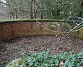
 Remains of the old ice house, Scampston Hall - geograph.org.uk - 3502951.jpg 1,024 × 692; 472 KB
-
 Right turn to Scampston Hall - geograph.org.uk - 3352096.jpg 800 × 559; 288 KB
-
 Rillington Milestone - geograph.org.uk - 1204023.jpg 480 × 640; 124 KB
-
 River Derwent near Skelton Wath Farm - geograph.org.uk - 1989344.jpg 640 × 480; 91 KB
-

-
 Road descending Knapton Brow - geograph.org.uk - 6061577.jpg 4,320 × 2,736; 1.92 MB
-
 Road from West Farm - geograph.org.uk - 6090496.jpg 1,024 × 768; 201 KB
-
 Road into and out of West Knapton - geograph.org.uk - 5966039.jpg 4,538 × 3,360; 6.83 MB
-
 Road to Wintringham - geograph.org.uk - 3503030.jpg 1,024 × 743; 272 KB
-
 Roadside poplars - geograph.org.uk - 3110674.jpg 800 × 556; 259 KB
-
 Sands Lane towards Scampston - geograph.org.uk - 5412395.jpg 1,600 × 1,200; 405 KB
-
 Sands Wood - geograph.org.uk - 1979166.jpg 640 × 480; 130 KB
-
 Sands Wood - geograph.org.uk - 3559146.jpg 800 × 600; 224 KB
-
 Sandy Lane off the A64 - geograph.org.uk - 2961812.jpg 800 × 600; 97 KB
-
 Sandy Lane towards Wintringham - geograph.org.uk - 1979170.jpg 640 × 480; 90 KB
-
 Scampston Bridge - geograph.org.uk - 1979243.jpg 640 × 480; 109 KB
-
 Scampston Hall - geograph.org.uk - 4079154.jpg 1,024 × 682; 550 KB
-
 Scampston Hall - geograph.org.uk - 6110240.jpg 5,343 × 3,005; 5.24 MB
-
 Scampston Hall - geograph.org.uk - 6110245.jpg 5,343 × 3,005; 4.61 MB
-
 Scampston Hall - geograph.org.uk - 6247886.jpg 640 × 480; 273 KB


.jpg)


.jpg)


.jpg)


_-_geograph.org.uk_-_4023044.jpg)


.jpg)


_-_geograph.org.uk_-_3560004.jpg)


_ahead_-_geograph.org.uk_-_5966327.jpg)


