Category:Scale model Map of Ternopil until 1939
Jump to navigation
Jump to search
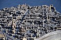
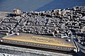
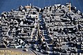
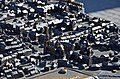
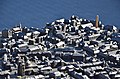
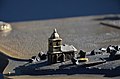
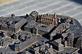
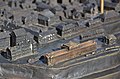
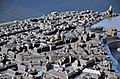
Українська: Макет «Тернопіль. Центральна частина міста початку XX ст.» Робота українського скульптора Дмитра Мулярчука.
| Camera location | | View all coordinates using: OpenStreetMap |
|---|
This work is copyrighted and licenced under the Creative Commons Attribution ShareAlike 3.0 Licence.
In short: you are free to distribute and modify the file as long as you attribute Dmytro Muliarchuk.
|
Media in category "Scale model Map of Ternopil until 1939"
The following 33 files are in this category, out of 33 total.
-
 Tarnopol (Ternopil) summer 2017 006.JPG 3,264 × 2,448; 3.16 MB
-
 Єзуїтський костел (бронзовий макет довоєнного міста).jpg 2,560 × 1,536; 2.18 MB
-
 Макет «Тернопіль. Центральна частина міста початку XX ст.» (фрагмент) - 17075536.jpg 3,020 × 2,000; 1.79 MB
-
 Макет «Тернопіль. Центральна частина міста початку XX ст.» (фрагмент) - 17075537.jpg 3,020 × 2,000; 1.77 MB
-
 Макет «Тернопіль. Центральна частина міста початку XX ст.» (фрагмент) - 17075538.jpg 3,020 × 2,000; 1.74 MB
-
 Макет «Тернопіль. Центральна частина міста початку XX ст.» (фрагмент) - 17075539.jpg 3,020 × 2,000; 1.68 MB
-
 Макет «Тернопіль. Центральна частина міста початку XX ст.» (фрагмент) - 17075540.jpg 3,020 × 2,000; 1.84 MB
-
 Макет «Тернопіль. Центральна частина міста початку XX ст.» (фрагмент) - 17075541.jpg 3,020 × 2,000; 1.74 MB
-
 Макет «Тернопіль. Центральна частина міста початку XX ст.» (фрагмент) - 17075542.jpg 3,020 × 2,000; 1.7 MB
-
 Макет «Тернопіль. Центральна частина міста початку XX ст.» (фрагмент) - 17075543.jpg 3,020 × 2,000; 1.6 MB
-
 Макет «Тернопіль. Центральна частина міста початку XX ст.» (фрагмент) - 17075544.jpg 3,020 × 2,000; 1.68 MB
-
 Макет «Тернопіль. Центральна частина міста початку XX ст.» (фрагмент) - 17075545.jpg 3,020 × 2,000; 1.79 MB
-
 Макет «Тернопіль. Центральна частина міста початку XX ст.» (фрагмент) - 17075546.jpg 3,020 × 2,000; 1.82 MB
-
 Макет «Тернопіль. Центральна частина міста початку XX ст.» (фрагмент) - 17075547.jpg 3,020 × 2,000; 1.85 MB
-
 Макет «Тернопіль. Центральна частина міста початку XX ст.» (фрагмент) - 17075548.jpg 3,020 × 2,000; 2.12 MB
-
 Макет «Тернопіль. Центральна частина міста початку XX ст.» (фрагмент) - 17075549.jpg 3,020 × 2,000; 2.21 MB
-
 Макет «Тернопіль. Центральна частина міста початку XX ст.» (фрагмент) - 17075550.jpg 3,020 × 2,000; 1.26 MB
-
 Макет «Тернопіль. Центральна частина міста початку XX ст.» (фрагмент) - 17075551.jpg 3,020 × 2,000; 1.73 MB
-
 Макет «Тернопіль. Центральна частина міста початку XX ст.» (фрагмент) - 17075552.jpg 3,020 × 2,000; 1.56 MB
-
 Макет «Тернопіль. Центральна частина міста початку XX ст.» (фрагмент) - 17075553.jpg 3,020 × 2,000; 2.01 MB
-
 Макет «Тернопіль. Центральна частина міста початку XX ст.» (фрагмент) - 17075554.jpg 3,020 × 2,000; 1.64 MB
-
 Макет «Тернопіль. Центральна частина міста початку XX ст.» (фрагмент) - 17075555.jpg 3,020 × 2,000; 1.45 MB
-
 Макет «Тернопіль. Центральна частина міста початку XX ст.» (фрагмент) - 17075556.jpg 3,020 × 2,000; 1.85 MB
-
 Макет «Тернопіль. Центральна частина міста початку XX ст.» (фрагмент) - 17075557.jpg 3,020 × 2,000; 1.64 MB
-
 Макет «Тернопіль. Центральна частина міста початку XX ст.» (фрагмент) - 17075558.jpg 3,020 × 2,000; 1.68 MB
-
 Макет «Тернопіль. Центральна частина міста початку XX ст.» (фрагмент) - 17075559.jpg 3,020 × 2,000; 1.96 MB
-
 Макет «Тернопіль. Центральна частина міста початку XX ст.» (фрагмент) - 17075561.jpg 3,020 × 2,000; 1.66 MB
-
 Макет «Тернопіль. Центральна частина міста початку XX ст.» (фрагмент) - 17075562.jpg 3,020 × 2,000; 1.69 MB
-
 Макет «Тернопіль. Центральна частина міста початку XX ст.» (фрагмент) - 17075563.jpg 3,020 × 2,000; 1.67 MB
-
 Макет «Тернопіль. Центральна частина міста початку XX ст.» (фрагмент) - 17075564.jpg 3,020 × 2,000; 1.75 MB
-
 Макет «Тернопіль. Центральна частина міста початку XX ст.» - 17075535.jpg 3,020 × 2,000; 2.43 MB
-
 Макет «Тернопіль. Центральна частина міста початку XX ст.» - 17075560.jpg 3,020 × 2,000; 2.13 MB
-
 Макет центральної частини Тернополя початку ХХ ст..jpg 3,998 × 2,666; 4.8 MB
_summer_2017_006.JPG)
.jpg)
_-_17075536.jpg)
_-_17075537.jpg)
_-_17075538.jpg)
_-_17075539.jpg)
_-_17075540.jpg)
_-_17075541.jpg)
_-_17075542.jpg)
_-_17075543.jpg)
_-_17075544.jpg)
_-_17075545.jpg)
_-_17075546.jpg)
_-_17075547.jpg)
_-_17075548.jpg)
_-_17075549.jpg)
_-_17075550.jpg)
_-_17075551.jpg)
_-_17075552.jpg)
_-_17075553.jpg)
_-_17075554.jpg)
_-_17075555.jpg)
_-_17075556.jpg)
_-_17075557.jpg)
_-_17075558.jpg)
_-_17075559.jpg)
_-_17075561.jpg)
_-_17075562.jpg)
_-_17075563.jpg)
_-_17075564.jpg)


