
Category:Sawtooth roofs in England
Media in category "Sawtooth roofs in England"
The following 21 files are in this category, out of 21 total.
-
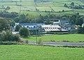
 Armitage Road, Armitage Bridge - geograph.org.uk - 5148397.jpg 1,600 × 1,065; 653 KB
-
 Barnoldswick Bankfield Site 0012526.JPG 3,264 × 2,448; 3.29 MB
-
 Barnoldswick Bankfield Site 0022531.jpg 3,264 × 2,448; 3.22 MB
-

-

-
 Disused factory, Staincliffe, Batley - geograph.org.uk - 79621.jpg 640 × 480; 64 KB
-
 Factory at Wainstalls - geograph.org.uk - 3487361.jpg 2,000 × 1,531; 815 KB
-
 Former Montpelier Place Baptist Church, Montpelier Place, Hove (August 2017) (2).JPG 3,200 × 4,200; 2.75 MB
-
 Former Montpelier Place Baptist Church, Montpelier Place, Hove (December 2017) (7).JPG 4,200 × 3,200; 2.19 MB
-

-
 Industrial buildings off Shroggs Road, Halifax - geograph.org.uk - 2574381.jpg 2,048 × 1,536; 774 KB
-
 Lower Slack - Wainstalls Road - geograph.org.uk - 2041037.jpg 640 × 480; 60 KB
-
 Mills in the valley, Luddenden Foot - geograph.org.uk - 1009237.jpg 640 × 456; 81 KB
-
 Nestle factory and Halifax station - geograph.org.uk - 1369315.jpg 480 × 640; 109 KB
-

-

-
 Portsmouth Historic Dockyard - geograph.org.uk - 548109.jpg 640 × 480; 98 KB
-
 Royd Edge Dyeworks, Meltham - geograph.org.uk - 855387.jpg 640 × 480; 85 KB
-
 Shipley (34609969775).jpg 6,000 × 4,000; 8.82 MB
-
 St Pancras railway station MMB 66 406-585.jpg 3,888 × 2,624; 2.2 MB
-


_-_geograph.org.uk_-_799154.jpg)


_(2).JPG)
_(7).JPG)


.jpg)

